File:Vrangel Bay Autumn 1997.jpg
Size of this preview: 400 × 600 pixels. Other resolutions: 160 × 240 pixels | 320 × 480 pixels | 512 × 768 pixels | 682 × 1,024 pixels | 1,500 × 2,250 pixels.
Original file (1,500 × 2,250 pixels, file size: 788 KB, MIME type: image/jpeg)
Captions
Captions
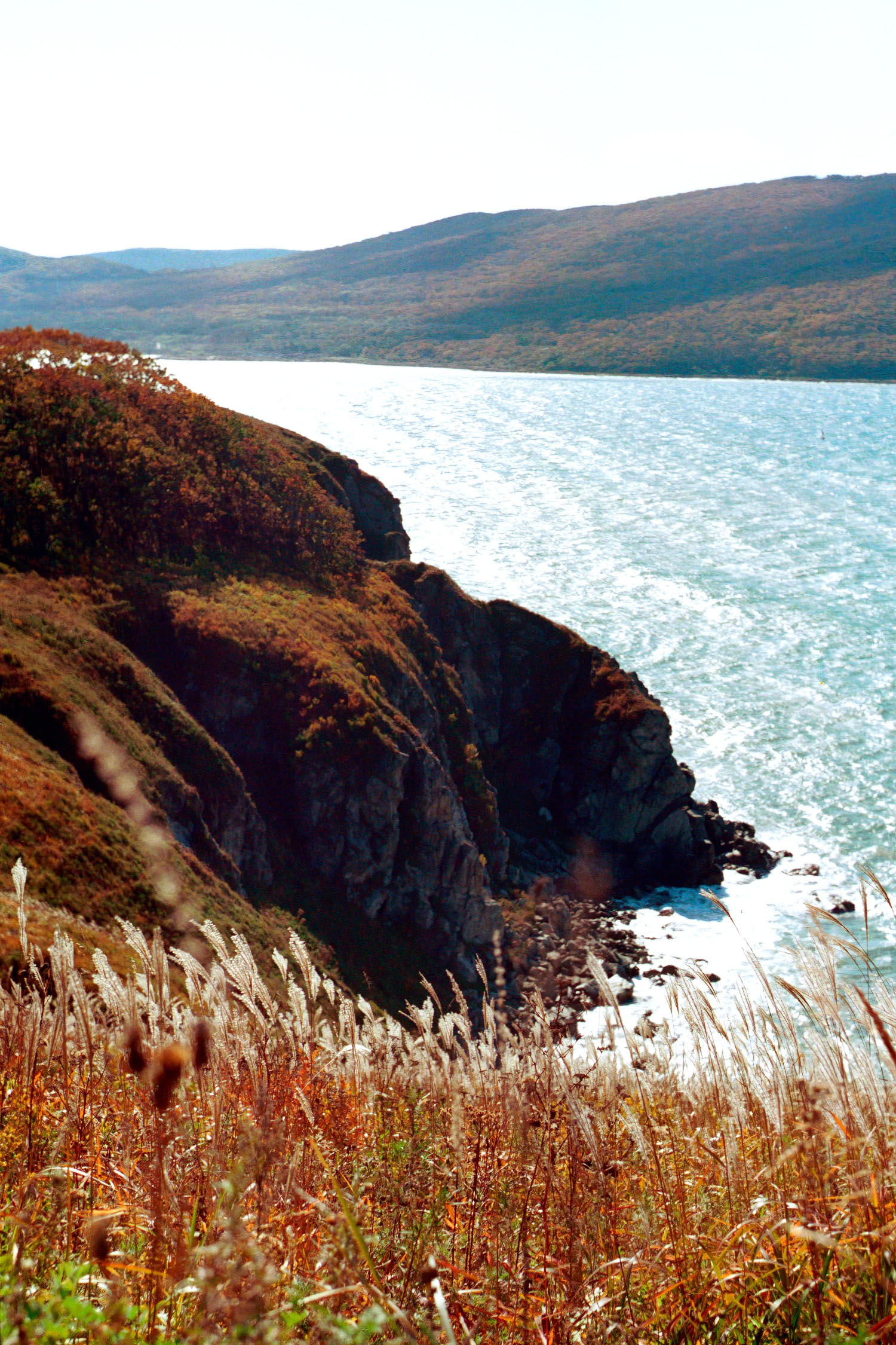
Entrance to Vrangel Cove
Summary
edit
| Description |
English: Autumn view from the slope of the BRLSovskaya Sopka, below the site on which the Nakhodka Bay VTS was built
Русский: Осенний вид со склона БРЛСовской сопки, ниже площадки, на которой построена СУДС залива Находка |
| Date | |
| Source | Own work |
| Author | Vrangel Bay (aka Alex Wild) |
| Camera location | | View this and other nearby images on: OpenStreetMap |
|---|
БРЛСовская сопка в почти первозданном виде (до начала строительства СУДС): https://pastvu.com/p/1604563
Licensing
edit
I, the copyright holder of this work, hereby publish it under the following license:
This file is licensed under the Creative Commons Attribution-Share Alike 4.0 International license.
- You are free:
- to share – to copy, distribute and transmit the work
- to remix – to adapt the work
- Under the following conditions:
- attribution – You must give appropriate credit, provide a link to the license, and indicate if changes were made. You may do so in any reasonable manner, but not in any way that suggests the licensor endorses you or your use.
- share alike – If you remix, transform, or build upon the material, you must distribute your contributions under the same or compatible license as the original.
| Annotations | This image is annotated: View the annotations at Commons |
File history
Click on a date/time to view the file as it appeared at that time.
| Date/Time | Thumbnail | Dimensions | User | Comment | |
|---|---|---|---|---|---|
| current | 09:23, 22 January 2023 | | 1,500 × 2,250 (788 KB) | Vrangel Bay (talk | contribs) | Uploaded own work with UploadWizard |
You cannot overwrite this file.
File usage on Commons
There are no pages that use this file.