File:Waxeneck.JPG

Size of this preview: 800 × 450 pixels. Other resolutions: 320 × 180 pixels | 640 × 360 pixels | 1,024 × 576 pixels | 1,280 × 720 pixels | 2,560 × 1,440 pixels | 5,200 × 2,925 pixels.
Original file (5,200 × 2,925 pixels, file size: 9.1 MB, MIME type: image/jpeg)
Captions
Captions
Add a one-line explanation of what this file represents
Summary edit
| Description |
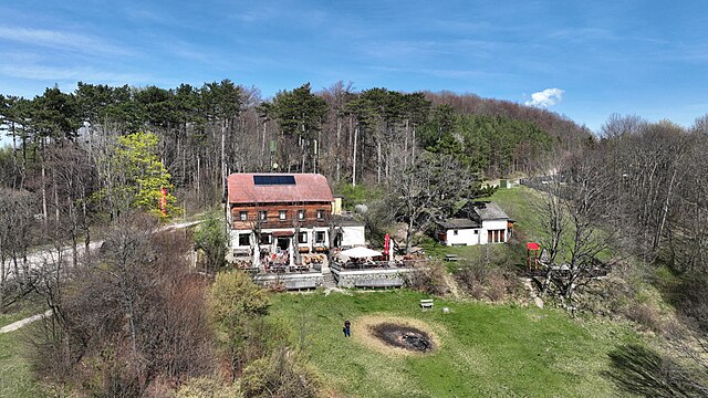
Deutsch: Südwestansicht des Waxenecks mit dem Schutzhaus im Vordergrund. Der Waxeneck in den Gutensteiner Alpen ist ein Höhenzug ohne markanten Gipfel, dessen höchster Punkt auf 796 m ü. A. liegt. Er befindet sich westlich der Stadt Berndorf im südlichen Niederösterreich. |
| Date | |
| Source | Own work |
| Author | C.Stadler/Bwag |
| Permission (Reusing this file) |
Deutsch: Hallo, du darfst mein Foto kostenlos nutzen, aber nenne mich bitte als Fotograf, beispielsweise „Foto: C.Stadler/Bwag“ oder © C.Stadler/Bwag; CC-BY-SA-4.0. Auf mehr Angaben bestehe ich nicht - im Gegensatz zu manch anderen, die die Vorgaben der unten angeführten Lizenzierung auf Punkt und Beistrich einfordern. English: Feel free to use my photos, but please mention me as the author like © C.Stadler/Bwag or © C.Stadler/Bwag; CC-BY-SA-4.0 (that's good enough) and if you want send me a message: bwag@gmx.net. |
| Object location | | View this and other nearby images on: OpenStreetMap |
|---|
| Camera location | | View this and other nearby images on: OpenStreetMap |
|---|
Licensing edit
I, the copyright holder of this work, hereby publish it under the following license:
This file is licensed under the Creative Commons Attribution-Share Alike 4.0 International license.
- You are free:
- to share – to copy, distribute and transmit the work
- to remix – to adapt the work
- Under the following conditions:
- attribution – You must give appropriate credit, provide a link to the license, and indicate if changes were made. You may do so in any reasonable manner, but not in any way that suggests the licensor endorses you or your use.
- share alike – If you remix, transform, or build upon the material, you must distribute your contributions under the same or compatible license as the original.
File history
Click on a date/time to view the file as it appeared at that time.
| Date/Time | Thumbnail | Dimensions | User | Comment | |
|---|---|---|---|---|---|
| current | 21:01, 8 April 2024 | | 5,200 × 2,925 (9.1 MB) | Bwag (talk | contribs) | == {{int:filedesc}} == {{Information |Description= {{de|1= Südwestansicht des Waxenecks mit dem Schutzhaus im Vordergrund.<br/>Der Waxeneck in den Gutensteiner Alpen ist ein Höhenzug ohne markanten Gipfel, dessen höchster Punkt auf 796 m ü. A. liegt. Er befindet sich westlich der Stadt Berndorf im südlichen Niederösterreich.}} |Source= {{own}} |Date= 2024-04-06 |Author= C.Stadler/Bwag |Permission= {{User:Bwag/Credits}} |other versions= }} {{Object location dec|47.93806|16.0286... |
You cannot overwrite this file.
File usage on Commons
The following 3 pages use this file:
.JPG)
.JPG)
.JPG)
File usage on other wikis
The following other wikis use this file:
- Usage on sv.wikipedia.org