File:Wellington map.jpg

Size of this preview: 407 × 600 pixels. Other resolutions: 163 × 240 pixels | 325 × 480 pixels | 521 × 768 pixels | 695 × 1,024 pixels | 1,709 × 2,519 pixels.
Original file (1,709 × 2,519 pixels, file size: 1.22 MB, MIME type: image/jpeg)
Captions
Captions
Add a one-line explanation of what this file represents
| Description |
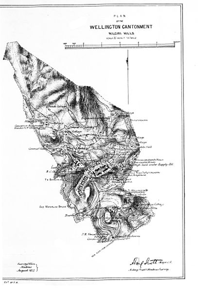
Wellington Cantonment |
|||||||||
| Date | ||||||||||
| Source | Manual of the Nilagiri district in the Madras Presidency | |||||||||
| Creator |
Compiled by H B Grigg |
|||||||||
| Permission (Reusing this file) |
|
|||||||||
| Geotemporal data | ||||||||||
| Bounding box |
|
|||||||||
| Georeferencing | ||||||||||
File history
Click on a date/time to view the file as it appeared at that time.
| Date/Time | Thumbnail | Dimensions | User | Comment | |
|---|---|---|---|---|---|
| current | 12:54, 22 January 2014 | | 1,709 × 2,519 (1.22 MB) | Shyamal (talk | contribs) | {{Information |Description=Wellington Cantonment |Source=[https://archive.org/stream/manualofnlagir00grigrich#page/n86/mode/1up Manual of the Nilagiri district in the Madras Presidency] |Date=1880 |Author=Compiled by H B Grigg |Permission={{pd-1923}} |... |
You cannot overwrite this file.
File usage on Commons
There are no pages that use this file.