File:Western sahara territorial control 1979-1981 topographic map-en.svg

Size of this PNG preview of this SVG file: 711 × 600 pixels. Other resolutions: 285 × 240 pixels | 569 × 480 pixels | 911 × 768 pixels | 1,214 × 1,024 pixels | 2,429 × 2,048 pixels | 1,187 × 1,001 pixels.
Original file (SVG file, nominally 1,187 × 1,001 pixels, file size: 873 KB)
Captions
Captions
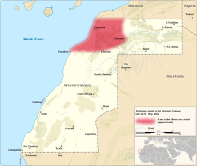
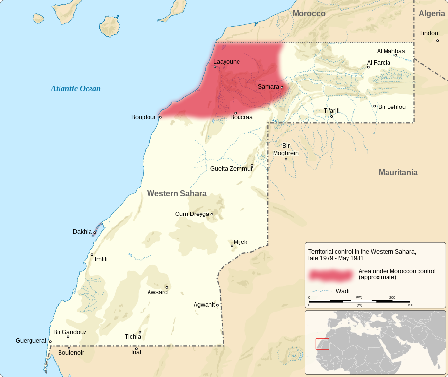
Map depicting the area under Moroccon control in the Western Sahara, late 1979 to May 1981
Summary edit
| Description |
English: Map depicting the area under Moroccon control in the Western Sahara, late 1979 to May 1981
|
| Date | |
| Source |
Own work based on:
|
| Author | Goran_tek-en |
| Permission (Reusing this file) |
This file is licensed under the Creative Commons Attribution-Share Alike 4.0 International license. Attribution: Goran_tek-en
|
| Other versions |
|
| SVG development | This vector image was created with Inkscape. |


| Object location | | View this and other nearby images on: OpenStreetMap |
|---|
File history
Click on a date/time to view the file as it appeared at that time.
| Date/Time | Thumbnail | Dimensions | User | Comment | |
|---|---|---|---|---|---|
| current | 12:47, 19 October 2022 | | 1,187 × 1,001 (873 KB) | Goran tek-en (talk | contribs) | {{Information |description ={{en|Map depicting the area under Moroccon control in the Western Sahara, late 1979 to May 1981}} {{Institution |wikidata=Q6250}} |date =2022-02-19 |source = {{Own based|Western sahara territorial control 1976-1979 topographic map-en.svg|b1=Goran tek-en}} <br> Information from: *[https://www.cia.gov/readingroom/docs/CIA-RDP83R00184R002600080003-3.pdf Director of Central Intelligence], Western Sahara. Ramifications of Mauritanian Withdrawal... |
You cannot overwrite this file.
File usage on Commons
The following 4 pages use this file: