File:Wien - Haas-Haus (2).JPG
Size of this preview: 458 × 599 pixels. Other resolutions: 183 × 240 pixels | 367 × 480 pixels | 587 × 768 pixels | 783 × 1,024 pixels | 1,566 × 2,048 pixels | 3,161 × 4,134 pixels.
Original file (3,161 × 4,134 pixels, file size: 9.91 MB, MIME type: image/jpeg)
Captions
Captions
Add a one-line explanation of what this file represents
Summary
edit| Description |
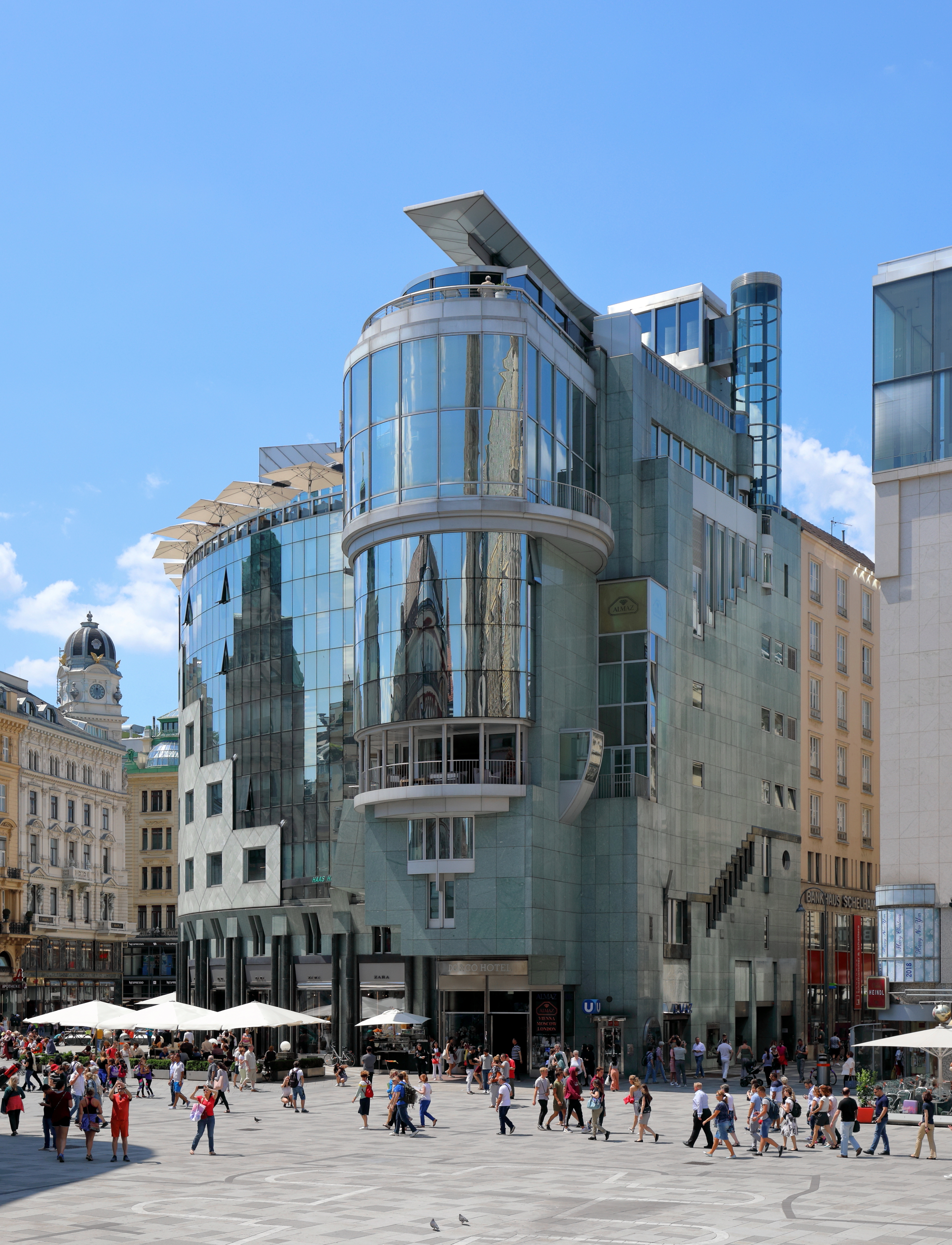
Deutsch: Das Haas-Haus an der Adresse Stock-im-Eisen-Platz 4 (Goldschmiedgasse 1 / Graben 32 / Stephansplatz 12) im 1. Wiener Gemeindebezirk Innere Stadt. Das 1. Haus wurde von 1865 bis 1867 als Warenhaus "Philipp Haas & Söhne" errichtet, im II. WK zerstört und dann abgetragen. Das 2. Haas-Haus wurde von 1951 bis 1953 nach Plänen von Max Fellerer und Carl Appel errichtet und trotz Protesten 1986 abgetragen. Das 3. Haas-Haus, auch als Hollein-Haus bezeichnet, ließen die damaligen Eigentümer (Zentralsparkasse und Kommerzialbank AG sowie Wiener Städtische Wechselseitige Versicherung) trotz heftigen Protesten und Bürgerinitiativen nach Plänen des Architekten Hans Hollein errichten. Die Grundsteinlegung fand im Herbst 1987, die Gleichenfeier am 2. September 1988 und die Eröffnung am 15. September 1990 statt. |
| Date | |
| Source | Own work |
| Author | C.Stadler/Bwag |
| Permission (Reusing this file) |
Deutsch: Hallo, du darfst mein Foto kostenlos nutzen, aber nenne mich bitte als Fotograf, beispielsweise „Foto: C.Stadler/Bwag“ oder © C.Stadler/Bwag; CC-BY-SA-4.0. Auf mehr Angaben bestehe ich nicht - im Gegensatz zu manch anderen, die die Vorgaben der unten angeführten Lizenzierung auf Punkt und Beistrich einfordern. English: Feel free to use my photos, but please mention me as the author like © C.Stadler/Bwag or © C.Stadler/Bwag; CC-BY-SA-4.0 (that's good enough) and if you want send me a message: bwag@gmx.net. |
| Other versions |
|

.JPG)
.JPG&action=edit§ion=1)
| Object location | | View this and other nearby images on: OpenStreetMap |
|---|
.JPG¶ms=048.208339_N_0016.371538_E_globe:Earth_class:object_type:object__&language=en)
| Camera location | | View this and other nearby images on: OpenStreetMap |
|---|
.JPG¶ms=048.208448_N_0016.372524_E_globe:Earth_type:camera_heading:255.00&language=en)
Licensing
edit.JPG&action=edit§ion=2)
I, the copyright holder of this work, hereby publish it under the following license:
This file is licensed under the Creative Commons Attribution-Share Alike 4.0 International license.
- You are free:
- to share – to copy, distribute and transmit the work
- to remix – to adapt the work
- Under the following conditions:
- attribution – You must give appropriate credit, provide a link to the license, and indicate if changes were made. You may do so in any reasonable manner, but not in any way that suggests the licensor endorses you or your use.
- share alike – If you remix, transform, or build upon the material, you must distribute your contributions under the same or compatible license as the original.
File history
Click on a date/time to view the file as it appeared at that time.
| Date/Time | Thumbnail | Dimensions | User | Comment | |
|---|---|---|---|---|---|
| current | 22:25, 18 June 2018 | | 3,161 × 4,134 (9.91 MB) | Bwag (talk | contribs) | wb |
| 21:00, 18 June 2018 |  | 3,161 × 4,134 (9.51 MB) | Bwag (talk | contribs) | {{Information |Description= {{de|1= Das Haas-Haus an der Adresse Stock-im-Eisen-Platz 4 (Goldschmiedgasse 1 / Graben 32 / Stephansplatz 12) im 1. Wiener Gemeindebezirk Innere Stadt.<br/ >Das 1. Haas-Haus wurde von 1865 bis 1867 errichtet, im II. WK zerstört und dann abgetragen. Das 2. Haas-Haus wurde von 1951 bis 1953 nach Plänen von Max Fellerer und Carl Appel errichtet und trotz Protesten 1986 abgetragen. Das 3. Haas-Haus (Hollein-... |
You cannot overwrite this file.
File usage on Commons
The following 2 pages use this file:
File usage on other wikis
The following other wikis use this file:
- Usage on de.wikipedia.org
- Usage on es.wikipedia.org
- Usage on fr.wikipedia.org
- Usage on nl.wikipedia.org
- Usage on sr.wikipedia.org
- Usage on www.wikidata.org
.JPG&oldid=706203692)