File:World Map by Vasily Kiprianov.jpg
Size of this preview: 800 × 537 pixels. Other resolutions: 320 × 215 pixels | 640 × 430 pixels | 1,024 × 688 pixels | 1,280 × 860 pixels | 2,560 × 1,720 pixels | 3,500 × 2,351 pixels.
Original file (3,500 × 2,351 pixels, file size: 2.94 MB, MIME type: image/jpeg)
Captions
Captions
Add a one-line explanation of what this file represents
Summary
edit
| Description |
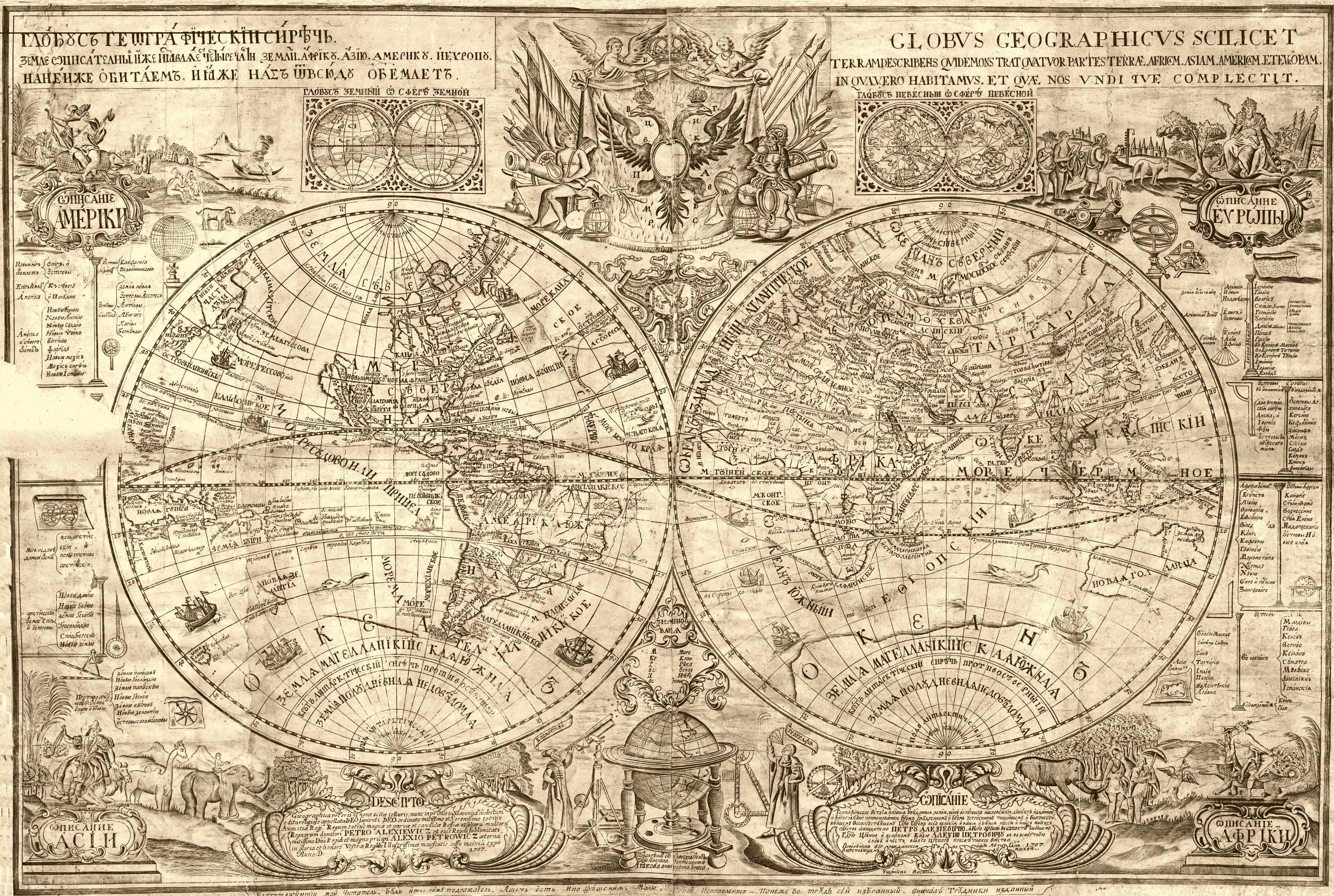
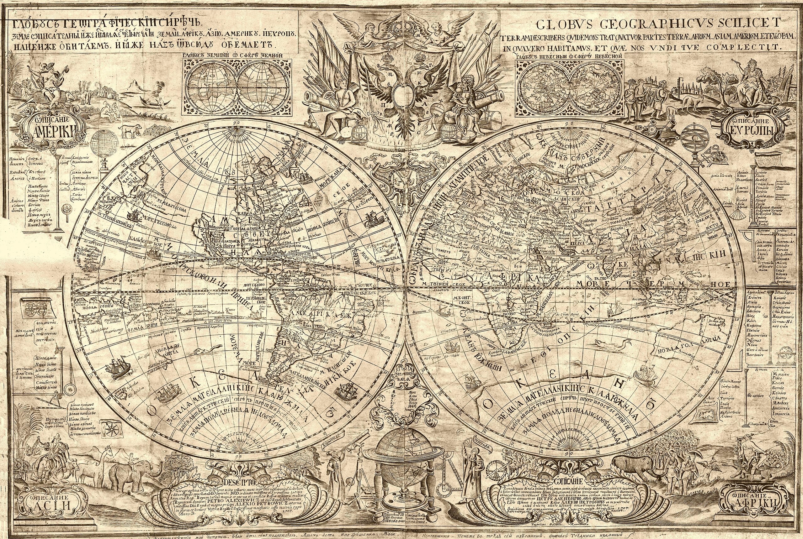
Русский: В основе первой крупной картографической работы Гражданской типографии – карты полушарий 1707 г. «Изображение глобуса земного» В.А. Киприянова (Василия Киприанова) лежит карта Хрисанфа Нотара «Географическая таблица» 1700 г. Помимо генерального источника заимствований Киприяновым привлекались также отдельные карты французских картографов. Установленная греческая основа топонимов карты мира 1707 г. объясняет многочисленные «странности» транскрипции надписей от Киприянова.
English: Map of the world, prepared by Vasily Kiprianov.
Begining of the 18th century |
| Date | |
| Source | http://history-maps.ru/view-picture.php?id=1710 |
| Author | Vasily Kiprianov |
Licensing
edit
|
This work is in the public domain in its country of origin and other countries and areas where the copyright term is the author's life plus 100 years or fewer. | |
| This file has been identified as being free of known restrictions under copyright law, including all related and neighboring rights. | |
File history
Click on a date/time to view the file as it appeared at that time.
| Date/Time | Thumbnail | Dimensions | User | Comment | |
|---|---|---|---|---|---|
| current | 10:46, 30 August 2018 | | 3,500 × 2,351 (2.94 MB) | Niklitov (talk | contribs) | Quality |
| 03:44, 28 February 2007 |  | 563 × 477 (130 KB) | Alex Bakharev (talk | contribs) | Map of the world, prepared by en:Vasily Kipriyanov From http://libraries.theeuropeanlibrary.org/RussiaStpetersburg/treasures_en.xml Begining of the 18th century Category:Old maps of the world |
You cannot overwrite this file.
File usage on Commons
The following page uses this file:
- File:Kuprijanov Map.jpg (file redirect)
File usage on other wikis
The following other wikis use this file:
- Usage on de.wikipedia.org
- Usage on en.wikipedia.org
- Usage on fr.wikipedia.org
- Usage on no.wikipedia.org
- Usage on ru.wikipedia.org