File:Yamagata-pref.png
Yamagata-pref.png (202 × 265 pixels, file size: 8 KB, MIME type: image/png)
Captions
Captions
Summary edit
| Description |
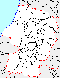
日本語: 市町村境界図、山形県 |
||
| Source | File:Japan map.png | ||
| Author |
|
||
| Permission (Reusing this file) |
|
Licensing edit

|
Permission is granted to copy, distribute and/or modify this document under the terms of the GNU Free Documentation License, Version 1.2 or any later version published by the Free Software Foundation; with no Invariant Sections, no Front-Cover Texts, and no Back-Cover Texts. A copy of the license is included in the section entitled GNU Free Documentation License. |
- You are free:
- to share – to copy, distribute and transmit the work
- to remix – to adapt the work
- Under the following conditions:
- attribution – You must give appropriate credit, provide a link to the license, and indicate if changes were made. You may do so in any reasonable manner, but not in any way that suggests the licensor endorses you or your use.
- share alike – If you remix, transform, or build upon the material, you must distribute your contributions under the same or compatible license as the original.
File history
Click on a date/time to view the file as it appeared at that time.
| Date/Time | Thumbnail | Dimensions | User | Comment | |
|---|---|---|---|---|---|
| current | 19:16, 22 January 2008 | | 202 × 265 (8 KB) | BigBang19 (talk | contribs) | 2005年7月1日 *東田川郡立川町+余目町=東田川郡庄内町(新設) 2005年10月1日 *鶴岡市+東田川郡藤島町+羽黒町+櫛引町+朝日村+西田川郡温海町=鶴岡市(新設) 2005年11月1日 *酒田市+飽海� |
| 08:16, 24 September 2004 |  | 202 × 265 (4 KB) | 赤鉛筆 (talk | contribs) | 山形県、市町村境界図 | |
| 11:00, 27 March 2004 |  | 200 × 253 (4 KB) | Koba-chan (talk | contribs) | 市町村境界図、山形県 |
You cannot overwrite this file.
File usage on Commons
There are no pages that use this file.