File:ZabuyeLake2.jpg
Size of this preview: 800 × 444 pixels. Other resolutions: 320 × 178 pixels | 640 × 355 pixels | 929 × 516 pixels.
Original file (929 × 516 pixels, file size: 114 KB, MIME type: image/jpeg)
Captions
Captions
Add a one-line explanation of what this file represents
Summary
edit
| Description |
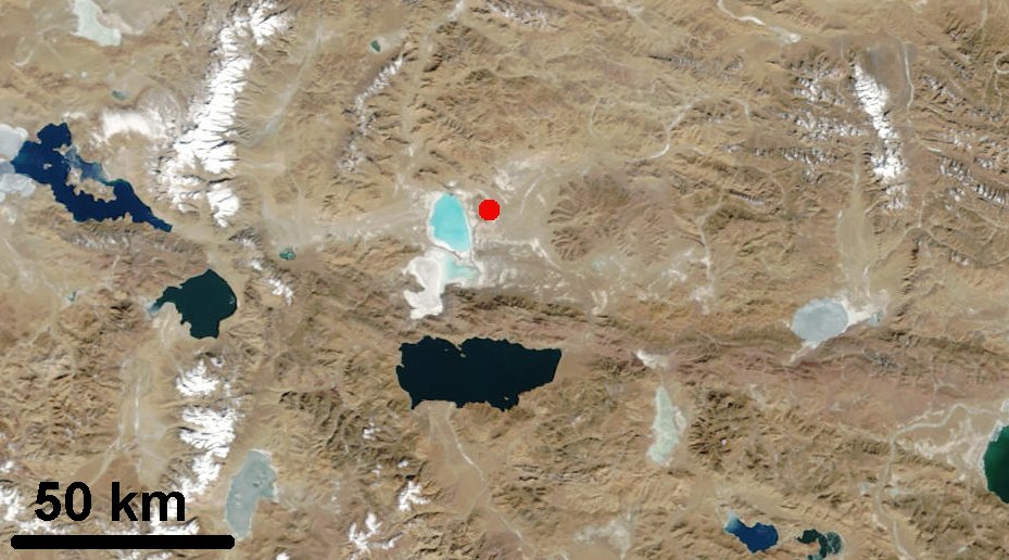
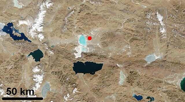
English: Map of Tibet showing the Ngangle Ringco Lake on the left and the Zabuye Lake marked with the red dot |
| Date | |
| Source | http://visibleearth.nasa.gov/view_rec.php?id=4806 |
| Author | NASA |
Licensing
edit
| This file is in the public domain in the United States because it was solely created by NASA. NASA copyright policy states that "NASA material is not protected by copyright unless noted". (See Template:PD-USGov, NASA copyright policy page or JPL Image Use Policy.) | ||
 |
Warnings:
|
File history
Click on a date/time to view the file as it appeared at that time.
| Date/Time | Thumbnail | Dimensions | User | Comment | |
|---|---|---|---|---|---|
| current | 03:03, 11 September 2010 | | 929 × 516 (114 KB) | Materialscientist (talk | contribs) | {{Information |Description={{en|1=Map of Tibet showing the Ngangle Ringco Lake on the left and the Zabuye Lake marked with the red dot}} |Source=http://visibleearth.nasa.gov/view_rec.php?id=4806 |Author=NASA |Date=June 08 2006 |Permission= |other_versions |
You cannot overwrite this file.
File usage on Commons
There are no pages that use this file.
File usage on other wikis
The following other wikis use this file:
- Usage on ceb.wikipedia.org
- Usage on de.wikipedia.org
- Usage on en.wikipedia.org
- Usage on pa.wikipedia.org
- Usage on ru.wikipedia.org
- Usage on sv.wikipedia.org
- Usage on uk.wikipedia.org
- Usage on zh.wikipedia.org