File:Zeist.png

Original file (1,396 × 1,725 pixels, file size: 308 KB, MIME type: image/png)
Captions
Captions
Summary
edit
| Description |
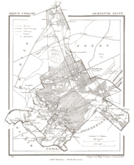
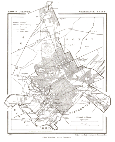
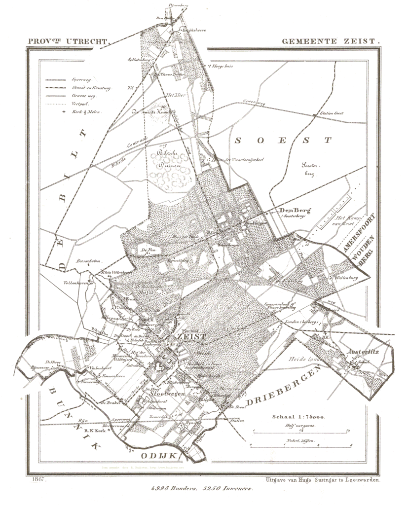
Nederlands: Kaart van Zeist uit Gemeente Atlas van Nederland, J. Kuyper 1865-1870, Uitgave Hugo Suringar Leeuwarden. |
| Date | between 1865 and 1870 |
| Source |
Transferred from nl.wikipedia |
| Author | Jacob Kuyper (1821-1908). Original uploader was Jeroen at nl.wikipedia |
| Permission (Reusing this file) |
PD-OUD. |
Licensing
edit
|
This work is in the public domain in its country of origin and other countries and areas where the copyright term is the author's life plus 70 years or fewer.
| |
| This file has been identified as being free of known restrictions under copyright law, including all related and neighboring rights. | |
Original upload log
edit
- 2005-04-03 22:30 Jeroen 1396×1725× (315588 bytes) {{beperkt}} Deze afbeelding kan alleen worden gebruikt op Wikipedia. De naam van de website waar het vandaan kwam moet worden vermeld. De afbeelding komt van http://www.rat.de/kuijsten/atlas/ut/ . Het is de kaart van de gemeente [[Zeist]]. This image ca
File history
Click on a date/time to view the file as it appeared at that time.
| Date/Time | Thumbnail | Dimensions | User | Comment | |
|---|---|---|---|---|---|
| current | 21:41, 25 November 2008 | | 1,396 × 1,725 (308 KB) | BotMultichill (talk | contribs) | {{BotMoveToCommons|nl.wikipedia}} {{Information |Description={{nl|Kaart van Zeist uit ''Gemeente Atlas van Nederland, J. Kuyper 1865-1870, Uitgave Hugo Suringar Leeuwarden.''}} |Source=Transferred from [http://nl.wikipedia.org nl.wikipedia |
You cannot overwrite this file.
File usage on Commons
There are no pages that use this file.
File usage on other wikis
The following other wikis use this file: