File talk:Kurdish states 1835.png
Latest comment: 9 years ago by PANONIAN in topic Bokan town
 | This file was nominated for deletion on 6 December 2016 but was kept. If you are thinking about re-nominating it for deletion, please read that discussion first. |
Bokan town edit
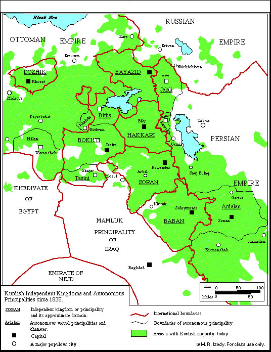
User Saman bokan72, please stop adding that town to this map. Yes, this town is relativelly large today, but map shows situation in 1835 and the question is was this town sizable in that time or not. Firstly, source used for this map does not show this town: http://www.institutkurde.org/images/cartes_and_maps/kurdish_independent_kingdom.jpg Secondly, this source says that town in the past was of "small size": http://www.iranicaonline.org/articles/bukan-kurd (quote: "Despite its small size"). However, if you want to have an locator map which will show position of this town in 1835, then you should upload that map under different filename. PANONIAN (talk) 09:41, 4 November 2014 (UTC)