File talk:Neretva9st.png
Latest comment: 9 years ago by PANONIAN in topic Mljet
Mljet
edit
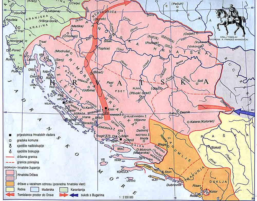
Ceha, as I understand, you used as a source for Pagania borders this map: http://www.croatia-in-english.com/images/maps/tomislav.jpg There, Mljet was indeed part of Zahumlje. However, you missed a century here. That map shows situation in the 10th century, during the reign of Tomislav (reigned from 910 until 928), while this Wikimedia map shows Pagania in the 9th century. Now here is another map from same Croatian source which shows situation in the 9th century: http://www.croatia-in-english.com/images/maps/800s.jpg There you can see that Mljet in this century was part of Pagania, not of Zahumlje. PANONIAN (talk) 08:23, 14 May 2015 (UTC)