Maps of Estonia
Countries of Europe: Albania · Andorra · Armenia‡ · Austria · Azerbaijan‡ · Belarus · Belgium · Bosnia and Herzegovina · Bulgaria · Croatia · Cyprus‡ · Czech Republic · Denmark · Estonia · Finland · France‡ · Georgia‡ · Germany · Greece · Hungary · Iceland · Republic of Ireland · Italy · Kazakhstan‡ · Latvia · Lithuania · Luxembourg · Malta · Monaco · Netherlands‡ · North Macedonia · Norway · Poland · Portugal‡ · Romania · Russia‡ · San Marino · Slovakia · Slovenia · Spain‡ · Sweden · Switzerland · Turkey‡ · Ukraine · United Kingdom · Vatican City
Specific status: Faroe Islands · Gibraltar · Isle of Man – Limited recognition: Abkhazia‡ · Kosovo
‡: partly located in Europe
Specific status: Faroe Islands · Gibraltar · Isle of Man – Limited recognition: Abkhazia‡ · Kosovo
‡: partly located in Europe
- Maps are also available as part of the
 Wikimedia Atlas of the World project in the Atlas of Estonia.
-
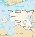 Map of Estonia from CIA World Factbook
 -
 Memec map
 -
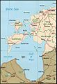 Estonian archipelago (Saaremaa and Hiiumaa)
 -
 Satellite image of Estonia in April 2004


.jpg)

Location Maps edit
-
Map of Estonia from CIA World Factbook
-
Estonian archipelago (Saaremaa and Hiiumaa)
-
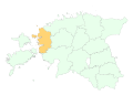
 Location map
 -
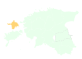
 Location map (Europe)


Maps of Estonian counties edit
-
 Location map of Hiiu maakond
 -
 Location map of Saare maakond
 -
 Location map of Lääne maakond
 -
 Location map of Pärnu maakond
 -
 Location map of Rapla maakond
 -
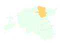
 Location map of Harju maakond
 -
 Location map of Ida-Viru maakond
 -
 Location map of Lääne-Viru maakond
 -
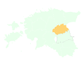 Location map of Jõgeva maakond
 -
 Location map of Tartu maakond
 -
 Location map of Viljandi maakond
 -
 Location map of Järva maakond
 -
 Location map of Valga maakond
 -
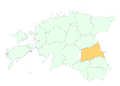
 Location map of Võru maakond
 -
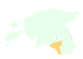
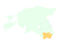
 Location map of Põlva maakond


Maps of Estonian cities edit
-
 Location map of Rakvere
 -
 Location map of Paldiski

