User:Pere prlpz/gallery37
Arxiu anterior User:Pere prlpz/gallery36
2014-10-28 00:53:38 edit
-
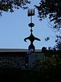
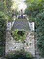
 Jardins Laribal, a Montjuïc (Barcelona)
 -
 Jardins Laribal, a Montjuïc (Barcelona)
 -
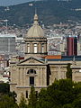
 Jardins Laribal, a Montjuïc (Barcelona). Al fons, escultura a la Fundació Miró.
 -
 Jardins Laribal, a Montjuïc (Barcelona). Al fons, escultura a la Fundació Miró.
 -
 Jardins Laribal, a Montjuïc (Barcelona)
 -
 Jardins Laribal, a Montjuïc (Barcelona)
 -
 Jardins Laribal, a Montjuïc (Barcelona)


2014-10-28 01:08:42 edit
-
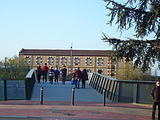
 Vistes des de les grades de l'Estadi Olímpic de Montjuïc (Barcelona)
 -
 Vistes des de les grades de l'Estadi Olímpic de Montjuïc (Barcelona)
 -
 Vistes des de les grades de l'Estadi Olímpic de Montjuïc (Barcelona)
 -
 Vistes des de les grades de l'Estadi Olímpic de Montjuïc (Barcelona)
 -
 Vistes des de les grades de l'Estadi Olímpic de Montjuïc (Barcelona)
 -
 Vistes des de les grades de l'Estadi Olímpic de Montjuïc (Barcelona)
 -
 Vistes des de les grades de l'Estadi Olímpic de Montjuïc (Barcelona)
 -
 Vistes des de les grades de l'Estadi Olímpic de Montjuïc (Barcelona)
 -
 Vistes des de les grades de l'Estadi Olímpic de Montjuïc (Barcelona)
 -
 Vistes des de les grades de l'Estadi Olímpic de Montjuïc (Barcelona)


2015-04-05 12:54:55 edit
-

-

-

-

-

-
-

-

-

-

-
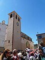
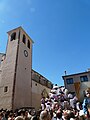
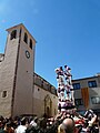
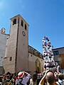
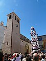
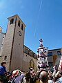
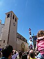
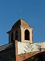
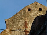
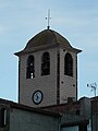
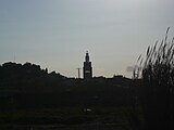
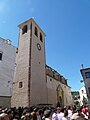 Català: Església parroquial de Sant Mateu. Pl. de l'Església (Riudecanyes).
This is a photo of a building indexed in the Catalan heritage register as Bé Cultural d'Interès Local (BCIL) under the reference IPA-9650.
Object location 
View all coordinates using: OpenStreetMap 
-
 Català: Església parroquial de Sant Mateu. Pl. de l'Església (Riudecanyes).
This is a photo of a building indexed in the Catalan heritage register as Bé Cultural d'Interès Local (BCIL) under the reference IPA-9650.
Object location View all coordinates using: OpenStreetMap -
 Català: Església parroquial de Sant Mateu. Pl. de l'Església (Riudecanyes).
This is a photo of a building indexed in the Catalan heritage register as Bé Cultural d'Interès Local (BCIL) under the reference IPA-9650.
Object location View all coordinates using: OpenStreetMap -
 Català: Església parroquial de Sant Mateu. Pl. de l'Església (Riudecanyes).
This is a photo of a building indexed in the Catalan heritage register as Bé Cultural d'Interès Local (BCIL) under the reference IPA-9650.
Object location View all coordinates using: OpenStreetMap -
 Català: Església parroquial de Sant Mateu. Pl. de l'Església (Riudecanyes).
This is a photo of a building indexed in the Catalan heritage register as Bé Cultural d'Interès Local (BCIL) under the reference IPA-9650.
Object location View all coordinates using: OpenStreetMap -
 Català: Església parroquial de Sant Mateu. Pl. de l'Església (Riudecanyes).
This is a photo of a building indexed in the Catalan heritage register as Bé Cultural d'Interès Local (BCIL) under the reference IPA-9650.
Object location View all coordinates using: OpenStreetMap -
 Català: Església parroquial de Sant Mateu. Pl. de l'Església (Riudecanyes).
This is a photo of a building indexed in the Catalan heritage register as Bé Cultural d'Interès Local (BCIL) under the reference IPA-9650.
Object location View all coordinates using: OpenStreetMap -
 Català: Església parroquial de Sant Mateu. Pl. de l'Església (Riudecanyes).
This is a photo of a building indexed in the Catalan heritage register as Bé Cultural d'Interès Local (BCIL) under the reference IPA-9650.
Object location View all coordinates using: OpenStreetMap -
 Català: Església parroquial de Sant Mateu. Pl. de l'Església (Riudecanyes).
This is a photo of a building indexed in the Catalan heritage register as Bé Cultural d'Interès Local (BCIL) under the reference IPA-9650.
Object location View all coordinates using: OpenStreetMap -
 Català: Església parroquial de Sant Mateu. Pl. de l'Església (Riudecanyes).
This is a photo of a building indexed in the Catalan heritage register as Bé Cultural d'Interès Local (BCIL) under the reference IPA-9650.
Object location View all coordinates using: OpenStreetMap -
 Català: Església parroquial de Sant Mateu. Pl. de l'Església (Riudecanyes).
This is a photo of a building indexed in the Catalan heritage register as Bé Cultural d'Interès Local (BCIL) under the reference IPA-9650.
Object location View all coordinates using: OpenStreetMap -
 Català: Església parroquial de Sant Mateu. Pl. de l'Església (Riudecanyes).
This is a photo of a building indexed in the Catalan heritage register as Bé Cultural d'Interès Local (BCIL) under the reference IPA-9650.
Object location View all coordinates using: OpenStreetMap -
 Català: Església parroquial de Sant Mateu. Pl. de l'Església (Riudecanyes).
This is a photo of a building indexed in the Catalan heritage register as Bé Cultural d'Interès Local (BCIL) under the reference IPA-9650.
Object location View all coordinates using: OpenStreetMap -
 Català: Església parroquial de Sant Mateu. Pl. de l'Església (Riudecanyes).
This is a photo of a building indexed in the Catalan heritage register as Bé Cultural d'Interès Local (BCIL) under the reference IPA-9650.
Object location View all coordinates using: OpenStreetMap -
 Català: Església parroquial de Sant Mateu. Pl. de l'Església (Riudecanyes).
This is a photo of a building indexed in the Catalan heritage register as Bé Cultural d'Interès Local (BCIL) under the reference IPA-9650.
Object location View all coordinates using: OpenStreetMap -
 Català: Església parroquial de Sant Mateu. Pl. de l'Església (Riudecanyes).
This is a photo of a building indexed in the Catalan heritage register as Bé Cultural d'Interès Local (BCIL) under the reference IPA-9650.
Object location View all coordinates using: OpenStreetMap -
 Català: Església parroquial de Sant Mateu. Pl. de l'Església (Riudecanyes).
This is a photo of a building indexed in the Catalan heritage register as Bé Cultural d'Interès Local (BCIL) under the reference IPA-9650.
Object location View all coordinates using: OpenStreetMap -
 Català: Església parroquial de Sant Mateu. Pl. de l'Església (Riudecanyes).
This is a photo of a building indexed in the Catalan heritage register as Bé Cultural d'Interès Local (BCIL) under the reference IPA-9650.
Object location View all coordinates using: OpenStreetMap -
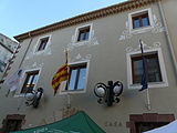
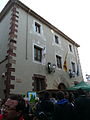
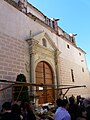
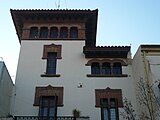
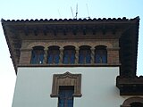
 Català: Casa de la Vila. C. del Dimecres (Riudecanyes).
This is a photo of a building indexed in the Catalan heritage register as Bé Cultural d'Interès Local (BCIL) under the reference IPA-9648.
-
 Català: Casa de la Vila. C. del Dimecres (Riudecanyes).
This is a photo of a building indexed in the Catalan heritage register as Bé Cultural d'Interès Local (BCIL) under the reference IPA-9648.
-
 Català: Casa de la Vila. C. del Dimecres (Riudecanyes).
This is a photo of a building indexed in the Catalan heritage register as Bé Cultural d'Interès Local (BCIL) under the reference IPA-9648.
-
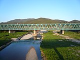
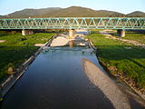
 Català: Pont de Riudecanyes. A l'entrada del poble (Riudecanyes).
This is a photo of a building indexed in the Catalan heritage register as Bé Cultural d'Interès Local (BCIL) under the reference IPA-36868.
Object location View all coordinates using: OpenStreetMap -
 Català: Pont de Riudecanyes. A l'entrada del poble (Riudecanyes).
This is a photo of a building indexed in the Catalan heritage register as Bé Cultural d'Interès Local (BCIL) under the reference IPA-36868.
Object location View all coordinates using: OpenStreetMap -
 Català: Pont de Riudecanyes. A l'entrada del poble (Riudecanyes).
This is a photo of a building indexed in the Catalan heritage register as Bé Cultural d'Interès Local (BCIL) under the reference IPA-36868.
Object location View all coordinates using: OpenStreetMap -

-

-

-

-

-

-

-

-

-

-

-

-

-

-

-

-
 Català: Església parroquial de Sant Mateu. Pl. de l'Església (Riudecanyes).
This is a photo of a building indexed in the Catalan heritage register as Bé Cultural d'Interès Local (BCIL) under the reference IPA-9650.
Object location View all coordinates using: OpenStreetMap -
 Català: Església parroquial de Sant Mateu. Pl. de l'Església (Riudecanyes).
This is a photo of a building indexed in the Catalan heritage register as Bé Cultural d'Interès Local (BCIL) under the reference IPA-9650.
Object location View all coordinates using: OpenStreetMap -
 Català: Església parroquial de Sant Mateu. Pl. de l'Església (Riudecanyes).
This is a photo of a building indexed in the Catalan heritage register as Bé Cultural d'Interès Local (BCIL) under the reference IPA-9650.
Object location View all coordinates using: OpenStreetMap -
 Català: Església parroquial de Sant Mateu. Pl. de l'Església (Riudecanyes).
This is a photo of a building indexed in the Catalan heritage register as Bé Cultural d'Interès Local (BCIL) under the reference IPA-9650.
Object location View all coordinates using: OpenStreetMap -
 Català: Església parroquial de Sant Mateu. Pl. de l'Església (Riudecanyes).
This is a photo of a building indexed in the Catalan heritage register as Bé Cultural d'Interès Local (BCIL) under the reference IPA-9650.
Object location View all coordinates using: OpenStreetMap -
 Català: Església parroquial de Sant Mateu. Pl. de l'Església (Riudecanyes).
This is a photo of a building indexed in the Catalan heritage register as Bé Cultural d'Interès Local (BCIL) under the reference IPA-9650.
Object location View all coordinates using: OpenStreetMap -
 Català: Església parroquial de Sant Mateu. Pl. de l'Església (Riudecanyes).
This is a photo of a building indexed in the Catalan heritage register as Bé Cultural d'Interès Local (BCIL) under the reference IPA-9650.
Object location View all coordinates using: OpenStreetMap -

-

-

-

-

-

-

-

-

-

-

-

-

-
 Català: Església parroquial de Sant Mateu. Pl. de l'Església (Riudecanyes).
This is a photo of a building indexed in the Catalan heritage register as Bé Cultural d'Interès Local (BCIL) under the reference IPA-9650.
Object location View all coordinates using: OpenStreetMap -
 Català: Església parroquial de Sant Mateu. Pl. de l'Església (Riudecanyes).
This is a photo of a building indexed in the Catalan heritage register as Bé Cultural d'Interès Local (BCIL) under the reference IPA-9650.
Object location View all coordinates using: OpenStreetMap -
 Català: Església parroquial de Sant Mateu. Pl. de l'Església (Riudecanyes).
This is a photo of a building indexed in the Catalan heritage register as Bé Cultural d'Interès Local (BCIL) under the reference IPA-9650.
Object location View all coordinates using: OpenStreetMap -
 Català: Església parroquial de Sant Mateu. Pl. de l'Església (Riudecanyes).
This is a photo of a building indexed in the Catalan heritage register as Bé Cultural d'Interès Local (BCIL) under the reference IPA-9650.
Object location View all coordinates using: OpenStreetMap -
 Català: Església parroquial de Sant Mateu. Pl. de l'Església (Riudecanyes).
This is a photo of a building indexed in the Catalan heritage register as Bé Cultural d'Interès Local (BCIL) under the reference IPA-9650.
Object location View all coordinates using: OpenStreetMap


2015-04-07 23:33:24 edit
-
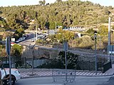
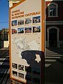
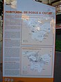
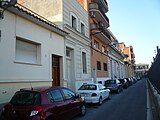
 Montcada i Reixac
 -
 Montcada i Reixac
 -
 Montcada i Reixac
 -
 Montcada i Reixac
 -
 Montcada i Reixac
 -
 Montcada i Reixac
 -
 Montcada i Reixac
 -
 Montcada i Reixac
 -
 Montcada i Reixac
 -
 Montcada i Reixac
 -
 Montcada i Reixac
 -
 Montcada i Reixac
 -
 Montcada i Reixac
 -
 Montcada i Reixac
 -
 Montcada i Reixac
 -
 Montcada i Reixac
 -
 Montcada i Reixac
 -
 Montcada i Reixac
 -
 Montcada i Reixac
 -
 Montcada i Reixac
 -
 Montcada i Reixac
 -
 Montcada i Reixac
 -
 Montcada i Reixac
 -
 Montcada i Reixac
 -
 Montcada i Reixac
 -
 Montcada i Reixac
 -
 Montcada i Reixac
 -
 Montcada i Reixac
 -
 Montcada i Reixac
 -
 Montcada i Reixac
 -
 Montcada i Reixac
 -
 Montcada i Reixac
 -
 Montcada i Reixac
 -
 Montcada i Reixac
 -
 Montcada i Reixac
 -
 Montcada i Reixac
 -
 Montcada i Reixac
 -
 Montcada i Reixac
 -
 Montcada i Reixac
 -
 Montcada i Reixac
 -
 Montcada i Reixac
 -
 Montcada i Reixac
 -
 Montcada i Reixac
 -
 Montcada i Reixac
 -
 Montcada i Reixac
 -
 Montcada i Reixac
 -
 Montcada i Reixac
 -
 Montcada i Reixac
 -
 Montcada i Reixac
 -
 Montcada i Reixac


_-_Montcada_i_Reixac_P1500715.jpg)


2015-04-07 23:43:56 edit
-
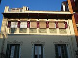
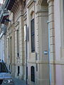
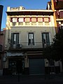 Català: Ca l'Ubach. C. Barceloneta, 9 (Montcada i Reixac).
This is a photo of a building indexed in the Catalan heritage register as Bé Cultural d'Interès Local (BCIL) under the reference IPA-27467.
Object location View all coordinates using: OpenStreetMap -
 Català: Ca l'Ubach. C. Barceloneta, 9 (Montcada i Reixac).
This is a photo of a building indexed in the Catalan heritage register as Bé Cultural d'Interès Local (BCIL) under the reference IPA-27467.
Object location View all coordinates using: OpenStreetMap -
 Català: Ca l'Ubach. C. Barceloneta, 9 (Montcada i Reixac).
This is a photo of a building indexed in the Catalan heritage register as Bé Cultural d'Interès Local (BCIL) under the reference IPA-27467.
Object location View all coordinates using: OpenStreetMap -
 Català: Ca l'Ubach. C. Barceloneta, 9 (Montcada i Reixac).
This is a photo of a building indexed in the Catalan heritage register as Bé Cultural d'Interès Local (BCIL) under the reference IPA-27467.
Object location View all coordinates using: OpenStreetMap -
 Català: Ca l'Ubach. C. Barceloneta, 9 (Montcada i Reixac).
This is a photo of a building indexed in the Catalan heritage register as Bé Cultural d'Interès Local (BCIL) under the reference IPA-27467.
Object location View all coordinates using: OpenStreetMap -
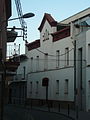
 Català: Carrer Colon. C. Colon (Montcada i Reixac).
This is a photo of a building indexed in the Catalan heritage register as Bé Cultural d'Interès Local (BCIL) under the reference IPA-27486.
Object location View all coordinates using: OpenStreetMap -
 Català: Carrer Colon. C. Colon (Montcada i Reixac).
This is a photo of a building indexed in the Catalan heritage register as Bé Cultural d'Interès Local (BCIL) under the reference IPA-27486.
Object location View all coordinates using: OpenStreetMap -
 Català: Carrer Colon. C. Colon (Montcada i Reixac).
This is a photo of a building indexed in the Catalan heritage register as Bé Cultural d'Interès Local (BCIL) under the reference IPA-27486.
Object location View all coordinates using: OpenStreetMap -
 Català: Carrer Colon. C. Colon (Montcada i Reixac).
This is a photo of a building indexed in the Catalan heritage register as Bé Cultural d'Interès Local (BCIL) under the reference IPA-27486.
Object location View all coordinates using: OpenStreetMap -
 Català: Carrer Colon. C. Colon (Montcada i Reixac).
This is a photo of a building indexed in the Catalan heritage register as Bé Cultural d'Interès Local (BCIL) under the reference IPA-27486.
Object location View all coordinates using: OpenStreetMap -
 Català: Carrer Colon. C. Colon (Montcada i Reixac).
This is a photo of a building indexed in the Catalan heritage register as Bé Cultural d'Interès Local (BCIL) under the reference IPA-27486.
Object location View all coordinates using: OpenStreetMap -
 Català: Carrer Colon. C. Colon (Montcada i Reixac).
This is a photo of a building indexed in the Catalan heritage register as Bé Cultural d'Interès Local (BCIL) under the reference IPA-27486.
Object location View all coordinates using: OpenStreetMap -
 Català: Carrer Colon. C. Colon (Montcada i Reixac).
This is a photo of a building indexed in the Catalan heritage register as Bé Cultural d'Interès Local (BCIL) under the reference IPA-27486.
Object location View all coordinates using: OpenStreetMap -
 Català: Carrer Colon. C. Colon (Montcada i Reixac).
This is a photo of a building indexed in the Catalan heritage register as Bé Cultural d'Interès Local (BCIL) under the reference IPA-27486.
Object location View all coordinates using: OpenStreetMap -
 Català: Carrer Colon. C. Colon (Montcada i Reixac).
This is a photo of a building indexed in the Catalan heritage register as Bé Cultural d'Interès Local (BCIL) under the reference IPA-27486.
Object location View all coordinates using: OpenStreetMap -
 Català: Carrer Colon. C. Colon (Montcada i Reixac).
This is a photo of a building indexed in the Catalan heritage register as Bé Cultural d'Interès Local (BCIL) under the reference IPA-27486.
Object location View all coordinates using: OpenStreetMap -
 Català: Carrer Colon. C. Colon (Montcada i Reixac).
This is a photo of a building indexed in the Catalan heritage register as Bé Cultural d'Interès Local (BCIL) under the reference IPA-27486.
Object location View all coordinates using: OpenStreetMap -
 Català: Carrer Colon. C. Colon (Montcada i Reixac).
This is a photo of a building indexed in the Catalan heritage register as Bé Cultural d'Interès Local (BCIL) under the reference IPA-27486.
Object location View all coordinates using: OpenStreetMap -
 Català: Casa Cuyàs. C. Major, 90 (Montcada i Reixac).
This is a photo of a building indexed in the Catalan heritage register as Bé Cultural d'Interès Local (BCIL) under the reference IPA-27496.
Object location View all coordinates using: OpenStreetMap Català: Casa Vilarrasa. C. Major, 92 (Montcada i Reixac).
This is a photo of a building indexed in the Catalan heritage register as Bé Cultural d'Interès Local (BCIL) under the reference IPA-27494.
Object location View all coordinates using: OpenStreetMap -
 Català: Casa Cuyàs. C. Major, 90 (Montcada i Reixac).
This is a photo of a building indexed in the Catalan heritage register as Bé Cultural d'Interès Local (BCIL) under the reference IPA-27496.
Object location View all coordinates using: OpenStreetMap -
 Català: Casa Cuyàs. C. Major, 90 (Montcada i Reixac).
This is a photo of a building indexed in the Catalan heritage register as Bé Cultural d'Interès Local (BCIL) under the reference IPA-27496.
Object location View all coordinates using: OpenStreetMap -
 Català: Casa Cuyàs. C. Major, 90 (Montcada i Reixac).
This is a photo of a building indexed in the Catalan heritage register as Bé Cultural d'Interès Local (BCIL) under the reference IPA-27496.
Object location View all coordinates using: OpenStreetMap -
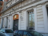
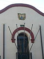
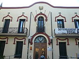 Català: Ajuntament de Montcada i Reixac. C. Major, 32 (Montcada i Reixac).
This is a photo of a building indexed in the Catalan heritage register as Bé Cultural d'Interès Local (BCIL) under the reference IPA-27499.
Object location View all coordinates using: OpenStreetMap -
 Català: Ajuntament de Montcada i Reixac. C. Major, 32 (Montcada i Reixac).
This is a photo of a building indexed in the Catalan heritage register as Bé Cultural d'Interès Local (BCIL) under the reference IPA-27499.
Object location View all coordinates using: OpenStreetMap -
 Català: Ajuntament de Montcada i Reixac. C. Major, 32 (Montcada i Reixac).
This is a photo of a building indexed in the Catalan heritage register as Bé Cultural d'Interès Local (BCIL) under the reference IPA-27499.
Object location View all coordinates using: OpenStreetMap -
 Català: Ajuntament de Montcada i Reixac. C. Major, 32 (Montcada i Reixac).
This is a photo of a building indexed in the Catalan heritage register as Bé Cultural d'Interès Local (BCIL) under the reference IPA-27499.
Object location View all coordinates using: OpenStreetMap -
 Català: Ajuntament de Montcada i Reixac. C. Major, 32 (Montcada i Reixac).
This is a photo of a building indexed in the Catalan heritage register as Bé Cultural d'Interès Local (BCIL) under the reference IPA-27499.
Object location View all coordinates using: OpenStreetMap -
 Català: Can Rufí. Carrer Domènec Fins, 48 (Montcada i Reixac).
This is a photo of a building indexed in the Catalan heritage register as Bé Cultural d'Interès Local (BCIL) under the reference IPA-27466.
Object location View all coordinates using: OpenStreetMap -
 Català: Can Rufí. Carrer Domènec Fins, 48 (Montcada i Reixac).
This is a photo of a building indexed in the Catalan heritage register as Bé Cultural d'Interès Local (BCIL) under the reference IPA-27466.
Object location View all coordinates using: OpenStreetMap -
 Català: Can Rufí. Carrer Domènec Fins, 48 (Montcada i Reixac).
This is a photo of a building indexed in the Catalan heritage register as Bé Cultural d'Interès Local (BCIL) under the reference IPA-27466.
Object location View all coordinates using: OpenStreetMap -
 Català: Casa Vilarrasa. C. Major, 92 (Montcada i Reixac).
This is a photo of a building indexed in the Catalan heritage register as Bé Cultural d'Interès Local (BCIL) under the reference IPA-27494.
Object location View all coordinates using: OpenStreetMap -
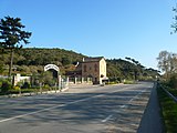 Català: Masoveria de Can Bonet. Ctra. de la Roca, km 8 (Montcada i Reixac).
This is a photo of a building indexed in the Catalan heritage register as Bé Cultural d'Interès Local (BCIL) under the reference IPA-27474.
Object location View all coordinates using: OpenStreetMap -
 Català: Masoveria de Can Bonet. Ctra. de la Roca, km 8 (Montcada i Reixac).
This is a photo of a building indexed in the Catalan heritage register as Bé Cultural d'Interès Local (BCIL) under the reference IPA-27474.
Object location View all coordinates using: OpenStreetMap -
 Català: Església parroquial de Santa Engràcia. Pl. Església (Montcada i Reixac).
This is a photo of a building indexed in the Catalan heritage register as Bé Cultural d'Interès Local (BCIL) under the reference IPA-27457.
Object location View all coordinates using: OpenStreetMap -
 Català: Església parroquial de Santa Engràcia. Pl. Església (Montcada i Reixac).
This is a photo of a building indexed in the Catalan heritage register as Bé Cultural d'Interès Local (BCIL) under the reference IPA-27457.
Object location View all coordinates using: OpenStreetMap -
 Català: Església parroquial de Santa Engràcia. Pl. Església (Montcada i Reixac).
This is a photo of a building indexed in the Catalan heritage register as Bé Cultural d'Interès Local (BCIL) under the reference IPA-27457.
Object location View all coordinates using: OpenStreetMap -
 Català: Església parroquial de Santa Engràcia. Pl. Església (Montcada i Reixac).
This is a photo of a building indexed in the Catalan heritage register as Bé Cultural d'Interès Local (BCIL) under the reference IPA-27457.
Object location View all coordinates using: OpenStreetMap -
 Català: Església parroquial de Santa Engràcia. Pl. Església (Montcada i Reixac).
This is a photo of a building indexed in the Catalan heritage register as Bé Cultural d'Interès Local (BCIL) under the reference IPA-27457.
Object location View all coordinates using: OpenStreetMap -
 Català: Església parroquial de Santa Engràcia. Pl. Església (Montcada i Reixac).
This is a photo of a building indexed in the Catalan heritage register as Bé Cultural d'Interès Local (BCIL) under the reference IPA-27457.
Object location View all coordinates using: OpenStreetMap -
 Català: Església parroquial de Santa Engràcia. Pl. Església (Montcada i Reixac).
This is a photo of a building indexed in the Catalan heritage register as Bé Cultural d'Interès Local (BCIL) under the reference IPA-27457.
Object location View all coordinates using: OpenStreetMap -
 Català: Església parroquial de Santa Engràcia. Pl. Església (Montcada i Reixac).
This is a photo of a building indexed in the Catalan heritage register as Bé Cultural d'Interès Local (BCIL) under the reference IPA-27457.
Object location View all coordinates using: OpenStreetMap -
 Català: Església parroquial de Santa Engràcia. Pl. Església (Montcada i Reixac).
This is a photo of a building indexed in the Catalan heritage register as Bé Cultural d'Interès Local (BCIL) under the reference IPA-27457.
Object location View all coordinates using: OpenStreetMap -
 Català: Església parroquial de Santa Engràcia. Pl. Església (Montcada i Reixac).
This is a photo of a building indexed in the Catalan heritage register as Bé Cultural d'Interès Local (BCIL) under the reference IPA-27457.
Object location View all coordinates using: OpenStreetMap -
 Català: Torre de Can Bonet. Ctra. de la Roca, km 8 (Montcada i Reixac).
This is a photo of a building indexed in the Catalan heritage register as Bé Cultural d'Interès Local (BCIL) under the reference IPA-27473.
Object location View all coordinates using: OpenStreetMap -
 Català: Torre de Can Bonet. Ctra. de la Roca, km 8 (Montcada i Reixac).
This is a photo of a building indexed in the Catalan heritage register as Bé Cultural d'Interès Local (BCIL) under the reference IPA-27473.
Object location View all coordinates using: OpenStreetMap -
 Català: Torre de Can Bonet. Ctra. de la Roca, km 8 (Montcada i Reixac).
This is a photo of a building indexed in the Catalan heritage register as Bé Cultural d'Interès Local (BCIL) under the reference IPA-27473.
Object location View all coordinates using: OpenStreetMap -
 Català: Torre de Can Bonet. Ctra. de la Roca, km 8 (Montcada i Reixac).
This is a photo of a building indexed in the Catalan heritage register as Bé Cultural d'Interès Local (BCIL) under the reference IPA-27473.
Object location View all coordinates using: OpenStreetMap -
 Català: Torre de Can Bonet. Ctra. de la Roca, km 8 (Montcada i Reixac).
This is a photo of a building indexed in the Catalan heritage register as Bé Cultural d'Interès Local (BCIL) under the reference IPA-27473.
Object location View all coordinates using: OpenStreetMap -
 Català: Torre de Can Bonet. Ctra. de la Roca, km 8 (Montcada i Reixac).
This is a photo of a building indexed in the Catalan heritage register as Bé Cultural d'Interès Local (BCIL) under the reference IPA-27473.
Object location View all coordinates using: OpenStreetMap -
 Català: Can Vila. C. Major, 100 (Montcada i Reixac).
This is a photo of a building indexed in the Catalan heritage register as Bé Cultural d'Interès Local (BCIL) under the reference IPA-27495.
Object location View all coordinates using: OpenStreetMap -
 Català: Can Vila. C. Major, 100 (Montcada i Reixac).
This is a photo of a building indexed in the Catalan heritage register as Bé Cultural d'Interès Local (BCIL) under the reference IPA-27495.
Object location View all coordinates using: OpenStreetMap -
 Català: Can Vila. C. Major, 100 (Montcada i Reixac).
This is a photo of a building indexed in the Catalan heritage register as Bé Cultural d'Interès Local (BCIL) under the reference IPA-27495.
Object location View all coordinates using: OpenStreetMap -
 Català: Can Vila. C. Major, 100 (Montcada i Reixac).
This is a photo of a building indexed in the Catalan heritage register as Bé Cultural d'Interès Local (BCIL) under the reference IPA-27495.
Object location View all coordinates using: OpenStreetMap


2015-05-01 20:02:10 edit


2015-05-02 22:27:43 edit
-
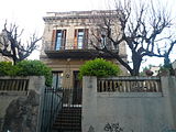
 Català: Casa de la Budellera. Parc Budellera, 15-17 (Barcelona).
This is a photo of a building indexed in the Catalan heritage register as Bé Cultural d'Interès Local (BCIL) under the reference IPA-30351.
Object location View all coordinates using: OpenStreetMap -
 Català: Casa de la Budellera. Parc Budellera, 15-17 (Barcelona).
This is a photo of a building indexed in the Catalan heritage register as Bé Cultural d'Interès Local (BCIL) under the reference IPA-30351.
Object location View all coordinates using: OpenStreetMap -
 Català: Casa de la Budellera. Parc Budellera, 15-17 (Barcelona).
This is a photo of a building indexed in the Catalan heritage register as Bé Cultural d'Interès Local (BCIL) under the reference IPA-30351.
Object location View all coordinates using: OpenStreetMap -
 Català: Casa de la Budellera. Parc Budellera, 15-17 (Barcelona).
This is a photo of a building indexed in the Catalan heritage register as Bé Cultural d'Interès Local (BCIL) under the reference IPA-30351.
Object location View all coordinates using: OpenStreetMap


2015-05-02 22:35:50 edit
-
 Català: Plaça dels Romeus de Sant Medir. Pl. dels Romeus de Sant Medir (Barcelona). Material: marbre blanc. AQUESTA PLAÇA, QUE DEU EL SEU NOM A LA / INICIATIVA DE LA “COLLA NOVA DE SANT MEDIR / DE SARRIÀ” I AL SUPORT DE SOCIS I VEÏNS, FOU / INAUGURADA SENT REGIDOR EL Sr. JAUME CIURANA / I LLEVADOT / SARRIÀ 3 DE MARÇ 1998. 1998.
 This is a photo of public art indexed in the cataloge Art Públic of Barcelona (Spain) under the code number5709-1 (prefixed with territorial id: 08019/5709-1)
Object location View all coordinates using: OpenStreetMap -
 Català: Plaça dels Romeus de Sant Medir. Pl. dels Romeus de Sant Medir (Barcelona). Material: marbre blanc. AQUESTA PLAÇA, QUE DEU EL SEU NOM A LA / INICIATIVA DE LA “COLLA NOVA DE SANT MEDIR / DE SARRIÀ” I AL SUPORT DE SOCIS I VEÏNS, FOU / INAUGURADA SENT REGIDOR EL Sr. JAUME CIURANA / I LLEVADOT / SARRIÀ 3 DE MARÇ 1998. 1998.This is a photo of public art indexed in the cataloge Art Públic of Barcelona (Spain) under the code number5709-1 (prefixed with territorial id: 08019/5709-1)
Object location View all coordinates using: OpenStreetMap


2015-05-03 23:32:33 edit
-
 Català: Acàcia de l'Estació St. Andreu Comtal (Barcelonès) (Barcelona). ca:Gleditsia triacanthos. Exòtica, no homologat.
 This is a a photo of a protected or outstanding tree in Catalonia, Spain, with id:MA-13.990.03
Object location View all coordinates using: OpenStreetMap -
 Català: Acàcia de l'Estació St. Andreu Comtal (Barcelonès) (Barcelona). ca:Gleditsia triacanthos. Exòtica, no homologat.
This is a a photo of a protected or outstanding tree in Catalonia, Spain, with id:MA-13.990.03
Català: Acàcia de l'Estació St. Andreu Comtal (Barcelonès) (Barcelona). ca:Gleditsia triacanthos. Exòtica, no homologat.
This is a a photo of a protected or outstanding tree in Catalonia, Spain, with id:MA-13.990.03Object location View all coordinates using: OpenStreetMap -
 Català: Acàcia del Japó del c. Mas Duran (Barcelonès) (Barcelona). ca:Sophora japonica. No homologat.
This is a a photo of a protected or outstanding tree in Catalonia, Spain, with id:MA-13.980.07
Català: Acàcia del Japó del c. Mas Duran (Barcelonès) (Barcelona). ca:Sophora japonica. No homologat.
This is a a photo of a protected or outstanding tree in Catalonia, Spain, with id:MA-13.980.07Object location View all coordinates using: OpenStreetMap -
 Català: Arbre de l'amor del c. Panorama (Barcelonès) (Barcelona). ca:Cercis siliquastrum. No homologat.
This is a a photo of a protected or outstanding tree in Catalonia, Spain, with id:MA-13.970.05
Català: Arbre de l'amor del c. Panorama (Barcelonès) (Barcelona). ca:Cercis siliquastrum. No homologat.
This is a a photo of a protected or outstanding tree in Catalonia, Spain, with id:MA-13.970.05Object location View all coordinates using: OpenStreetMap -
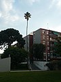
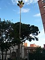
 Català: Palmera del passatge de les Palmeres (Barcelonès) (Barcelona). ca:Phoenix dactylifera. No homologat.
This is a a photo of a protected or outstanding tree in Catalonia, Spain, with id:MA-13.980.05
Català: Palmera del passatge de les Palmeres (Barcelonès) (Barcelona). ca:Phoenix dactylifera. No homologat.
This is a a photo of a protected or outstanding tree in Catalonia, Spain, with id:MA-13.980.05Object location View all coordinates using: OpenStreetMap -
 Català: Ullastre del Parc Güell (Barcelonès) (Barcelona). ca:Olea europaea var. sylvestris. No homologat.
This is a a photo of a protected or outstanding tree in Catalonia, Spain, with id:MA-13.960.07
Català: Ullastre del Parc Güell (Barcelonès) (Barcelona). ca:Olea europaea var. sylvestris. No homologat.
This is a a photo of a protected or outstanding tree in Catalonia, Spain, with id:MA-13.960.07Object location View all coordinates using: OpenStreetMap -
 Català: Washingtònia de Can Verdaguer (Barcelonès) (Barcelona). ca:Washingtonia robusta. No homologat.
This is a a photo of a protected or outstanding tree in Catalonia, Spain, with id:MA-13.980.03
Català: Washingtònia de Can Verdaguer (Barcelonès) (Barcelona). ca:Washingtonia robusta. No homologat.
This is a a photo of a protected or outstanding tree in Catalonia, Spain, with id:MA-13.980.03Object location View all coordinates using: OpenStreetMap -
 Català: Washingtònia de Can Verdaguer (Barcelonès) (Barcelona). ca:Washingtonia robusta. No homologat.
This is a a photo of a protected or outstanding tree in Catalonia, Spain, with id:MA-13.980.03
Català: Washingtònia de Can Verdaguer (Barcelonès) (Barcelona). ca:Washingtonia robusta. No homologat.
This is a a photo of a protected or outstanding tree in Catalonia, Spain, with id:MA-13.980.03Object location View all coordinates using: OpenStreetMap


_P1500883.jpg)


2015-05-04 00:25:55 edit
-
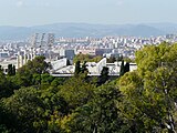
![]] des del turó de la Rovira. This is a a photo of a natural area in Catalonia, Spain, with id: ES510066 Object location 41° 26′ 24″ N, 2° 06′ 36″ E View all coordinates using: OpenStreetMap Camera location 41° 25′ 13.3″ N, 2° 09′ 49.02″ E View all coordinates using: OpenStreetMap](https://upload.wikimedia.org/wikipedia/commons/thumb/3/32/Collserola_des_del_carrer_Gran_Vista_al_tur%C3%B3_de_la_Rovira_P1500847.jpg/160px-Collserola_des_del_carrer_Gran_Vista_al_tur%C3%B3_de_la_Rovira_P1500847.jpg) ]] des del turó de la Rovira.
This is a a photo of a natural area in Catalonia, Spain, with id:ES510066
]] des del turó de la Rovira.
This is a a photo of a natural area in Catalonia, Spain, with id:ES510066Object location View all coordinates using: OpenStreetMap Camera location 
View all coordinates using: OpenStreetMap -
![]] des del turó de la Rovira. This is a a photo of a natural area in Catalonia, Spain, with id: ES510066 Object location 41° 26′ 24″ N, 2° 06′ 36″ E View all coordinates using: OpenStreetMap Camera location 41° 25′ 13.3″ N, 2° 09′ 49.02″ E View all coordinates using: OpenStreetMap](https://upload.wikimedia.org/wikipedia/commons/thumb/a/ae/Del_tur%C3%B3_de_Valldaura_al_tur%C3%B3_d%27en_Fotj%C3%A0_-_Collserola_des_del_carrer_Gran_Vista_al_tur%C3%B3_de_la_Rovira_P1500857.jpg/160px-Del_tur%C3%B3_de_Valldaura_al_tur%C3%B3_d%27en_Fotj%C3%A0_-_Collserola_des_del_carrer_Gran_Vista_al_tur%C3%B3_de_la_Rovira_P1500857.jpg) ]] des del turó de la Rovira.
This is a a photo of a natural area in Catalonia, Spain, with id:ES510066
]] des del turó de la Rovira.
This is a a photo of a natural area in Catalonia, Spain, with id:ES510066Object location View all coordinates using: OpenStreetMap Camera location View all coordinates using: OpenStreetMap -
![]] des del turó de la Rovira. This is a a photo of a natural area in Catalonia, Spain, with id: ES510066 Object location 41° 26′ 24″ N, 2° 06′ 36″ E View all coordinates using: OpenStreetMap Camera location 41° 25′ 13.3″ N, 2° 09′ 49.02″ E View all coordinates using: OpenStreetMap](https://upload.wikimedia.org/wikipedia/commons/thumb/6/6a/Torre_Bar%C3%B3_-_Collserola_des_del_carrer_Gran_Vista_al_tur%C3%B3_de_la_Rovira_P1500848.jpg/160px-Torre_Bar%C3%B3_-_Collserola_des_del_carrer_Gran_Vista_al_tur%C3%B3_de_la_Rovira_P1500848.jpg) ]] des del turó de la Rovira.
This is a a photo of a natural area in Catalonia, Spain, with id:ES510066
]] des del turó de la Rovira.
This is a a photo of a natural area in Catalonia, Spain, with id:ES510066Object location View all coordinates using: OpenStreetMap Camera location View all coordinates using: OpenStreetMap -
![]] des del turó de la Rovira. This is a a photo of a natural area in Catalonia, Spain, with id: ES510066 Object location 41° 26′ 24″ N, 2° 06′ 36″ E View all coordinates using: OpenStreetMap Camera location 41° 25′ 13.3″ N, 2° 09′ 49.02″ E View all coordinates using: OpenStreetMap](https://upload.wikimedia.org/wikipedia/commons/thumb/e/e8/Tur%C3%B3_d%27en_Fotj%C3%A0_-_Collserola_des_del_carrer_Gran_Vista_al_tur%C3%B3_de_la_Rovira_P1500855.jpg/160px-Tur%C3%B3_d%27en_Fotj%C3%A0_-_Collserola_des_del_carrer_Gran_Vista_al_tur%C3%B3_de_la_Rovira_P1500855.jpg) ]] des del turó de la Rovira.
This is a a photo of a natural area in Catalonia, Spain, with id:ES510066
]] des del turó de la Rovira.
This is a a photo of a natural area in Catalonia, Spain, with id:ES510066Object location View all coordinates using: OpenStreetMap Camera location View all coordinates using: OpenStreetMap -
![]] des del turó de la Rovira. This is a a photo of a natural area in Catalonia, Spain, with id: ES510066 Object location 41° 26′ 24″ N, 2° 06′ 36″ E View all coordinates using: OpenStreetMap Camera location 41° 25′ 13.3″ N, 2° 09′ 49.02″ E View all coordinates using: OpenStreetMap](https://upload.wikimedia.org/wikipedia/commons/thumb/b/be/Tur%C3%B3_d%27en_Fotj%C3%A0_-_Collserola_des_del_carrer_Gran_Vista_al_tur%C3%B3_de_la_Rovira_P1500856.jpg/160px-Tur%C3%B3_d%27en_Fotj%C3%A0_-_Collserola_des_del_carrer_Gran_Vista_al_tur%C3%B3_de_la_Rovira_P1500856.jpg) ]] des del turó de la Rovira.
This is a a photo of a natural area in Catalonia, Spain, with id:ES510066
]] des del turó de la Rovira.
This is a a photo of a natural area in Catalonia, Spain, with id:ES510066Object location View all coordinates using: OpenStreetMap Camera location View all coordinates using: OpenStreetMap -
![]] des del turó de la Rovira. This is a a photo of a natural area in Catalonia, Spain, with id: ES510066 Object location 41° 26′ 24″ N, 2° 06′ 36″ E View all coordinates using: OpenStreetMap Camera location 41° 25′ 13.3″ N, 2° 09′ 49.02″ E View all coordinates using: OpenStreetMap](https://upload.wikimedia.org/wikipedia/commons/thumb/4/41/Tur%C3%B3_d%27en_Gras_-_Collserola_des_del_carrer_Gran_Vista_al_tur%C3%B3_de_la_Rovira_P1500853.jpg/160px-Tur%C3%B3_d%27en_Gras_-_Collserola_des_del_carrer_Gran_Vista_al_tur%C3%B3_de_la_Rovira_P1500853.jpg) ]] des del turó de la Rovira.
This is a a photo of a natural area in Catalonia, Spain, with id:ES510066
]] des del turó de la Rovira.
This is a a photo of a natural area in Catalonia, Spain, with id:ES510066Object location View all coordinates using: OpenStreetMap Camera location View all coordinates using: OpenStreetMap -
![]] des del turó de la Rovira. This is a a photo of a natural area in Catalonia, Spain, with id: ES510066 Object location 41° 26′ 24″ N, 2° 06′ 36″ E View all coordinates using: OpenStreetMap Camera location 41° 25′ 13.3″ N, 2° 09′ 49.02″ E View all coordinates using: OpenStreetMap](https://upload.wikimedia.org/wikipedia/commons/thumb/f/f6/Tur%C3%B3_d%27en_Gras_-_Collserola_des_del_carrer_Gran_Vista_al_tur%C3%B3_de_la_Rovira_P1500854.jpg/160px-Tur%C3%B3_d%27en_Gras_-_Collserola_des_del_carrer_Gran_Vista_al_tur%C3%B3_de_la_Rovira_P1500854.jpg) ]] des del turó de la Rovira.
This is a a photo of a natural area in Catalonia, Spain, with id:ES510066
]] des del turó de la Rovira.
This is a a photo of a natural area in Catalonia, Spain, with id:ES510066Object location View all coordinates using: OpenStreetMap Camera location View all coordinates using: OpenStreetMap -
![]] des del turó de la Rovira. This is a a photo of a natural area in Catalonia, Spain, with id: ES510066 Object location 41° 26′ 24″ N, 2° 06′ 36″ E View all coordinates using: OpenStreetMap Camera location 41° 25′ 13.3″ N, 2° 09′ 49.02″ E View all coordinates using: OpenStreetMap](https://upload.wikimedia.org/wikipedia/commons/thumb/e/ea/Tur%C3%B3_d%27en_Gras%2C_tur%C3%B3_Sul_i_tur%C3%B3_d%27en_Segarra_-_Collserola_des_del_carrer_Gran_Vista_al_tur%C3%B3_de_la_Rovira_P1500852.jpg/160px-Tur%C3%B3_d%27en_Gras%2C_tur%C3%B3_Sul_i_tur%C3%B3_d%27en_Segarra_-_Collserola_des_del_carrer_Gran_Vista_al_tur%C3%B3_de_la_Rovira_P1500852.jpg) ]] des del turó de la Rovira.
This is a a photo of a natural area in Catalonia, Spain, with id:ES510066
]] des del turó de la Rovira.
This is a a photo of a natural area in Catalonia, Spain, with id:ES510066Object location View all coordinates using: OpenStreetMap Camera location View all coordinates using: OpenStreetMap -
![]] des del turó de la Rovira. This is a a photo of a natural area in Catalonia, Spain, with id: ES510066 Object location 41° 26′ 24″ N, 2° 06′ 36″ E View all coordinates using: OpenStreetMap Camera location 41° 25′ 13.3″ N, 2° 09′ 49.02″ E View all coordinates using: OpenStreetMap](https://upload.wikimedia.org/wikipedia/commons/thumb/0/06/Tur%C3%B3_d%27en_Segarra%2C_tur%C3%B3_Blau_i_tur%C3%B3_de_Roquetes_-_Collserola_des_del_carrer_Gran_Vista_al_tur%C3%B3_de_la_Rovira_P1500850.jpg/160px-Tur%C3%B3_d%27en_Segarra%2C_tur%C3%B3_Blau_i_tur%C3%B3_de_Roquetes_-_Collserola_des_del_carrer_Gran_Vista_al_tur%C3%B3_de_la_Rovira_P1500850.jpg) ]] des del turó de la Rovira.
This is a a photo of a natural area in Catalonia, Spain, with id:ES510066
]] des del turó de la Rovira.
This is a a photo of a natural area in Catalonia, Spain, with id:ES510066Object location View all coordinates using: OpenStreetMap Camera location View all coordinates using: OpenStreetMap -
![]] des del turó de la Rovira. This is a a photo of a natural area in Catalonia, Spain, with id: ES510066 Object location 41° 26′ 24″ N, 2° 06′ 36″ E View all coordinates using: OpenStreetMap Camera location 41° 25′ 09.7″ N, 2° 09′ 42.13″ E View all coordinates using: OpenStreetMap](https://upload.wikimedia.org/wikipedia/commons/thumb/5/57/Tur%C3%B3_d%27en_Segarra%2C_tur%C3%B3_Blau_i_tur%C3%B3_de_Roquetes_des_del_cim_del_tur%C3%B3_de_la_Rovira_P1500874.jpg/160px-Tur%C3%B3_d%27en_Segarra%2C_tur%C3%B3_Blau_i_tur%C3%B3_de_Roquetes_des_del_cim_del_tur%C3%B3_de_la_Rovira_P1500874.jpg) ]] des del turó de la Rovira.
This is a a photo of a natural area in Catalonia, Spain, with id:ES510066
]] des del turó de la Rovira.
This is a a photo of a natural area in Catalonia, Spain, with id:ES510066Object location View all coordinates using: OpenStreetMap Camera location View all coordinates using: OpenStreetMap -
![]] des del turó de la Rovira. This is a a photo of a natural area in Catalonia, Spain, with id: ES510066 Object location 41° 26′ 24″ N, 2° 06′ 36″ E View all coordinates using: OpenStreetMap Camera location 41° 25′ 13.3″ N, 2° 09′ 49.02″ E View all coordinates using: OpenStreetMap](https://upload.wikimedia.org/wikipedia/commons/thumb/a/ae/Tur%C3%B3_de_la_Magarola_i_tur%C3%B3_de_Valldaura_-_Collserola_des_del_carrer_Gran_Vista_al_tur%C3%B3_de_la_Rovira_P1500858.jpg/160px-Tur%C3%B3_de_la_Magarola_i_tur%C3%B3_de_Valldaura_-_Collserola_des_del_carrer_Gran_Vista_al_tur%C3%B3_de_la_Rovira_P1500858.jpg) ]] des del turó de la Rovira.
This is a a photo of a natural area in Catalonia, Spain, with id:ES510066
]] des del turó de la Rovira.
This is a a photo of a natural area in Catalonia, Spain, with id:ES510066Object location View all coordinates using: OpenStreetMap Camera location View all coordinates using: OpenStreetMap -
![]] des del turó de la Rovira. This is a a photo of a natural area in Catalonia, Spain, with id: ES510066 Object location 41° 26′ 24″ N, 2° 06′ 36″ E View all coordinates using: OpenStreetMap Camera location 41° 25′ 13.3″ N, 2° 09′ 49.02″ E View all coordinates using: OpenStreetMap](https://upload.wikimedia.org/wikipedia/commons/thumb/0/00/Tur%C3%B3_de_Roquetes_-_Collserola_des_del_carrer_Gran_Vista_al_tur%C3%B3_de_la_Rovira_P1500849.jpg/160px-Tur%C3%B3_de_Roquetes_-_Collserola_des_del_carrer_Gran_Vista_al_tur%C3%B3_de_la_Rovira_P1500849.jpg) ]] des del turó de la Rovira.
This is a a photo of a natural area in Catalonia, Spain, with id:ES510066
]] des del turó de la Rovira.
This is a a photo of a natural area in Catalonia, Spain, with id:ES510066Object location View all coordinates using: OpenStreetMap Camera location View all coordinates using: OpenStreetMap -
![]] des del turó de la Rovira. This is a a photo of a natural area in Catalonia, Spain, with id: ES510066 Object location 41° 26′ 24″ N, 2° 06′ 36″ E View all coordinates using: OpenStreetMap Camera location 41° 25′ 13.3″ N, 2° 09′ 49.02″ E View all coordinates using: OpenStreetMap](https://upload.wikimedia.org/wikipedia/commons/thumb/5/51/Tur%C3%B3_Sul%2C_tur%C3%B3_d%27en_Segarra%2C_tur%C3%B3_Blau_i_tur%C3%B3_de_Roquetes_-_Collserola_des_del_carrer_Gran_Vista_al_tur%C3%B3_de_la_Rovira_P1500851.jpg/160px-Tur%C3%B3_Sul%2C_tur%C3%B3_d%27en_Segarra%2C_tur%C3%B3_Blau_i_tur%C3%B3_de_Roquetes_-_Collserola_des_del_carrer_Gran_Vista_al_tur%C3%B3_de_la_Rovira_P1500851.jpg) ]] des del turó de la Rovira.
This is a a photo of a natural area in Catalonia, Spain, with id:ES510066
]] des del turó de la Rovira.
This is a a photo of a natural area in Catalonia, Spain, with id:ES510066Object location View all coordinates using: OpenStreetMap Camera location View all coordinates using: OpenStreetMap -
![]] des del turó de la Rovira. This is a a photo of a natural area in Catalonia, Spain, with id: ES510066 Object location 41° 26′ 24″ N, 2° 06′ 36″ E View all coordinates using: OpenStreetMap Camera location 41° 25′ 13.3″ N, 2° 09′ 49.02″ E View all coordinates using: OpenStreetMap](https://upload.wikimedia.org/wikipedia/commons/thumb/3/37/Tur%C3%B3_d%27en_Segarra%2C_tur%C3%B3_Blau_i_tur%C3%B3_de_Roquetes_-_Collserola_des_del_carrer_Gran_Vista_al_tur%C3%B3_de_la_Rovira_P1500850ret.jpg/200px-Tur%C3%B3_d%27en_Segarra%2C_tur%C3%B3_Blau_i_tur%C3%B3_de_Roquetes_-_Collserola_des_del_carrer_Gran_Vista_al_tur%C3%B3_de_la_Rovira_P1500850ret.jpg) ]] des del turó de la Rovira.
This is a a photo of a natural area in Catalonia, Spain, with id:ES510066
]] des del turó de la Rovira.
This is a a photo of a natural area in Catalonia, Spain, with id:ES510066Object location View all coordinates using: OpenStreetMap Camera location View all coordinates using: OpenStreetMap
![]] des del turó de la Rovira. This is a a photo of a natural area in Catalonia, Spain, with id: ES510066 Object location 41° 26′ 24″ N, 2° 06′ 36″ E View all coordinates using: OpenStreetMap Camera location 41° 25′ 13.3″ N, 2° 09′ 49.02″ E View all coordinates using: OpenStreetMap](/wiki/File:Collserola_des_del_carrer_Gran_Vista_al_tur%C3%B3_de_la_Rovira_P1500847.jpg)
![]] des del turó de la Rovira. This is a a photo of a natural area in Catalonia, Spain, with id: ES510066 Object location 41° 26′ 24″ N, 2° 06′ 36″ E View all coordinates using: OpenStreetMap Camera location 41° 25′ 13.3″ N, 2° 09′ 49.02″ E View all coordinates using: OpenStreetMap](/wiki/File:Del_tur%C3%B3_de_Valldaura_al_tur%C3%B3_d%27en_Fotj%C3%A0_-_Collserola_des_del_carrer_Gran_Vista_al_tur%C3%B3_de_la_Rovira_P1500857.jpg)
![]] des del turó de la Rovira. This is a a photo of a natural area in Catalonia, Spain, with id: ES510066 Object location 41° 26′ 24″ N, 2° 06′ 36″ E View all coordinates using: OpenStreetMap Camera location 41° 25′ 13.3″ N, 2° 09′ 49.02″ E View all coordinates using: OpenStreetMap](/wiki/File:Torre_Bar%C3%B3_-_Collserola_des_del_carrer_Gran_Vista_al_tur%C3%B3_de_la_Rovira_P1500848.jpg)
![]] des del turó de la Rovira. This is a a photo of a natural area in Catalonia, Spain, with id: ES510066 Object location 41° 26′ 24″ N, 2° 06′ 36″ E View all coordinates using: OpenStreetMap Camera location 41° 25′ 13.3″ N, 2° 09′ 49.02″ E View all coordinates using: OpenStreetMap](/wiki/File:Tur%C3%B3_d%27en_Fotj%C3%A0_-_Collserola_des_del_carrer_Gran_Vista_al_tur%C3%B3_de_la_Rovira_P1500855.jpg)
![]] des del turó de la Rovira. This is a a photo of a natural area in Catalonia, Spain, with id: ES510066 Object location 41° 26′ 24″ N, 2° 06′ 36″ E View all coordinates using: OpenStreetMap Camera location 41° 25′ 13.3″ N, 2° 09′ 49.02″ E View all coordinates using: OpenStreetMap](/wiki/File:Tur%C3%B3_d%27en_Fotj%C3%A0_-_Collserola_des_del_carrer_Gran_Vista_al_tur%C3%B3_de_la_Rovira_P1500856.jpg)
![]] des del turó de la Rovira. This is a a photo of a natural area in Catalonia, Spain, with id: ES510066 Object location 41° 26′ 24″ N, 2° 06′ 36″ E View all coordinates using: OpenStreetMap Camera location 41° 25′ 13.3″ N, 2° 09′ 49.02″ E View all coordinates using: OpenStreetMap](/wiki/File:Tur%C3%B3_d%27en_Gras_-_Collserola_des_del_carrer_Gran_Vista_al_tur%C3%B3_de_la_Rovira_P1500853.jpg)
![]] des del turó de la Rovira. This is a a photo of a natural area in Catalonia, Spain, with id: ES510066 Object location 41° 26′ 24″ N, 2° 06′ 36″ E View all coordinates using: OpenStreetMap Camera location 41° 25′ 13.3″ N, 2° 09′ 49.02″ E View all coordinates using: OpenStreetMap](/wiki/File:Tur%C3%B3_d%27en_Gras_-_Collserola_des_del_carrer_Gran_Vista_al_tur%C3%B3_de_la_Rovira_P1500854.jpg)
![]] des del turó de la Rovira. This is a a photo of a natural area in Catalonia, Spain, with id: ES510066 Object location 41° 26′ 24″ N, 2° 06′ 36″ E View all coordinates using: OpenStreetMap Camera location 41° 25′ 13.3″ N, 2° 09′ 49.02″ E View all coordinates using: OpenStreetMap](/wiki/File:Tur%C3%B3_d%27en_Gras,_tur%C3%B3_Sul_i_tur%C3%B3_d%27en_Segarra_-_Collserola_des_del_carrer_Gran_Vista_al_tur%C3%B3_de_la_Rovira_P1500852.jpg)
![]] des del turó de la Rovira. This is a a photo of a natural area in Catalonia, Spain, with id: ES510066 Object location 41° 26′ 24″ N, 2° 06′ 36″ E View all coordinates using: OpenStreetMap Camera location 41° 25′ 13.3″ N, 2° 09′ 49.02″ E View all coordinates using: OpenStreetMap](/wiki/File:Tur%C3%B3_d%27en_Segarra,_tur%C3%B3_Blau_i_tur%C3%B3_de_Roquetes_-_Collserola_des_del_carrer_Gran_Vista_al_tur%C3%B3_de_la_Rovira_P1500850.jpg)
![]] des del turó de la Rovira. This is a a photo of a natural area in Catalonia, Spain, with id: ES510066 Object location 41° 26′ 24″ N, 2° 06′ 36″ E View all coordinates using: OpenStreetMap Camera location 41° 25′ 09.7″ N, 2° 09′ 42.13″ E View all coordinates using: OpenStreetMap](/wiki/File:Tur%C3%B3_d%27en_Segarra,_tur%C3%B3_Blau_i_tur%C3%B3_de_Roquetes_des_del_cim_del_tur%C3%B3_de_la_Rovira_P1500874.jpg)
![]] des del turó de la Rovira. This is a a photo of a natural area in Catalonia, Spain, with id: ES510066 Object location 41° 26′ 24″ N, 2° 06′ 36″ E View all coordinates using: OpenStreetMap Camera location 41° 25′ 13.3″ N, 2° 09′ 49.02″ E View all coordinates using: OpenStreetMap](/wiki/File:Tur%C3%B3_de_la_Magarola_i_tur%C3%B3_de_Valldaura_-_Collserola_des_del_carrer_Gran_Vista_al_tur%C3%B3_de_la_Rovira_P1500858.jpg)
![]] des del turó de la Rovira. This is a a photo of a natural area in Catalonia, Spain, with id: ES510066 Object location 41° 26′ 24″ N, 2° 06′ 36″ E View all coordinates using: OpenStreetMap Camera location 41° 25′ 13.3″ N, 2° 09′ 49.02″ E View all coordinates using: OpenStreetMap](/wiki/File:Tur%C3%B3_de_Roquetes_-_Collserola_des_del_carrer_Gran_Vista_al_tur%C3%B3_de_la_Rovira_P1500849.jpg)
![]] des del turó de la Rovira. This is a a photo of a natural area in Catalonia, Spain, with id: ES510066 Object location 41° 26′ 24″ N, 2° 06′ 36″ E View all coordinates using: OpenStreetMap Camera location 41° 25′ 13.3″ N, 2° 09′ 49.02″ E View all coordinates using: OpenStreetMap](/wiki/File:Tur%C3%B3_Sul,_tur%C3%B3_d%27en_Segarra,_tur%C3%B3_Blau_i_tur%C3%B3_de_Roquetes_-_Collserola_des_del_carrer_Gran_Vista_al_tur%C3%B3_de_la_Rovira_P1500851.jpg)
![]] des del turó de la Rovira. This is a a photo of a natural area in Catalonia, Spain, with id: ES510066 Object location 41° 26′ 24″ N, 2° 06′ 36″ E View all coordinates using: OpenStreetMap Camera location 41° 25′ 13.3″ N, 2° 09′ 49.02″ E View all coordinates using: OpenStreetMap](/wiki/File:Tur%C3%B3_d%27en_Segarra,_tur%C3%B3_Blau_i_tur%C3%B3_de_Roquetes_-_Collserola_des_del_carrer_Gran_Vista_al_tur%C3%B3_de_la_Rovira_P1500850ret.jpg)
2015-05-13 11:32:12 edit
-
 Església de la Bonanova.
 -
 Església de la Bonanova.
 -
 Església de la Bonanova.
 -
 Església de la Bonanova.
 -
 Església de la Bonanova.
 -
 Església de la Bonanova.
 -
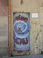 Església de la Bonanova.
 -
 Església de la Bonanova.
 -
 Església de la Bonanova.
 -
 Església de la Bonanova.
 -
 Església de la Bonanova.
 -
 Església de la Bonanova.
 -
 Església de la Bonanova.
 -
 Església de la Bonanova.
 -
 Església de la Bonanova.
 -
 Església de la Bonanova.
 -
 Església de la Bonanova.
 -
 Església de la Bonanova.
 -
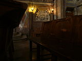 Església de la Bonanova.
 -
 Església de la Bonanova.
 -
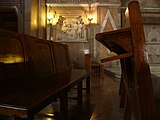 Església de la Bonanova.
 -
 Església de la Bonanova.
 -
 Església de la Bonanova.
 -
 Església de la Bonanova.
 -
 Església de la Bonanova.
 -
 Església de la Bonanova.
 -
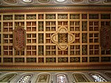 Església de la Bonanova.
 -
 Església de la Bonanova.
 -
 Església de la Bonanova.
 -
 Església de la Bonanova.
 -
 Església de la Bonanova.
 -
 Església de la Bonanova.
 -
 Església de la Bonanova.
 -
 Església de la Bonanova.
 -
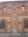 Església de la Bonanova.
 -
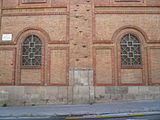 Església de la Bonanova.
 -
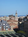 Església de la Bonanova.


2015-05-14 12:19:07 edit
-
 Rellotges de sol bessons en un dels edificis de l'escola La Salle Bonanova, vistos des del carrer de Sant Joan de La Salle.
 Warning: The subject of this image is believed to be protected by copyright.
It is believed that the taking, uploading and reuse of this derivative work is permitted under the copyright law of the country in which the photograph was taken, possibly with some restrictions, because the subject was permanently located in a public place. In Germany, this exception is known as Panoramafreiheit; many other countries have similar exceptions which are referred to on Commons by the generic term "freedom of panorama".
Freedom of panorama does not apply in all countries, and often applies only to photographs of buildings that are permanently located in a public place. In some countries the freedom may apply more broadly. It may or may not extend to sculptures and/or to subjects that are not in a "public place" but are in a "place to which the public has access". The allowed usage of this picture, if any, depends upon the laws of the country of creation, and may also depend on the laws of the country in which the derived image is to be used. See Commons:Freedom of panorama for a country by country list.
Before reusing this content, ensure that you have the right to do so. You are solely responsible for ensuring that you do not infringe someone else's copyrights. See our general disclaimer for more information.
If you have added this template to an image description page, remember that in most cases it should be accompanied by an acknowledgement of source.
-
 Rellotges de sol bessons en un dels edificis de l'escola La Salle Bonanova, vistos des del carrer de Sant Joan de La Salle.
Warning: The subject of this image is believed to be protected by copyright.
Rellotges de sol bessons en un dels edificis de l'escola La Salle Bonanova, vistos des del carrer de Sant Joan de La Salle.
Warning: The subject of this image is believed to be protected by copyright.It is believed that the taking, uploading and reuse of this derivative work is permitted under the copyright law of the country in which the photograph was taken, possibly with some restrictions, because the subject was permanently located in a public place. In Germany, this exception is known as Panoramafreiheit; many other countries have similar exceptions which are referred to on Commons by the generic term "freedom of panorama".
Freedom of panorama does not apply in all countries, and often applies only to photographs of buildings that are permanently located in a public place. In some countries the freedom may apply more broadly. It may or may not extend to sculptures and/or to subjects that are not in a "public place" but are in a "place to which the public has access". The allowed usage of this picture, if any, depends upon the laws of the country of creation, and may also depend on the laws of the country in which the derived image is to be used. See Commons:Freedom of panorama for a country by country list.
Before reusing this content, ensure that you have the right to do so. You are solely responsible for ensuring that you do not infringe someone else's copyrights. See our general disclaimer for more information.
If you have added this template to an image description page, remember that in most cases it should be accompanied by an acknowledgement of source.


2015-05-15 22:29:01 edit
-
 Rellotges de sol de l'església dels Àngels, a la cantonada de carrer Balmes i carrer València de Barcelona. Fotografia feta des del carrer.
 -
 Rellotges de sol de l'església dels Àngels, a la cantonada de carrer Balmes i carrer València de Barcelona. Fotografia feta des del carrer.
 -
 Rellotges de sol de l'església dels Àngels, a la cantonada de carrer Balmes i carrer València de Barcelona. Fotografia feta des del carrer.
 -
 Rellotges de sol de l'església dels Àngels, a la cantonada de carrer Balmes i carrer València de Barcelona. Fotografia feta des del carrer.


2015-05-17 00:24:50 edit


2015-05-17 01:15:00 edit
-
 Català: Papallona de l'arborç (Charaxes jasius) prop del cim del Puig Francàs, posada sobre una estepa blanca (Cistus albidus). El Montmell-Marmellar (Baix Penedès, Alt Penedès, Alt Camp) (El Montmell, la Bisbal del Penedès, Sant Jaume dels Domenys i altres).
This is a a photo of a natural area in Catalonia, Spain, with id:ES510138
Català: Papallona de l'arborç (Charaxes jasius) prop del cim del Puig Francàs, posada sobre una estepa blanca (Cistus albidus). El Montmell-Marmellar (Baix Penedès, Alt Penedès, Alt Camp) (El Montmell, la Bisbal del Penedès, Sant Jaume dels Domenys i altres).
This is a a photo of a natural area in Catalonia, Spain, with id:ES510138Object location View all coordinates using: OpenStreetMap -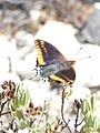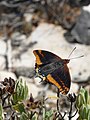
 Català: Papallona de l'arborç (Charaxes jasius) prop del cim del Puig Francàs, posada sobre una estepa blanca (Cistus albidus). El Montmell-Marmellar (Baix Penedès, Alt Penedès, Alt Camp) (El Montmell, la Bisbal del Penedès, Sant Jaume dels Domenys i altres).
This is a a photo of a natural area in Catalonia, Spain, with id:ES510138
Català: Papallona de l'arborç (Charaxes jasius) prop del cim del Puig Francàs, posada sobre una estepa blanca (Cistus albidus). El Montmell-Marmellar (Baix Penedès, Alt Penedès, Alt Camp) (El Montmell, la Bisbal del Penedès, Sant Jaume dels Domenys i altres).
This is a a photo of a natural area in Catalonia, Spain, with id:ES510138Object location View all coordinates using: OpenStreetMap
_al_Puig_Franc%C3%A0s_P1250454.jpg)
_al_Puig_Franc%C3%A0s_P1250455.jpg)
_al_Puig_Franc%C3%A0s_P1250456.jpg)
_al_Puig_Franc%C3%A0s_P1250457.jpg)
_al_Puig_Franc%C3%A0s_P1250458.jpg)
_al_Puig_Franc%C3%A0s_P1250459.jpg)
_al_Puig_Franc%C3%A0s_P1250460.jpg)
_al_Puig_Franc%C3%A0s_P1250461.jpg)
_al_Puig_Franc%C3%A0s_P1250462.jpg)
_al_Puig_Franc%C3%A0s_P1250463.jpg)
2015-05-17 00:30:10 edit
-

-

-

-
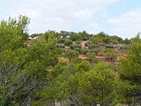
-
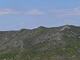
-

-

-

-

-

-

-

-

-

-

-

-

-
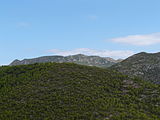
-

-

-

-
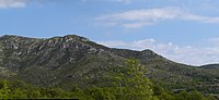
-

-

-

-

-
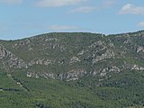
-

-
 Català: Imatges preses en una excursió al Puig Francàs des del Priorat del Penedès (la Bisbal del Penedès, Baix Penedès). Espai d'interès natural del Montmell-Marmellar (Baix Penedès, Alt Penedès, Alt Camp) (El Montmell, la Bisbal del Penedès, Sant Jaume dels Domenys i altres).
Template:AutotranslateTemplate:Object location dec
This is a a photo of a natural area in Catalonia, Spain, with id:ES510138 -
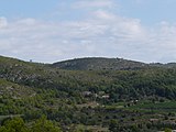
-

-

-

-

-

-

-

-

-

-

-

-
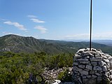
-

-

-

-

-

-
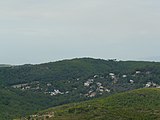
-

-

-
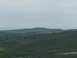
-
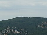
-

-
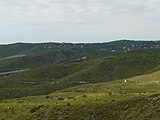
-
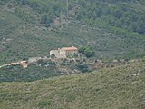
-
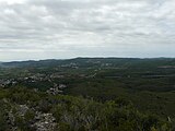
-

-
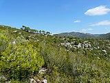
-

-

-

-
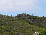
-
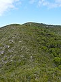
-

-

-

-

-

-

-

-
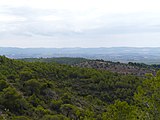


_P1250380.jpg)


2015-05-20 00:57:53 edit


2015-05-20 01:21:42 edit


2015-05-20 01:30:06 edit


2015-05-24 17:56:28 edit


2015-05-24 18:03:29 edit


2015-05-24 18:32:18 edit


2015-05-24 18:17:38 edit


2015-05-24 18:48:50 edit


2015-05-24 19:48:26 edit

_P1510110.jpg)
_P1510111.jpg)
2015-05-24 19:53:35 edit


2015-05-24 20:03:59 edit


2015-05-24 20:06:54 edit


2015-05-24 20:13:36 edit


2015-05-24 19:12:01 edit


2015-05-24 20:27:03 edit
-
 Montcada i Reixac, prop del Rec Comtal.

2015-05-24 20:24:31 edit
-
 Edifici al carrer de Felicià Xarau (Cerdanyola del Vallès).
 -
 Edifici al carrer de Felicià Xarau (Cerdanyola del Vallès).
 -
 Carretera N-150 a Cerdanyola del Vallès.
 -
 Carretera N-150. La vorera de la dreta és de Cerdanyola del Vallès i l'esquerra és de Ripollet.


2015-05-24 20:46:12 edit
-
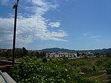 La Coscollada, a la serra de Marina, vista des de la passera de vianants sobre el riu Ripoll i l'autopista a Ripollet.
 -
 La Coscollada, a la serra de Marina, vista des de la passera de vianants sobre el riu Ripoll i l'autopista a Ripollet.
 -
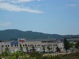 La Coscollada, a la serra de Marina, vista des de la passera de vianants sobre el riu Ripoll i l'autopista a Ripollet.


2015-05-24 20:31:59 edit
-
 Celler cooperatiu de Ripollet.
 -
 Vista des de la passera sobre el riu Ripoll, a Ripollet, mirant aigües avall.
 -
 Vista des de la passera sobre el riu Ripoll, a Ripollet, mirant aigües avall.
 -
 Vista des de la passera sobre el riu Ripoll, a Ripollet, mirant aigües avall.
 -
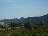 Vista des de la passera sobre el riu Ripoll, a Ripollet, mirant aigües avall.
 -
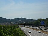 Vista des de la passera sobre el riu Ripoll, a Ripollet, mirant aigües avall.
 -
 Vista des de la passera sobre el riu Ripoll, a Ripollet, mirant aigües avall.
 -
 Vista des de la passera sobre el riu Ripoll, a Ripollet, mirant aigües avall.


2015-05-24 20:38:23 edit
-
 Senyal del camí dels Alous.
 -
 Centre Operatiu de Rubí i Centre de Comandament Integrat dels Ferrocarrils de la Generalitat, a Rubí.
 -
 Centre Operatiu de Rubí i Centre de Comandament Integrat dels Ferrocarrils de la Generalitat, a Rubí.
 -
 Centre Operatiu de Rubí i Centre de Comandament Integrat dels Ferrocarrils de la Generalitat, a Rubí.
 -
 Centre Operatiu de Rubí i Centre de Comandament Integrat dels Ferrocarrils de la Generalitat, a Rubí.
 -
 Estació de Renfe (o d'Adif) de Rubí.
 -
 Parc de ca n'Oriol, a Rubí (Vallès Occidental).
 -
 Parc de ca n'Oriol, a Rubí (Vallès Occidental).


2015-05-24 21:11:46 edit
-
 Rata comuna (Rattus norvegicus) al carrer d'Astúries de Sant Cugat del Vallès, corrent tranquilament pel mig del carrer un matí de diumenge. Està fotografiada des d'una bicicleta en marxa per no espantar-la.
 -
 Rata comuna (Rattus norvegicus) al carrer d'Astúries de Sant Cugat del Vallès, corrent tranquilament pel mig del carrer un matí de diumenge. Està fotografiada des d'una bicicleta en marxa per no espantar-la.


2015-05-24 19:04:52 edit


2015-05-24 19:26:54 edit


2015-05-24 22:03:27 edit
-
 Rata comuna (Rattus norvegicus) al carrer d'Astúries de Sant Cugat del Vallès, corrent tranquilament pel mig del carrer un matí de diumenge. Està fotografiada des d'una bicicleta en marxa per no espantar-la.
