Category:1849 maps
| ← · 1840 · 1841 · 1842 · 1843 · 1844 · 1845 · 1846 · 1847 · 1848 · 1849 · → |
Deutsch: Karten mit Bezug zum Jahr 1849
English: Maps related to the year 1849
Español: Mapas relativos al año 1849
Français : Cartes concernant l’an 1849
Русский: Карты 1849 года
Subcategories
This category has the following 10 subcategories, out of 10 total.
*
- 1849 maps of the world (2 F)
A
- 1849 maps of Africa (11 F)
E
G
N
O
S
- 1849 maps of South America (1 F)
Media in category "1849 maps"
The following 110 files are in this category, out of 110 total.
-
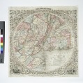
 (1849) España y Portugal.jpg 5,294 × 3,777; 8.9 MB
-
 CHAO(1849) Atlas Historico Geografico de España - Mapa 1 (409).jpg 4,462 × 3,750; 7.4 MB
-
 CHAO(1849) Atlas Historico Geografico de España - Mapa 2 (409-585).jpg 4,521 × 3,790; 7.74 MB
-
 CHAO(1849) Atlas Historico Geografico de España - Mapa 4 (756-1030).jpg 4,420 × 3,684; 7.53 MB
-
 CHAO(1849) Atlas Historico Geografico de España - Mapa 6 (1214-1492).jpg 4,430 × 3,769; 8.02 MB
-

-
 1849 Japanese Map of Edo or Tokyo, Japan - Geographicus - Edo-tokyo-1849.jpg 6,000 × 4,892; 9.26 MB
-
 1849 Land Survey Map of Michigan Upper Peninsula - Geographicus - Michigan-ls-1850.jpg 3,000 × 1,810; 964 KB
-
 1849 Munich public libraries map HouseOfCommonsSelectCommittee.jpg 606 × 363; 140 KB
-
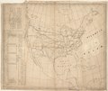
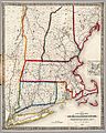 1849 Railroad Map of New England & Eastern New York.jpg 7,882 × 9,884; 19.41 MB
-
-
 60 of 'Historia de Méjico, etc' (11030031305).jpg 2,432 × 1,460; 990 KB
-

-

-
 A map of the counties of Salem and Gloucester, New Jersey - from actual surveys LOC 2012586902.jpg 17,080 × 11,507; 26.48 MB
-
 A map of the counties of Salem and Gloucester, New Jersey - from actual surveys LOC 2012586902.tif 17,080 × 11,507; 562.3 MB
-
 Admiralty Chart No 1654 File-J. & C. Walker, The Archipelago (FL37663320 3370988), Published 1849.jpg 12,425 × 16,384; 278.21 MB
-
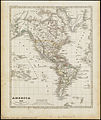 America (3121047664).jpg 1,678 × 2,000; 3.24 MB
-
 Asia minor 1140-es.svg 932 × 1,008; 978 KB
-
 Badische Hauptbahn aus Bahnkarte Deutschland 1849.png 814 × 1,100; 1.77 MB
-
-
 China. LOC 2006629389.tif 6,835 × 5,333; 104.29 MB
-

-
 City of Washington. LOC 88694047.jpg 5,131 × 4,057; 3.57 MB
-
 City of Washington. LOC 88694047.tif 5,131 × 4,057; 59.56 MB
-

-

-

-

-
 Detailed map of the eight provinces of the Kantō region (14961991615).jpg 2,271 × 2,000; 1.87 MB
-
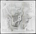
 Diagram of the south part of Shaker Village, Canterbury, NH. LOC 00552211.jpg 3,709 × 4,839; 2.27 MB
-
 Diagram of the south part of Shaker Village, Canterbury, NH. LOC 00552211.tif 3,709 × 4,839; 51.35 MB
-
-
 Distance map of the state of New York - containing all the towns in the state. LOC 2009584046.tif 8,921 × 6,563; 167.51 MB
-
 Eduard Kretzschmar, Das Heilige Land aus der Vogelschau (FL199985561 2368690).jpg 8,620 × 6,620; 31.77 MB
-
 Edward Aldrich, Plan of the town and environs of Jerusalem (FL10521888 2810420).jpg 7,488 × 6,922; 53.46 MB
-
 Edward Gennys Fanshawe, Chart of the harbour of Rio de Janeiro, Brazil.jpg 995 × 1,280; 919 KB
-

-

-
 Head of navigation of the Potomac River LOC 87695757.jpg 15,202 × 9,015; 17.53 MB
-
 Head of navigation of the Potomac River LOC 87695757.tif 15,202 × 9,015; 392.09 MB
-
 Himalayas 1849.jpg 3,468 × 1,792; 1.71 MB
-
 John Relly Beard, Sketch of the Lake of Galilee (FL45582603 3924391).jpg 1,622 × 2,619; 959 KB
-
 John Seaton Warburton, Palestine or the Holy Land (FL37121891 3898137).jpg 2,431 × 3,768; 6.07 MB
-
 Karte Provinz Schlesien 1849.jpg 8,273 × 6,616; 11.75 MB
-
-
-
 KulikovoPole.jpg 14,084 × 16,414; 15.54 MB
-
 Lake Erie LOC 2017588900.jpg 12,001 × 7,533; 10.6 MB
-
 Lake Erie LOC 2017588900.tif 12,001 × 7,533; 258.65 MB
-
 Map of Burlington County LOC 2012586251.jpg 19,864 × 10,194; 24.54 MB
-
 Map of Győr and its fortifications from February 1849.png 8,346 × 5,970; 82.49 MB
-
 Map of Mercer County, New Jersey LOC 2004629246.jpg 12,507 × 9,611; 17.95 MB
-
 Map of New Castle County, Delaware - from original surveys LOC 2013593084.jpg 10,802 × 15,122; 26.83 MB
-

-

-

-
 Map of the battleground of the Battle of Ihász (1849).jpg 3,850 × 2,850; 2.53 MB
-

-

-
 Map of the city of Trenton, New Jersey LOC 2010592395.jpg 11,304 × 8,162; 10.68 MB
-
 Map of the city of Trenton, New Jersey LOC 2010592395.tif 11,304 × 8,162; 263.97 MB
-
-
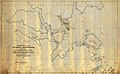
 Map of the emigrant road from Independence Mo. to St. Francisco, California LOC 2005627024.jpg 25,436 × 8,401; 16.66 MB
-

-

-
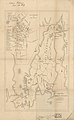
 Map of the town of Northbridge (3720895814).jpg 1,024 × 902; 779 KB
-

-

-
-
 MAPA DE AVILA EN 1849.jpg 3,251 × 4,967; 1.92 MB
-
-

-
 Meyer‘s Zeitungsatlas 064 – Das System unserer Sonne.jpg 7,379 × 6,265; 10.59 MB
-
 Meyer‘s Zeitungsatlas 066 – Belgien und Luxemburg.jpg 7,309 × 6,272; 16.03 MB
-

-

-
 NewCityWeeklyTimes Extra 1849.jpg 4,398 × 6,919; 7.61 MB
-
 NormanPlanNOLA1849statelaus.jpg 600 × 434; 90 KB
-
 Paper-Mill tract - (on Rock Creek, N.W. Washington D.C.). LOC 88693009.jpg 5,305 × 6,786; 3.14 MB
-
 Paper-Mill tract - (on Rock Creek, N.W. Washington D.C.). LOC 88693009.tif 5,305 × 6,786; 103 MB
-
 Plan and profile of the Androscoggin & Kennebec Railroad LOC 79693205.jpg 19,419 × 7,143; 11.28 MB
-
 Plan and profile of the Androscoggin & Kennebec Railroad LOC 79693205.tif 19,419 × 7,143; 396.85 MB
-

-
 Rail road map of New England & eastern New York (9138251888).jpg 658 × 800; 153 KB
-
 Rail road map of New England and eastern New York (10839204275).jpg 6,429 × 7,706; 11.37 MB
-

-

-

-
 Road map of the island of Rhode Island or Aquidneck LOC 2012593354.jpg 3,470 × 5,641; 2.5 MB
-
 Road map of the island of Rhode Island or Aquidneck LOC 2012593354.tif 3,470 × 5,641; 56 MB
-
 S. Western route ; Northern route ; Way routes (9471623021).jpg 800 × 529; 113 KB
-

-

-
 Sjøkart over den nordlige delen av Nordsjøen, fra 1849.png 4,292 × 2,864; 19.5 MB
-

-
 South Eastern Asia.png 8,160 × 6,570; 52.12 MB
-
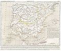
 Spain 1849.jpg 1,810 × 1,502; 603 KB
-
 Tableau orographique... de la chaîne des Pyrénées - Frossard, Emilien - btv1b105677251.jpg 9,024 × 3,798; 3.59 MB
-
 The hymenial expositor, or, matrimonial chart (35015060082).jpg 2,000 × 1,679; 3.07 MB
-
 Thomas-Shapter-HistoryOfCholeraInExeter1832-map.jpg 1,280 × 1,168; 384 KB
-

-

-
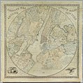
 Twelve Miles Around New York (City) Map 1849 by James Charles Sidney.jpg 8,500 × 8,452; 22.91 MB
-
 West end of Lake Erie and Detroit River LOC 2017588902.jpg 8,721 × 11,099; 10.77 MB
-
 West end of Lake Erie and Detroit River LOC 2017588902.tif 8,721 × 11,099; 276.93 MB
-
 West Indien und Mittel America (3120220075).jpg 2,000 × 1,656; 3.16 MB
-
 William Francis Lynch, Map of the River Jordan & Dead Sea (FL6881003 3426908).jpg 8,080 × 14,254; 140.41 MB
-
 William Francis Lynch, Sketch map of the Dead Sea (FL25570575 3468188).jpg 5,688 × 10,096; 81.74 MB
-
 William Hughes, Plan of Jerusalem (after Schultz and Kiepert) (FL49973282 4073123).jpg 3,951 × 5,378; 20.06 MB
_Espa%C3%B1a_y_Portugal.jpg)
_Atlas_Historico_Geografico_de_Espa%C3%B1a_-_Mapa_1_(409).jpg)
_Atlas_Historico_Geografico_de_Espa%C3%B1a_-_Mapa_2_(409-585).jpg)
_Atlas_Historico_Geografico_de_Espa%C3%B1a_-_Mapa_4_(756-1030).jpg)
_Atlas_Historico_Geografico_de_Espa%C3%B1a_-_Mapa_6_(1214-1492).jpg)


.jpg)


,_Published_1849.jpg)
.jpg)


_und_das_Kaiserthum_Japan_LOC_2006635525.jpg)
.jpg)


.jpg)
.jpg)


.jpg)
.jpg)


.jpg)
.jpg)
.jpg)


.jpg)
.jpg)


._LOC_88693009.jpg)
.jpg)
.jpg)
.jpg)

.jpg)

.jpg)


.jpg)


_Map_1849_by_James_Charles_Sidney.jpg)

.jpg)
.jpg)
.jpg)
_(FL49973282_4073123).jpg)