Category:1841 maps
| ← · 1840 · 1841 · 1842 · 1843 · 1844 · 1845 · 1846 · 1847 · 1848 · 1849 · → |
Deutsch: Karten mit Bezug zum Jahr 1841
English: Maps related to the year 1841
Español: Mapas relativos al año 1841
Français : Cartes concernant l’an 1841
Русский: Карты 1841 года
Subcategories
This category has the following 11 subcategories, out of 11 total.
Media in category "1841 maps"
The following 84 files are in this category, out of 84 total.
-
 1841 Perthes Map of Ireland - Geographicus - Ireland-perthes-1841.jpg 4,000 × 3,258; 3.43 MB
-
 (1841) Plan of Cheduba Island.jpg 4,240 × 4,142; 8.17 MB
-
 (1841) Plan of Regnain Island.jpg 3,793 × 2,095; 3.09 MB
-
-
-
 Admiralty Chart No 1375 Galapagos Islands, Published 1841 (cropped).jpg 3,825 × 2,869; 2.17 MB
-
 Admiralty Chart No 1375 Galapagos Islands, Published 1841.jpg 5,793 × 7,828; 7.99 MB
-

-
-
-
 Buurtwegen - Oostkerke Diksmuide.jpg 845 × 615; 86 KB
-
-
 Canaan at the period of the captivity (FL36587238 3916859).jpg 1,916 × 2,897; 2.32 MB
-
 Carte des environs de Mastricht - lith. de P. Bineteau - btv1b53087666j.jpg 4,288 × 3,424; 2.8 MB
-

-

-
 Corcomroe 2a thumb.jpg 381 × 302; 30 KB
-
 Hamilton monument map.jpg 1,004 × 1,187; 317 KB
-
 Heinrich Kiepert, Der Sinai (FL170208112 2370012).jpg 2,559 × 3,460; 7.17 MB
-
 Heinrich Kiepert, Environs of Jerusalem (FL6879311 2369662).jpg 2,092 × 3,976; 13.9 MB
-

-
 Heinrich Kiepert, Plan of Jerusalem (FL6879056 2369661).jpg 2,310 × 2,665; 3.36 MB
-
 Heinrich Kiepert, Sinai (FL17237332 2369664).jpg 1,722 × 2,596; 6.98 MB
-
 Hloubetin cadastral map 1841cr2.jpg 3,284 × 2,189; 2.75 MB
-
 Hong Kong Map made by Edward Belcher in 1841.jpg 2,000 × 1,488; 623 KB
-
 Incidents of travel in Central America, Chiapas, and Yucatan BHL45589598.jpg 1,936 × 2,454; 498 KB
-

-
 J. Andriveau, Carte de L'Amérique du Sud (FL13728549 2511731).jpg 6,288 × 8,061; 78.29 MB
-

-
 James Wyld, the elder, Map of Syria (FL35084270 3890728).jpg 6,013 × 7,641; 61.01 MB
-
 Jerusalem (plan of) (FL36587221 3916862).jpg 1,892 × 2,887; 1.89 MB
-
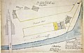 Land applied for by Mr John Eagen.jpg 3,502 × 2,210; 1.66 MB
-
-
 Map of Rome in 1841 by Paul-Marie Letarouilly.jpg 2,300 × 1,850; 1.14 MB
-
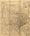 Map of Texas LOC 2002627151.jpg 6,592 × 7,961; 7.86 MB
-
 Map of Texas LOC 2002627151.tif 6,592 × 7,961; 150.14 MB
-

-
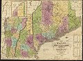
 Map of the State of Maryland. LOC 2002624038.jpg 16,567 × 11,197; 30.31 MB
-

-
 Maps LOC mmorse000105-1.jpg 7,440 × 5,000; 5.6 MB
-
 Maps LOC mmorse000105-1.tif 7,452 × 5,000; 106.62 MB
-
 Maps LOC mmorse000105-2.jpg 3,915 × 2,566; 2.52 MB
-
 Maps LOC mmorse000105-2.tif 3,915 × 2,566; 28.74 MB
-
 Maps LOC mmorse000105-3.jpg 6,960 × 5,000; 4.37 MB
-
 Maps LOC mmorse000105-3.tif 6,969 × 5,000; 99.71 MB
-
 Maps LOC mmorse000105-4.jpg 3,967 × 2,792; 2.04 MB
-
 Maps LOC mmorse000105-4.tif 3,967 × 2,792; 31.69 MB
-
 New Orleans 1841 Illustrated Map.jpg 900 × 664; 296 KB
-
 Petschau COSK 1841.jpg 3,999 × 3,999; 5.15 MB
-

-
 Plan of the cemetery of Mount Auburn (3720668892).jpg 1,024 × 848; 754 KB
-
 Planta da Imperial Cidade de São Paulo (1841).jpg 4,584 × 3,651; 1.45 MB
-
 Scientific Memoirs, Vol 2, Plate XI.png 2,447 × 1,494; 2.19 MB
-
 Scientific Memoirs, Vol 2, Plate XII, Fig 1.png 1,257 × 1,262; 975 KB
-
 Scientific Memoirs, Vol 2, Plate XIX Fig 1.png 1,223 × 1,238; 641 KB
-
 Scientific Memoirs, Vol 2, Plate XVII.png 2,693 × 1,788; 1.95 MB
-
 Scientific Memoirs, Vol 2, Plate XVIII.png 2,555 × 1,448; 2.22 MB
-
 Scientific Memoirs, Vol 2, Plate XX.png 2,438 × 1,388; 1.17 MB
-
 Scientific Memoirs, Vol 2, Plate XXI Fig 1.png 1,193 × 1,272; 487 KB
-
 Selter Grundriss von Berlin 1841.jpg 2,048 × 1,536; 2.98 MB
-
 Skelling Michael ft1d5nb0gb 00009.gif 620 × 539; 30 KB
-
 Skoky cadastral map 1841.jpg 1,024 × 901; 785 KB
-

-
 São Paulo city 1841 map.jpg 6,092 × 6,985; 2.59 MB
-
 The Kensington Hippodrome, 1841.png 474 × 464; 490 KB
-

-
-
 Thomas Hutchins' land grant and map to 2000 acres in West Florida LOC 90684037.jpg 3,362 × 4,043; 1.68 MB
-
 Ticonderoga & its dependencies, August 1776. LOC 73691879.jpg 5,135 × 4,044; 1.55 MB
-
 Ticonderoga & its dependencies, August 1776. LOC 73691879.tif 5,135 × 4,044; 59.41 MB
-
 Topographic map of the Parish of Concordia, state of Louisiana LOC 2012592311.jpg 10,420 × 17,848; 23.7 MB
-
 Topographic map of the Parish of Concordia, state of Louisiana LOC 2012592311.tif 10,420 × 17,848; 532.08 MB
-

-

-
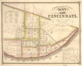
 Topographical map of the city of Cincinnati, from actual survey LOC 2006626028.jpg 6,914 × 5,566; 5.23 MB
-
 Topographical map of the city of Cincinnati, from actual survey LOC 2006626028.tif 6,914 × 5,566; 110.1 MB
-
 Uferchaussee am Wassertor.jpg 4,306 × 2,798; 1.54 MB
-
 Victoria Park proposal 1841.jpg 712 × 343; 74 KB
-
 View of Woolwich, 1841 (R. Rixon).jpg 1,996 × 507; 1.06 MB
-
 William Hughes, Ancient Jerusalem (FL36567457 3909158).jpg 2,226 × 3,372; 3.8 MB
-
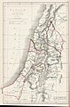 William Hughes, Canaan, as divided among the tribes (FL36567434 3909139).jpg 2,178 × 3,318; 2.52 MB
-

-

-
 William Hughes, The Kingdoms of Judah and Israel (FL36567450 3909153).jpg 2,281 × 3,416; 4.15 MB

_Plan_of_Cheduba_Island.jpg)
_Plan_of_Regnain_Island.jpg)
.jpg)

_(14762152891).jpg)
_(14762972494).jpg)

_(14768839955).jpg)
.jpg)

.jpg)
.jpg)


.jpg)
.jpg)
.jpg)
.jpg)
.jpg)


.jpg)
.jpg)
.jpg)
.jpg)
_(FL36587221_3916862).jpg)

.jpg)


.jpg)

.jpg)


.jpg)
.jpg)
.jpg)


.jpg)
.jpg)
.jpg)
.jpg)
.jpg)
.jpg)