Category:1891 maps of Massachusetts
States of the United States: California · Connecticut · Delaware · Florida · Idaho · Illinois · Iowa · Kansas · Kentucky · Louisiana · Maine · Maryland · Massachusetts · Michigan · Minnesota · Missouri · Montana · New Hampshire · New Jersey · New York · North Carolina · Ohio · Oklahoma · Oregon · Pennsylvania · Rhode Island · South Dakota · Tennessee · Texas · Utah · Vermont · Virginia · Washington · Wisconsin · Wyoming – Washington, D.C.
| ← 1890 1891 1892 1893 1894 1895 1896 1897 1898 1899 → |
Subcategories
This category has the following 2 subcategories, out of 2 total.
B
Media in category "1891 maps of Massachusetts"
The following 24 files are in this category, out of 24 total.
-
 1891 map of Brockton, Massachusetts.png 3,500 × 2,444; 9.22 MB
-

-
 1891 preliminary plan for widening Chestnut Hill Avenue.jpg 10,256 × 3,592; 3.17 MB
-
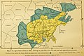 Annual report of the Secretary of the Board of Agriculture" (1854-1915) (18744567024).jpg 2,912 × 1,930; 1.09 MB
-
 Barre, Massachusetts. LOC 81690186.jpg 8,032 × 6,800; 9.64 MB
-
 Corey Hill Terraces, Brookline (2674491398).jpg 1,554 × 2,000; 2.42 MB
-
 Erving, Mass. LOC 2019586298.jpg 8,036 × 5,334; 5.99 MB
-
 Erving, Mass. LOC 2019586298.tif 8,036 × 5,334; 122.64 MB
-
 Hebronville, Massachusetts. LOC 90685120.jpg 6,516 × 4,926; 7.06 MB
-
 Jamaica Plain, Massachusetts (2674956369).jpg 2,000 × 1,521; 2.99 MB
-
 Manchaug, Massachusetts LOC 79695470.jpg 4,160 × 3,280; 2.17 MB
-
 Map of Cambridge Massachusetts (9472186737).jpg 799 × 560; 116 KB
-
 Map showing drives from the Walker-Gordon Laboratory... (2675021998).jpg 2,000 × 1,373; 2.68 MB
-
 Massachusetts (2674607177).jpg 2,000 × 1,416; 2.91 MB
-
 North Attleborough, Massachusetts (2675095839).jpg 2,000 × 1,495; 2.91 MB
-
 North Easton, Massachusetts (2674483332).jpg 2,000 × 1,517; 2.51 MB
-
 Norton, Massachusetts (2673698271).jpg 2,000 × 1,508; 2.32 MB
-
 Norton, Massachusetts 1891. LOC 74693247.jpg 7,968 × 6,048; 7.91 MB
-
 Oakdale, Massachusetts. LOC 91680102.jpg 8,352 × 7,040; 11.35 MB
-
 Outline map of Massachusetts (2674590931).jpg 2,000 × 1,374; 2.21 MB
-
 Outline map of Massachusetts (2674595573).jpg 2,000 × 1,318; 2.05 MB
-
 Oxford, Massachusetts (2674521782).jpg 2,000 × 1,493; 2.43 MB
-
 West Boylston Massachusetts 1891. LOC 2014593374.jpg 9,496 × 6,528; 11.56 MB
-
 Whitinsville, Massachusetts (2674516760).jpg 2,000 × 1,537; 3.1 MB


_(18744567024).jpg)

.jpg)


.jpg)

.jpg)
.jpg)
.jpg)
.jpg)
.jpg)
.jpg)


.jpg)
.jpg)
.jpg)

.jpg)