Category:1899 maps of Massachusetts
States of the United States: California · Delaware · Florida · Georgia · Illinois · Indiana · Iowa · Kansas · Kentucky · Louisiana · Maine · Maryland · Massachusetts · Michigan · Minnesota · Mississippi · Missouri · Montana · Nevada · New Hampshire · New Jersey · New Mexico · New York · Ohio · Oklahoma · Oregon · Pennsylvania · Rhode Island · South Carolina · South Dakota · Tennessee · Texas · Vermont · Virginia · Washington · West Virginia · Wisconsin – Washington, D.C.
| ← 1890 1891 1892 1893 1894 1895 1896 1897 1898 1899 → |
Subcategories
This category has the following 4 subcategories, out of 4 total.
Media in category "1899 maps of Massachusetts"
The following 6 files are in this category, out of 6 total.
-
 1899 bird's eye view map of Pittsfield, Massachusetts.jpg 7,928 × 5,608; 7.56 MB
-
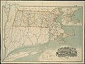 1899 Massachusetts railroads map.jpg 9,384 × 7,128; 19.48 MB
-
 Annual report (1899) (18430506431).jpg 2,912 × 1,856; 898 KB
-
 Hopedale, Mass. 1899. LOC 75694583.jpg 7,856 × 4,976; 5.14 MB
-
 Hopedale, Mass. 1899. LOC 75694583.tif 7,856 × 4,976; 111.84 MB
-
 Pittsfield, Mass. LOC 91680092.jpg 10,800 × 7,200; 18.37 MB


_(18430506431).jpg)

