Category:19th-century maps of Iceland
Countries of Europe: Albania · Armenia‡ · Austria · Azerbaijan‡ · Belarus · Belgium · Bosnia and Herzegovina · Bulgaria · Croatia · Cyprus‡ · Czech Republic · Denmark · Estonia · Finland · France‡ · Georgia‡ · Germany · Greece · Hungary · Iceland · Republic of Ireland · Italy · Latvia · Lithuania · Luxembourg · Malta · Moldova · Montenegro · Netherlands‡ · North Macedonia · Norway · Poland · Portugal‡ · Romania · Russia‡ · Serbia · Slovakia · Slovenia · Spain‡ · Sweden · Switzerland · Turkey‡ · Ukraine · United Kingdom
Specific status: Isle of Man – Limited recognition: Abkhazia‡
‡: partly located in Europe
Specific status: Isle of Man – Limited recognition: Abkhazia‡
‡: partly located in Europe
Subcategories
This category has the following 2 subcategories, out of 2 total.
Media in category "19th-century maps of Iceland"
The following 43 files are in this category, out of 43 total.
-

-
 130 of '(Journal of a tour in Iceland in the summer of 1809.)' (11002633624).jpg 2,464 × 1,433; 686 KB
-

-
 Atlas elementaire portatif 1807 (139435850).jpg 13,774 × 10,535; 168.95 MB
-
 Pg547.jpg 2,976 × 2,269; 1.72 MB
-
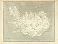
 HENDERSON(1819) ICELAND.jpg 3,895 × 2,806; 5.87 MB
-
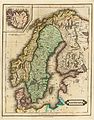 Norway and Sweden 1831.jpg 4,813 × 6,155; 3.64 MB
-

-
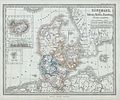
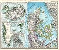
 1837 Malte-Brun Denmark Iceland.jpg 1,250 × 1,717; 1.74 MB
-
 Islande. 1837 Malte-Brun Denmark Iceland (cropped).jpg 414 × 355; 153 KB
-
 Dänemark Karte 1841 Friedrich Wilhelm Streit.jpg 3,248 × 3,807; 2.54 MB
-
 Dänemark Karte 1841 Friedrich Wilhelm Streit.tif 3,262 × 3,807; 34.73 MB
-
 Carte de la Suède et du Danemark - dressée par Pierre Tardieu - btv1b53087619t.jpg 7,664 × 10,912; 12.01 MB
-
 Dänemark Karte 1841 Friedrich Wilhelm Streit-2.jpg 3,262 × 3,807; 16.17 MB
-
 Dänemark Karte 1847 Christian Gottfried Daniel Stein.jpg 8,855 × 11,555; 19.41 MB
-
 HEINZELMANN(1848) 02.869 Kartenblatt Island.jpg 3,360 × 2,581; 4.37 MB
-

-

-
 1862 Stieler Map of Denmark - Geographicus - Danemark-perthes-1862.jpg 3,068 × 2,551; 1.3 MB
-

-

-

-

-
 Álþíng við Öxará.jpg 4,888 × 2,693; 6.91 MB
-
 (Baumg1889) Orientierungskarte der Umgebung von Reykjavik.jpg 906 × 900; 411 KB
-
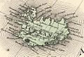
 (Baumg1889) Kirchliche Einteilung (Bistümer) Islands im Mittelalter.jpg 1,351 × 931; 396 KB
-
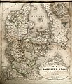
 Danmark med bilande - Map of Denmark 19th century.jpg 7,510 × 7,509; 9.64 MB
-
 236 of 'The International Geography. ... Edited by H. R. Mill' (11288876923).jpg 1,224 × 917; 358 KB
-

-
 35 of '(Sulphur in Iceland. (With plates and a map.))' (11106176556).jpg 1,420 × 2,295; 554 KB
-

-
 8 of '(Sulphur in Iceland. (With plates and a map.))' (11106691423).jpg 2,282 × 1,408; 408 KB
-
 Danemark.jpg 3,219 × 4,715; 6.3 MB
-
 Dänemark und die Herzogthümer Schleswig, Holstein u. Lauenburg.jpg 4,567 × 5,506; 6.44 MB
-
 Islande-1883-carte du pays.jpg 7,018 × 5,100; 7.49 MB
-
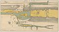
 Islande-1883-gravure-plan de la Vallée des Geysers.jpg 2,304 × 2,860; 2.83 MB
-
 Johnson, A.J. Europe. 1864.L.jpg 1,007 × 683; 236 KB
-
 Landkort over Norge og nogle Naboe-Lande - no-nb krt 01037.jpg 8,468 × 5,294; 11.94 MB
-
 Meyers b9 s0036 b1.png 381 × 294; 73 KB
-
 Si0149x1024.jpg 1,024 × 774; 250 KB
-
 Stielers Handatlas 1891 42.jpg 5,000 × 4,250; 6.53 MB
-
 W. & A.K. Johnston - Denmark with Northwest portion of the German Empire, 1893.jpg 7,494 × 9,660; 28.52 MB
-
 W. & A.K. Johnston - Iceland, 1893.jpg 2,536 × 1,930; 2.09 MB
%27_(11002633624).jpg)
.jpg)
.jpg)

_ICELAND.jpg)

_-_Geographicus_-_Denmark-mb-1837.jpg)

.jpg)


_02.869_Kartenblatt_Island.jpg)
.jpg)
.jpg)

.jpg)
.jpg)
.jpg)
.jpg)

_Orientierungskarte_der_Umgebung_von_Reykjavik.jpg)
_Kirchliche_Einteilung_(Bist%C3%BCmer)_Islands_im_Mittelalter.jpg)

.jpg)
.jpg)
)%27_(11106176556).jpg)
)%27_(11106691423).jpg)


%27_(11196775404).jpg)
.jpg)