Category:19th-century maps of Portugal
Countries of Europe: Albania · Armenia‡ · Austria · Azerbaijan‡ · Belarus · Belgium · Bosnia and Herzegovina · Bulgaria · Croatia · Cyprus‡ · Czech Republic · Denmark · Estonia · Finland · France‡ · Georgia‡ · Germany · Greece · Hungary · Iceland · Republic of Ireland · Italy · Latvia · Lithuania · Luxembourg · Malta · Moldova · Montenegro · Netherlands‡ · North Macedonia · Norway · Poland · Portugal‡ · Romania · Russia‡ · Serbia · Slovakia · Slovenia · Spain‡ · Sweden · Switzerland · Turkey‡ · Ukraine · United Kingdom
Specific status: Isle of Man – Limited recognition: Abkhazia‡
‡: partly located in Europe
Specific status: Isle of Man – Limited recognition: Abkhazia‡
‡: partly located in Europe
Subcategories
This category has the following 14 subcategories, out of 14 total.
- 1810s maps of Portugal (29 F)
- 1830s maps of Portugal (11 F)
- 1840s maps of Portugal (47 F)
- 1850s maps of Portugal (28 F)
- 1870s maps of Portugal (22 F)
*
- 19th-century maps of the Azores (33 F)
- 19th-century maps of Lisbon (22 F)
- 19th-century maps of Porto (12 F)
Media in category "19th-century maps of Portugal"
The following 5 files are in this category, out of 5 total.
-

-
 Espagne et Portugal - btv1b84460609.jpg 7,822 × 6,072; 7.53 MB
-
 Pictorial map of Spain and Portugal (cropped).jpg 1,909 × 2,679; 1.13 MB
-
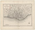 Plan de la ville de Lisbonne - dessiné par E. Mentelle... - btv1b530605808.jpg 6,405 × 5,500; 6.12 MB
-
 Spain-Portugal 1900.jpg 1,689 × 1,276; 286 KB
.jpg)

.jpg)

