Category:19th-century maps of Belgium
Countries of Europe: Albania · Armenia‡ · Austria · Azerbaijan‡ · Belarus · Belgium · Bosnia and Herzegovina · Bulgaria · Croatia · Cyprus‡ · Czech Republic · Denmark · Estonia · Finland · France‡ · Georgia‡ · Germany · Greece · Hungary · Iceland · Republic of Ireland · Italy · Latvia · Lithuania · Luxembourg · Malta · Moldova · Montenegro · Netherlands‡ · North Macedonia · Norway · Poland · Portugal‡ · Romania · Russia‡ · Serbia · Slovakia · Slovenia · Spain‡ · Sweden · Switzerland · Turkey‡ · Ukraine · United Kingdom
Specific status: Isle of Man – Limited recognition: Abkhazia‡
‡: partly located in Europe
Specific status: Isle of Man – Limited recognition: Abkhazia‡
‡: partly located in Europe
Subcategories
This category has the following 11 subcategories, out of 11 total.
- 1800s maps of Belgium (13 F)
- 1810s maps of Belgium (6 F)
- 1820s maps of Belgium (3 F)
- 1830s maps of Belgium (10 F)
- 1850s maps of Belgium (9 F)
- 1860s maps of Belgium (23 F)
- 1870s maps of Belgium (22 F)
- 1880s maps of Belgium (19 F)
A
- 19th-century maps of Antwerp (181 F)
Media in category "19th-century maps of Belgium"
The following 32 files are in this category, out of 32 total.
-
-
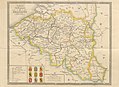
 The Austrian, French and Dutch Netherlands, from the best authorities (3046075558).jpg 2,000 × 1,485; 2.99 MB
-
 1827 Carte routière du Royaume des Pays-Bas, comprenant la Hollande et la Belgique.pdf 1,239 × 1,752, 2 pages; 3.02 MB
-
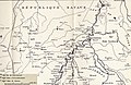
 Austrasie752.jpg 484 × 689; 78 KB
-

-

-
 1866 Johnson Map of Holland and Belgium - Geographicus - HollandBelgium-johnson-1865.jpg 3,233 × 4,000; 4.94 MB
-
 Histoire de Turenne-Armagnac-1883 chez Mame-14.jpg 2,046 × 2,816; 1.87 MB
-
 Stielers Handatlas 1891 41.jpg 4,050 × 5,200; 6.48 MB
-
 1895 Stanford's Pocket Map of Europe - Geographicus - CentralEuorpe-stanford-1895.jpg 3,000 × 2,405; 2.37 MB
-
 119 of 'The “Beaumont” Geography and Map Tracing Book' (11245036626).jpg 1,970 × 2,400; 943 KB
-
 Allgemeiner historischer Handatlas - Deutschland im 14. Jahrhundert.png 1,264 × 977; 3.16 MB
-
 Belgien und Luxemburg.jpg 4,910 × 3,221; 6.85 MB
-
 Belgien1844.png 1,455 × 878; 2.84 MB
-
 Belgium 1873.jpg 7,301 × 5,177; 3.7 MB
-
 Belgium, Thomson , 1820.jpg 2,339 × 1,815; 1.35 MB
-
 Carte Belgique 1843.jpg 2,650 × 1,939; 2.39 MB
-
 Departement Nedermaas, arrondissement Hasselt.jpg 4,038 × 5,741; 6.56 MB
-
 Departement Nedermaas, arrondissement Maastricht.jpg 6,257 × 4,010; 7.3 MB
-
 Departement Nedermaas, arrondissement Roermond, kanton Achel met Luyksgestel.jpg 2,108 × 1,051; 667 KB
-
 Departement Nedermaas, arrondissement Roermond.jpg 6,223 × 4,024; 6.63 MB
-
 Johnson, A.J. Europe. 1864.O.jpg 613 × 675; 145 KB
-
 Johnston Belgium Map National Atlas.jpg 10,329 × 8,444; 8.4 MB
-
 Karte von Deutschland, dem Königr. der Niederlande und der Schweiz - Brüssel, Antwerpen.jpg 5,520 × 4,678; 7.38 MB
-
 Pays-Bas.PNG 528 × 756; 869 KB
-
 Philippe Van der Maelen (1866) - carte archéologique de la Belgique - version réconciliée.jpg 14,926 × 11,918; 146.97 MB
-
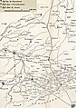
 Railway belgium 1875.jpg 1,646 × 1,265; 205 KB
-
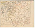
 Vandermaelen - 1866 - Carte archéologique (planche 1).jpg 7,874 × 6,299; 7.67 MB
-
 Vandermaelen - 1866 - Carte archéologique (planche 2).jpg 7,874 × 6,299; 7.56 MB
-
 Vandermaelen - 1866 - Carte archéologique (planche 3).jpg 7,874 × 6,299; 7.25 MB
-
 Vandermaelen - 1866 - Carte archéologique (planche 4).jpg 7,874 × 6,299; 7.31 MB
-
 Vidal-Lablache 436290-1.jpg 4,272 × 3,464; 4.99 MB
.jpg)
.jpg)


.jpg)


_-_carte_arch%C3%A9ologique_de_la_Belgique_-_version_r%C3%A9concili%C3%A9e.jpg)

.jpg)
.jpg)
.jpg)
.jpg)
