Category:2010 aerial photographs of the United States
English: 2010 aerial photographs of the United States
Svenska: Flygfotografier från USA 2010
Deutsch: Luftbildfotografien aus die Vereinigte Staaten von Amerika von 2010
Media in category "2010 aerial photographs of the United States"
The following 21 files are in this category, out of 21 total.
-
 2010-1101-BicknellUT.jpg 3,120 × 1,752; 5.73 MB
-
 2010-1101-CedarCity-Utah.jpg 3,345 × 1,902; 6.79 MB
-
 2010-1101-IvinsUT.jpg 2,910 × 2,106; 6.3 MB
-
 2010-1101-LoaUT.jpg 2,659 × 2,070; 6.12 MB
-
 2010-1101-PanguitchUT.jpg 4,000 × 3,000; 9.93 MB
-
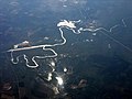
 2010-Aerial photograph of Green River, Utah.jpg 2,500 × 1,875; 4.87 MB
-
 Aerial view of McMurdo Station - descriptions.JPG 3,790 × 2,416; 6.12 MB
-
 Augusta, KS (4705724286).jpg 1,535 × 1,329; 290 KB
-
 Baton Rouge, Louisiana (4705082379).jpg 1,600 × 1,200; 209 KB
-
 Bemidji, Minnesota aerial.jpg 3,504 × 2,336; 7.35 MB
-
 Calion, AR (4705082093).jpg 1,600 × 1,200; 159 KB
-
 Caney, KS (4705081755).jpg 1,600 × 1,200; 193 KB
-
 Cleawatermn.jpg 3,648 × 2,736; 3.1 MB
-
 Kvujstanlyco.jpg 1,600 × 1,200; 669 KB
-
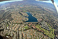 Lake Mission Viejo photo D Ramey Logan.JPG 4,288 × 2,848; 10.15 MB
-
 Maryvale Baseball Park.jpg 3,048 × 2,503; 4.67 MB
-
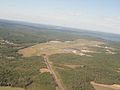
 North Dam (4307003306).jpg 800 × 600; 114 KB
-
 Oologah Lake through the clouds (4705081819).jpg 1,200 × 1,600; 192 KB
-
 RST-Airport-Rochester-Minnesota.jpg 913 × 568; 129 KB
-
 Silver Bay, Minnesota aerial.jpg 3,504 × 2,336; 6.1 MB
-
 St croix mississippi confluence prescott wi.jpg 2,852 × 1,845; 2.36 MB


.jpg)
.jpg)

.jpg)
.jpg)


.jpg)
.jpg)


