Category:2016 aerial photographs of the United States
English: 2016 aerial photographs of the United States
Svenska: Flygfotografier från USA 2016
Deutsch: Luftbildfotografien aus die Vereinigte Staaten von Amerika von 2016
Media in category "2016 aerial photographs of the United States"
The following 19 files are in this category, out of 19 total.
-
 (NOT A) Drone view of golden gate bridge (Unsplash).jpg 4,623 × 2,942; 4.14 MB
-

-

-
-

-
 2nd Air Refueling Squadron refuels B-2's 161110-F-GV347-141.jpg 4,928 × 3,280; 3.22 MB
-
 Aerial view Louisiana flooding August 2016 USGS.jpg 1,180 × 374; 169 KB
-
 Bingham Canyon mine 2016.jpg 1,024 × 616; 312 KB
-
 Bowknot Bend on the Green River UT.jpg 4,368 × 2,912; 10.68 MB
-
 CBP Air and Marine Operations provides security for Super Bowl 50.jpg 5,150 × 3,249; 2.38 MB
-
 Clouds above Tahoe National Forest.jpg 4,032 × 3,024; 1.85 MB
-
 Detroit Aerial (29986331515).jpg 2,400 × 1,600; 2.92 MB
-
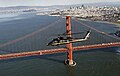
 Drone view golden gate bridge (Unsplash).jpg 3,070 × 1,975; 2.63 MB
-
 Drumlins around Horicon Marsh in Wisconsin.jpg 5,633 × 3,393; 14.29 MB
-
 Glacial features near Beaver Dam Lake, Wisconsin.jpg 5,760 × 3,840; 13.96 MB
-
 HPN (July 2016).jpg 4,000 × 3,000; 2.29 MB
-
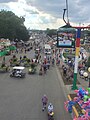 Iowa state fair from the air.jpg 2,160 × 2,880; 1.42 MB
-
 Richmond, Virginia - Facing Northwest (32004147783).jpg 2,400 × 1,600; 3.98 MB
-
 Salisbury, Maryland - Aerial (31840722741).jpg 2,400 × 1,600; 2.72 MB
_Drone_view_of_golden_gate_bridge_(Unsplash).jpg)


.jpg)
.jpg)


.jpg)

.jpg)
.jpg)