Category:2015 aerial photographs of the United States
English: 2015 aerial photographs of the United States
Svenska: Flygfotografier från USA 2015
Deutsch: Luftbildfotografien aus die Vereinigte Staaten von Amerika von 2015
Media in category "2015 aerial photographs of the United States"
The following 85 files are in this category, out of 85 total.
-

-

-
-

-

-
-
-

-

-

-

-
 A large railroad yard near Niagara Falls (27617821470).jpg 4,928 × 3,264; 4.25 MB
-

-
 Aerial - Interstate 25 crosses an arroyo, Albuquerque, New Mexico 01.jpg 4,288 × 2,848; 7.46 MB
-
 Aerial north of Albuquerque 01.jpg 4,288 × 2,848; 6.79 MB
-
 Aerial of Amole Arroyo Flood Detention Basin 01.jpg 4,288 × 2,848; 7.88 MB
-
 Aerial of Atrisco Heritage Academy High School 01-cropped.jpg 2,299 × 1,430; 2.17 MB
-
 Aerial of Atrisco Heritage Academy High School 01.jpg 4,288 × 2,848; 7.43 MB
-
 Aerial of Coors Blvd SW in south Albuquerque 01.jpg 4,288 × 2,848; 7.41 MB
-
 Aerial of Dennis Chavez Blvd, southwest Albuquerque 01.jpg 4,288 × 2,848; 10.12 MB
-
 Aerial of Rudolfo Anaya Elementary School 01.jpg 4,288 × 2,848; 6.97 MB
-
 Aerial of South Valley, Albuquerque, New Mexico 01.jpg 4,288 × 2,848; 6.99 MB
-
 Aerial of South Valley, Albuquerque, New Mexico 02.jpg 4,288 × 2,848; 7.32 MB
-
 Aerial of South Valley, Albuquerque, New Mexico 03.jpg 4,288 × 2,848; 7 MB
-
 Aerial of South Valley, Albuquerque, New Mexico 04.jpg 4,288 × 2,848; 7.6 MB
-
 Aerial of South Valley, Albuquerque, New Mexico 05.jpg 4,288 × 2,848; 6.58 MB
-
 Aerial of South Valley, Albuquerque, New Mexico 06.jpg 4,288 × 2,848; 7.43 MB
-
 Aerial of southwest Albuquerque 01.jpg 4,288 × 2,848; 10.47 MB
-
 Aerial of southwest Albuquerque 02.jpg 4,288 × 2,848; 7.46 MB
-
 Aerial of University Blvd South, Albuquerque, New Mexico 01.jpg 4,288 × 2,848; 6.42 MB
-
 Aerial view of Arlington, OR 01.jpg 4,288 × 2,848; 9.36 MB
-
 Aerial view of Arlington, OR 02.jpg 4,288 × 2,848; 12.93 MB
-
 Aerial view of Bernalillo County, NM 01.jpg 4,288 × 2,848; 9.38 MB
-
 Aerial view of Canoncito Indian Reservation 01.jpg 4,288 × 2,848; 9.65 MB
-
 Aerial view of Canoncito Indian Reservation 02.jpg 4,288 × 2,848; 9.32 MB
-
 Aerial view of Cibola National Forest 01.jpg 4,288 × 2,848; 7.46 MB
-
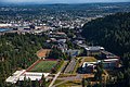
 Aerial view of Goldendale, WA from the northeast.jpg 3,680 × 2,002; 6.73 MB
-
 Aerial view of Kensington Mine Comet portal.jpg 2,400 × 1,387; 2.43 MB
-
 Aerial view of Montessa Park Convenience Center, Albuquerque, NM.jpg 4,288 × 2,848; 9.39 MB
-
 Aerial view of Rancho Grande, Albuquerque, NM 01.jpg 4,288 × 2,848; 9.08 MB
-
 Aerial view of Route 66 Casino Hotel 01.jpg 4,288 × 2,848; 9.73 MB
-
 Aerial view of Route 66 Casino Hotel 02.jpg 4,288 × 2,848; 8.8 MB
-
 Aerial view of Route 66 Casino Hotel 03.jpg 4,288 × 2,848; 7.07 MB
-
 Aerial view of Route 66 Casino Hotel 04.jpg 4,288 × 2,848; 7.15 MB
-
 Aerial view of South Valley, New Mexico 01.jpg 4,288 × 2,848; 8.03 MB
-
 Amherstburg, Ontario (21676451896).jpg 2,950 × 2,210; 2.58 MB
-
 Amherstburg, Ontario (21702556395).jpg 4,000 × 3,000; 3.03 MB
-
 Amherstburg, Ontario (21711771721) (cropped 3-5).jpg 3,300 × 1,980; 1.71 MB
-
 Amherstburg, Ontario (21711771721) (cropped).jpg 3,300 × 1,100; 961 KB
-
 Amherstburg, Ontario (21711771721).jpg 4,000 × 3,000; 2.9 MB
-
 Atlanta Airport Aerial Angle (31435634003).jpg 2,400 × 1,600; 2.55 MB
-
 Bloomington Illinois Aerial (30143726088).jpg 2,400 × 1,600; 2.35 MB
-
 Boston high spine aerial view, October 2015.jpg 3,116 × 2,145; 2.47 MB
-
 Bridge leading from Canada to the USA (27819348811).jpg 4,928 × 3,264; 3.96 MB
-
 Castaic Lake November2015.jpg 3,648 × 2,052; 1.73 MB
-
 Citrus Bowl Orlando City.jpg 960 × 720; 129 KB
-
 Cleveland Thermal - January 2015 (43528614944).jpg 1,600 × 2,400; 2.13 MB
-
 Detroit River Draining Into Lake Erie, Michigan (21515756299).jpg 4,000 × 3,000; 7.07 MB
-
 Detroit River Draining Into Lake Erie, Michigan (21691142062).jpg 4,000 × 3,000; 2.85 MB
-
 Downtown Los Angeles Aerial 4164 (49531430551).jpg 3,600 × 2,400; 5.2 MB
-
 Downtown Seattle Aerial 1 (19751620803).jpg 1,200 × 800; 604 KB
-
 Drone Golden Gate Bridge (Unsplash).jpg 5,432 × 3,621; 1.9 MB
-
-
 Fayetteville, North Carolina (38003455884).jpg 2,400 × 1,600; 2.74 MB
-
 Fighting Island, LaSalle, Ontario (21079792884).jpg 3,720 × 2,790; 5.3 MB
-
 Genoa, Nevada (21384470488).jpg 4,000 × 3,000; 2.96 MB
-
 Golden Gate Bridge (127965999).jpeg 2,048 × 1,534; 1.12 MB
-
 Long Beach Aerial (49531440276).jpg 3,600 × 2,400; 4.81 MB
-
 North Laguna Aerial photo by D Ramey Logan.jpg 5,997 × 3,997; 10.98 MB
-
 Not a bag sunset (16285331468).jpg 2,368 × 3,200; 1.49 MB
-
 Not a bag sunset (16286781789).jpg 3,264 × 2,448; 1.36 MB
-
 Not a bag sunset (16473025205).jpg 3,200 × 2,368; 1.67 MB
-
 Palm Springs International Airport photo Don Ramey Logan.jpg 4,800 × 3,200; 10.62 MB
-
 Snowy Downtown Cleveland 1 - January 2015 (44245792201).jpg 2,400 × 1,600; 1.75 MB
-
 Snowy Downtown Cleveland 2 - January 2015 (43340083585).jpg 2,400 × 1,600; 1.2 MB
-
 Source of the Detroit River at Lake St. Clair, Detroit Michigan (21514444320).jpg 3,540 × 2,660; 5.03 MB
-
 The Detroit River Between Detroit, Michigan and Windsor, Ontario (21702477435).jpg 3,000 × 4,000; 2.46 MB
-
 The Detroit River Between Detroit, Michigan and Windsor, Ontario (21711721771).jpg 2,950 × 3,940; 6.69 MB
-
 University Circle and Case Western Reserve Aerial - Cleveland (29310290927).jpg 2,400 × 1,600; 2.56 MB
-
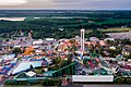 Valleyfair, Shakopee, Minnesota (52358528378).jpg 4,096 × 2,731; 8.59 MB
-
 Western Washington University Looking North.jpg 5,616 × 3,744; 17.35 MB
-
 Windsor, Ontario (21079796834).jpg 4,000 × 3,000; 2.75 MB
-
 Windsor, Ontario (21514642888).jpg 4,000 × 3,000; 2.67 MB
-
 Windsor, Ontario (21711660971).jpg 4,000 × 3,000; 2.94 MB
-
 Windsor, Ontario (21711728411).jpg 3,590 × 2,690; 4.16 MB


_and_Interstate%27s_15_and_80_(background)_along_the_border_of_Salt_Lake_City_and_West_Valley_City,_Utah.jpg)


,US_sat05dec2015-1226h(UTC-5(EST).jpg)
.jpg)
.jpg)


.jpg)
.jpg)
_(cropped_3-5).jpg)
.jpg)
.jpg)
.jpg)

.jpg)


.jpg)
.jpg)
.jpg)
.jpg)
.jpg)
.jpg)
.jpg)
.jpg)
.jpg)
.jpg)
.jpeg)
.jpg)

.jpg)
.jpg)
.jpg)

.jpg)
.jpg)
.jpg)
.jpg)
.jpg)
.jpg)
.jpg)

.jpg)
.jpg)
.jpg)
.jpg)
_(cropped).jpg)