Category:Aerial photographs of Derbyshire
Ceremonial counties of England: Bedfordshire · Berkshire · Buckinghamshire · Cambridgeshire · Cheshire · Cornwall · Cumbria · Derbyshire · Devon · Dorset · Durham · East Riding of Yorkshire · East Sussex · Essex · Gloucestershire · Greater London · Greater Manchester · Hampshire · Herefordshire · Hertfordshire · Isle of Wight · Kent · Lancashire · Leicestershire · Lincolnshire · Merseyside · Norfolk · North Yorkshire · Northamptonshire · Northumberland · Nottinghamshire · Oxfordshire · Shropshire · Somerset · South Yorkshire · Staffordshire · Suffolk · Surrey · Tyne and Wear · Warwickshire · West Midlands · West Sussex · West Yorkshire · Wiltshire · Worcestershire
City-counties: Bristol · City of London
Former historic counties: Middlesex · Sussex · Yorkshire
Other former counties:
City-counties: Bristol · City of London
Former historic counties: Middlesex · Sussex · Yorkshire
Other former counties:

Media in category "Aerial photographs of Derbyshire"
The following 47 files are in this category, out of 47 total.
-
 Aerial view of Hardwick Hall - geograph.org.uk - 2511291.jpg 1,529 × 1,019; 2.17 MB
-
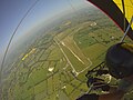
 Ashbourne to Buxton Railway (Tissington Trail) - geograph.org.uk - 2511311.jpg 1,529 × 1,019; 1.79 MB
-

-
 Biggin Dale, aerial 2015 - geograph.org.uk - 4687627.jpg 494 × 640; 69 KB
-
 Blake Moor and beyond - geograph.org.uk - 5240339.jpg 610 × 640; 61 KB
-
 Bonsall arial.jpg 450 × 338; 19 KB
-
 Calton Houses Viewed from the Air - geograph.org.uk - 1935245.jpg 3,296 × 2,472; 1.03 MB
-
 Crich tramway museum from the air, 1986 – 1 (geograph 6541275).jpg 1,280 × 832; 374 KB
-
 Crich tramway museum from the air, 1986 – 2 (geograph 6541277).jpg 838 × 1,280; 331 KB
-
 DarleyMoorAirfield.jpg 1,397 × 1,047; 200 KB
-
 DJI 0002 (22872948059).jpg 4,000 × 2,250; 3.49 MB
-
 DJI 0003 (22613811863).jpg 4,000 × 2,250; 3.47 MB
-
 DJI 0005 (22872945519).jpg 4,000 × 2,250; 3.6 MB
-
 DJI 0006 (23240727365).jpg 4,096 × 2,160; 553 KB
-
 DJI 0007 (22613809863).jpg 4,000 × 2,250; 3.64 MB
-
 DJI 0008 (22846754217).jpg 4,000 × 2,250; 3.44 MB
-
 DJI 0009 (22612465974).jpg 4,000 × 2,250; 3.58 MB
-
 DJI 0010 (22945083200).jpg 4,000 × 2,250; 3.72 MB
-
 Dowlow Limestone quarry - geograph.org.uk - 3557201.jpg 2,533 × 2,164; 1.86 MB
-
 Dowlow Limestone Quarry, aerial 2015 - geograph.org.uk - 4697286.jpg 466 × 640; 62 KB
-

-

-
 EPW062835.jpg 580 × 495; 130 KB
-
 Estate Housing, Tibshelf - Aerial Photo - geograph.org.uk - 150051.jpg 640 × 427; 117 KB
-
 Flagg, aerial 2015 - geograph.org.uk - 4697302.jpg 640 × 406; 39 KB
-
 Flagg, aerial 2015 - geograph.org.uk - 4697307.jpg 640 × 416; 53 KB
-
 Flagg, aerial 2015 - geograph.org.uk - 4697311.jpg 640 × 407; 54 KB
-
 Flash Dam - geograph.org.uk - 1194765.jpg 640 × 427; 329 KB
-
 Flight over Buxton (22846725677).jpg 4,096 × 2,160; 669 KB
-
 Hindlow Quarry, aerial 2015 - geograph.org.uk - 4697270.jpg 640 × 477; 64 KB
-
 Hindlow Quarry, aerial 2015 - geograph.org.uk - 4697275.jpg 640 × 427; 59 KB
-

-
 Leashaw Farm from a Hot Air Balloon (geograph 6332948).jpg 1,024 × 664; 154 KB
-
 Longdendale and surrounding area - geograph.org.uk - 5240355.jpg 494 × 640; 51 KB
-
 Mam Tor Hill Fort, Castleton - geograph.org.uk - 639370.jpg 640 × 471; 105 KB
-
 Meander on the Trent - geograph.org.uk - 4902290.jpg 3,264 × 2,448; 3.53 MB
-
 Minninglow Embankment - geograph.org.uk - 1194554.jpg 640 × 427; 81 KB
-
 Minninglow Hill Summit - geograph.org.uk - 1194536.jpg 640 × 427; 97 KB
-
 New Mills Torrs Aerial Photo.jpg 4,819 × 3,739; 3.96 MB
-
 RAF Darley Moor.jpg 2,448 × 3,264; 548 KB
-
 Repton and the River Trent - geograph.org.uk - 3558522.jpg 3,264 × 2,448; 3.36 MB
-

-
 The River Trent from above Newton Solney - geograph.org.uk - 3177206.jpg 3,264 × 2,448; 3.24 MB
-
 The Trent Valley - geograph.org.uk - 4901373.jpg 3,264 × 2,448; 2.23 MB
-
 Willington and the power station - geograph.org.uk - 3177216.jpg 3,264 × 2,448; 3.12 MB
-

-
 Stretton Hillside - Aerial Photo - geograph.org.uk - 150018.jpg 640 × 392; 53 KB

_-_geograph.org.uk_-_2511311.jpg)


.jpg)
.jpg)

.jpg)
.jpg)
.jpg)
.jpg)
.jpg)
.jpg)
.jpg)
.jpg)


.jpg)


.jpg)


