Category:Maps of Biscayne National Park
United States national parks: Acadia · American Samoa · Arches · Badlands · Big Bend · Biscayne · Black Canyon of the Gunnison · Bryce Canyon · Canyonlands · Capitol Reef · Carlsbad Caverns · Channel Islands · Congaree · Crater Lake · Cuyahoga Valley · Death Valley · Denali · Dry Tortugas · Everglades · Gateway Arch · Gates of the Arctic · Glacier · Glacier Bay · Grand Canyon · Grand Teton · Great Basin · Great Smoky Mountains · Guadalupe Mountains · Haleakalā · Hawaii Volcanoes · Hot Springs · Indiana Dunes · Isle Royale · Joshua Tree · Kenai Fjords · Kings Canyon · Kobuk Valley · Lake Clark · Lassen Volcanic · Mammoth Cave · Mesa Verde · Mount Rainier · North Cascades · Olympic · Petrified Forest · Pinnacles · Redwood · Rocky Mountain · Saguaro · Sequoia · Shenandoah · Theodore Roosevelt · Virgin Islands · Voyageurs · White Sands · Wind Cave · Wrangell-St. Elias · Yellowstone · Yosemite · Zion
English: Maps of Biscayne National Park
Wikimedia category | |||||
| Upload media | |||||
| Instance of | |||||
|---|---|---|---|---|---|
| Category combines topics | |||||
| Biscayne National Park | |||||
180,000 acres of mostly waterways, in Florida (US), managed by the National Park Service   | |||||
| Instance of | |||||
| Location | Miami-Dade County, Florida | ||||
| Visitor center | |||||
| Operator | |||||
| IUCN protected areas category | |||||
| Inception |
| ||||
| Area |
| ||||
| Visitors per year |
| ||||
| official website | |||||
 | |||||
Subcategories
This category has only the following subcategory.
Media in category "Maps of Biscayne National Park"
The following 18 files are in this category, out of 18 total.
-
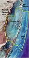
 LocMap Biscayne National Park.png 280 × 183; 31 KB
-
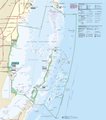 Biscayne National Park Map 2009.png 3,391 × 3,851; 487 KB
-
 Biscayne National Park, Florida LOC 91685082.jpg 10,044 × 7,072; 11.77 MB
-
 Biscayne National Park, Florida LOC 91685082.tif 10,044 × 7,072; 203.22 MB
-
 Biscayne National Park, Florida LOC 91685084.jpg 10,012 × 7,070; 12.16 MB
-
 Biscayne National Park, Florida LOC 92683270.tif 10,030 × 7,069; 202.85 MB
-
 Biscayne National Park, Florida LOC 98684502.tif 10,029 × 7,055; 202.43 MB
-
 Biscayne National Park.svg 1,000 × 1,000; 5 KB
-
 Biscayne NM proposal NPS1.png 600 × 1,177; 863 KB
-
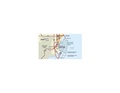
 Biscaynemap.jpg 200 × 398; 18 KB
-
 BiscayneNP1.png 589 × 385; 72 KB
-
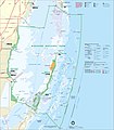 Map of Biscayne National Park.jpg 3,983 × 4,535; 2.34 MB
-
 NPS biscayne-lobster-sanctuary-map.gif 1,052 × 1,406; 192 KB
-
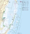
 NPS biscayne-map.jpg 3,220 × 3,658; 1.2 MB
-
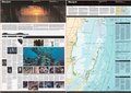
 NPS biscayne-map.pdf 2,541 × 2,887; 1.81 MB
-
 NPS biscayne-regional-map.jpg 939 × 550; 88 KB
-
 NPS biscayne-regional-map.pdf 593 × 347; 451 KB
-
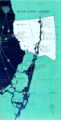
 NPS biscayne-south-florida-regional-map.gif 1,685 × 2,187; 314 KB


