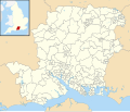
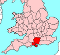
Category:Maps of Hampshire
Wikimedia category | |||||
| Upload media | |||||
| Instance of | |||||
|---|---|---|---|---|---|
| Category combines topics | |||||
| Hampshire | |||||
ceremonial county of England      | |||||
| Instance of |
| ||||
| Location | South East England, England | ||||
| Capital | |||||
| Highest point |
| ||||
| Population |
| ||||
| Area |
| ||||
| Different from | |||||
| Said to be the same as | Hampshire (historic county of England, ceremonial county of England, 1844) | ||||
| official website | |||||
 | |||||
Subcategories
This category has the following 13 subcategories, out of 13 total.
!
C
E
H
- Hundreds of Hampshire (50 F)
M
- Maps of Farnborough (6 F)
N
- Maps of the New Forest (12 F)
O
- OpenStreetMap maps of Hampshire (32 F)
R
- Rail transport maps of Hampshire (17 F)
S
- Maps of The Solent (22 F)
T
Media in category "Maps of Hampshire"
The following 65 files are in this category, out of 65 total.
-
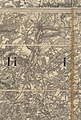
 A history of Hampshire and the Isle of Wight (Page 472) BHL20977735.jpg 1,788 × 1,599; 1.08 MB
-
 A history of Hampshire and the Isle of Wight (Page 530) BHL20977807.jpg 2,274 × 3,380; 1.17 MB
-
 A history of Hampshire and the Isle of Wight (Page 531) BHL20977808.jpg 2,274 × 3,380; 1.29 MB
-
 A history of Hampshire and the Isle of Wight (Page 532) BHL20977809.jpg 2,274 × 3,380; 1.38 MB
-
 A history of Hampshire and the Isle of Wight (Page 533) BHL20977810.jpg 2,274 × 3,380; 1.32 MB
-
 A history of Hampshire and the Isle of Wight (Page 534) BHL20977811.jpg 2,274 × 3,380; 1.25 MB
-
 A history of Hampshire and the Isle of Wight (Page 535) BHL20977812.jpg 2,274 × 3,380; 1.34 MB
-
 A history of Hampshire and the Isle of Wight (Page 536) BHL20977813.jpg 2,274 × 3,380; 1.32 MB
-
 A history of Hampshire and the Isle of Wight (Page 537) BHL20977814.jpg 2,274 × 3,380; 1.35 MB
-
 A history of Hampshire and the Isle of Wight (Page 538) BHL20977815.jpg 2,274 × 3,380; 1.29 MB
-
 A history of Hampshire and the Isle of Wight (Page 539) BHL20977816.jpg 2,274 × 3,380; 1.3 MB
-
 A history of Hampshire and the Isle of Wight (Page 540) BHL20977817.jpg 2,274 × 3,380; 1.14 MB
-
 A history of Hampshire and the Isle of Wight (Page 541) BHL20977818.jpg 2,274 × 3,380; 1,024 KB
-
 BCPBUA.png 1,618 × 850; 1.41 MB
-
 Bishop's Waltham - Hampshire dot.png 417 × 599; 122 KB
-

-
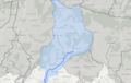 EMS water body.png 706 × 446; 280 KB
-
 England Police Forces (Hampshire).svg 1,108 × 1,345; 312 KB
-
 EnglandHampshire.png 200 × 247; 22 KB
-
 EnglandHampshireTrad.png 200 × 250; 28 KB
-
 EnglandPoliceHampshire.png 2,165 × 2,670; 88 KB
-
 Fareham - Hampshire dot.png 417 × 599; 122 KB
-
 FarnAldershot.png 989 × 817; 133 KB
-
 Geological Map Hampshire Basin Chatwin.jpg 3,242 × 2,874; 721 KB
-
 Geological map of Hampshire Basin.jpg 714 × 361; 42 KB
-
 Gosport UK ward map 2010 (blank).svg 1,187 × 1,226; 247 KB
-
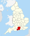
 Hampshire - British Isles.svg 1,260 × 1,835; 943 KB
-
 Hampshire Administrative Map 1832.png 2,000 × 2,109; 851 KB
-
 Hampshire Brit Isles Sect 5.svg 809 × 743; 939 KB
-
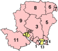 Hampshire Ceremonial Numbered.png 200 × 176; 4 KB
-
 Hampshire constabulary map to April 2006.png 800 × 818; 170 KB
-
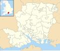
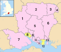 Hampshire numbered districts.svg 1,425 × 1,213; 1.26 MB
-
 Hampshire outline map with UK.png 712 × 600; 196 KB
-
 Hampshire UK constituency map (blank).svg 1,425 × 1,213; 1.33 MB
-
 Hampshire UK district map (blank).svg 1,425 × 1,213; 1.23 MB
-
 Hampshire UK electoral division map (blank).svg 1,425 × 1,213; 1.77 MB
-
 Hampshire UK electoral division map 2017 (blank).svg 1,425 × 1,213; 1.79 MB
-
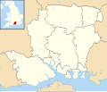
 Hampshire UK location map.svg 1,425 × 1,213; 2.35 MB
-
 Hampshire UK locator map 2010.svg 1,108 × 1,345; 302 KB
-
 Hampshire UK parish map (blank).svg 1,425 × 1,213; 2.61 MB
-
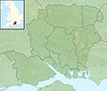 Hampshire UK relief location map.jpg 1,999 × 1,702; 407 KB
-
 Hampshire UK ward map (blank).svg 1,425 × 1,213; 2.44 MB
-
 HampshireBrit5.PNG 625 × 569; 26 KB
-
 Havant UK ward map 2010 (blank).svg 897 × 1,226; 295 KB
-
 HavantConstituency.png 300 × 270; 6 KB
-
 HorseaConsMap.jpg 1,740 × 1,409; 391 KB
-
 How the definitive map gets modified - geograph.org.uk - 970800.jpg 640 × 427; 161 KB
-
 LocationsMap.gif 550 × 400; 41 KB
-
 Map-hampshire.png 1,500 × 1,841; 50 KB
-
 New Forest National Park map.svg 1,244 × 1,227; 925 KB
-
 Ora-distribution.jpg 2,121 × 1,488; 698 KB
-
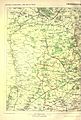
 Ordnance Survey 1-250000 - SU.jpg 4,000 × 4,000; 9.11 MB
-
 OS First Edition map of Hampshire (section 42).jpg 1,896 × 2,800; 1.89 MB
-
 Plan of Spithead, showing the planned evolutions of the Review of the Fleet - ILN 1856.jpg 1,826 × 1,220; 1,008 KB
-
 Ports-direct-1849.png 1,053 × 1,490; 106 KB
-
 Ports-direct-1859.png 1,053 × 1,490; 117 KB
-
 S East Geology.jpg 547 × 649; 92 KB
-
 Soton - fareham - 1889.png 1,257 × 1,036; 100 KB
-
 South Hampshire population density map, 2011 census.png 3,744 × 2,251; 6.14 MB
-
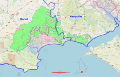 South West Hampshire & South East Dorset Green Belt.svg 2,641 × 1,690; 9.52 MB
-
 SpitheadCloseup.png 544 × 510; 11 KB
-
 Stokes bay railway.png 966 × 779; 39 KB
-
 Wickham - Hampshire dot.png 417 × 599; 122 KB
-
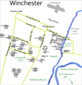 Winchester College map.svg 1,056 × 1,092; 137 KB
-
 Winchester proper ward borders.svg 990 × 1,227; 617 KB
_BHL20977735.jpg)
_BHL20977807.jpg)
_BHL20977808.jpg)
_BHL20977809.jpg)
_BHL20977810.jpg)
_BHL20977811.jpg)
_BHL20977812.jpg)
_BHL20977813.jpg)
_BHL20977814.jpg)
_BHL20977815.jpg)
_BHL20977816.jpg)
_BHL20977817.jpg)
_BHL20977818.jpg)


.png)

.svg)


.jpg)


.svg)
.svg)
.svg)
.svg)
.svg)
.svg)
.svg)
.svg)