Category:Maps of the history of Hungary
Countries of Europe: Albania · Andorra · Armenia‡ · Austria · Azerbaijan‡ · Belarus · Belgium · Bosnia and Herzegovina · Bulgaria · Croatia · Cyprus‡ · Czech Republic · Denmark · Estonia · Finland · France‡ · Georgia‡ · Germany · Greece · Hungary · Iceland · Republic of Ireland · Italy · Kazakhstan‡ · Latvia · Lithuania · Luxembourg · Malta · Moldova · Montenegro · Netherlands‡ · North Macedonia · Norway · Poland · Portugal‡ · Romania · Russia‡ · Serbia · Slovakia · Slovenia · Spain‡ · Sweden · Switzerland · Turkey‡ · Ukraine · United Kingdom
Limited recognition: Abkhazia‡ · Kosovo · South Ossetia‡ · Transnistria · Northern Cyprus‡
‡: partly located in Europe
Limited recognition: Abkhazia‡ · Kosovo · South Ossetia‡ · Transnistria · Northern Cyprus‡
‡: partly located in Europe
Wikimedia category | |||||
| Upload media | |||||
| Instance of | |||||
|---|---|---|---|---|---|
| |||||
Subcategories
This category has the following 9 subcategories, out of 9 total.
Media in category "Maps of the history of Hungary"
The following 40 files are in this category, out of 40 total.
-
 119 of 'Dejiny pročiatkov terajšieho Uhorska' (11075620065).jpg 5,898 × 4,607; 4.02 MB
-
 13szköz.jpg 800 × 595; 42 KB
-
 13szvége.jpg 800 × 595; 43 KB
-
 15szeleje.jpg 800 × 595; 46 KB
-
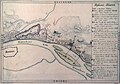
 A Duna medre Pest-Buda alatt 1815.jpg 1,559 × 1,097; 579 KB
-
 A Honfoglalás útja.jpg 3,399 × 2,169; 3.74 MB
-
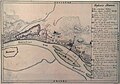
 A Kopaszi zátony és a pesti vizimalmok a Dunában a Nádor kert előtt 1822-ben.JPG 1,555 × 1,130; 238 KB
-
 A Magyar Királyság a 14. század közepén.JPG 800 × 595; 51 KB
-
 A Magyar Királyság plébániasűrűsége 1330 körül.jpg 718 × 470; 290 KB
-
 Az 1332-1337. évi pápai tizedjegyzék - Fizetett pápai tized településenként.jpg 1,501 × 1,969; 1.99 MB
-
 Buda Pest map of 1838 flood damage IMG 0821.JPG 2,043 × 2,916; 2.29 MB
-
 Buda Pest map of 1838 flood damage IMG 0822.JPG 2,126 × 3,027; 2.51 MB
-
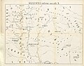
 Central Europe in the late ninth century.png 511 × 289; 195 KB
-
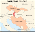 Czech corridor proposal-es.svg 955 × 860; 488 KB
-
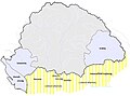
 Hrvati u Ugarskoj 1748.png 4,771 × 3,337; 676 KB
-
 Hungarian leaders territories map after Conquest.jpg 720 × 464; 79 KB
-
 Hungary 1760 map of buda and obuda IMG 0629.JPG 2,429 × 1,707; 1.2 MB
-
 Hungary 1760 map of buda and obuda IMG 0630.JPG 2,438 × 1,708; 1.15 MB
-
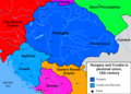 Hungary-Croatia 12th century.png 2,000 × 1,430; 255 KB
-
 Jagello terkep.png 1,231 × 960; 853 KB
-
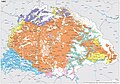 Kingdom of Hungary - Ethnic Map - 1495.jpg 4,771 × 3,337; 11.96 MB
-
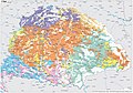 Kingdom of Hungary - Ethnic Map - 1784.jpg 4,771 × 3,337; 11.87 MB
-
 Louis's kingdoms and his vassal territories.png 1,817 × 1,120; 3.3 MB
-
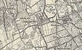 Lövőpetri 19. század második felében.jpg 822 × 503; 196 KB
-
 Magyar Királyság.JPG 4,320 × 3,240; 5.74 MB
-
 Magyar-, Horvát-Szlavónország vármegyék,járások 1910.jpg 3,507 × 2,480; 1.65 MB
-
 Map Europe 1923-hu.svg 1,037 × 704; 189 KB
-
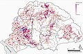
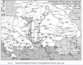
 Map of Romanian Settlements and Autonomy in Medieval Hungary.jpg 2,238 × 2,411; 872 KB
-
 Matthiascorvinusmap01.jpg 1,135 × 862; 364 KB
-
 PNG Jagelon.png 1,268 × 1,054; 90 KB
-
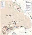
 Rákóczi estates.jpg 1,104 × 786; 211 KB
-
 South-eastern Europe 1040.jpg 1,122 × 867; 332 KB
-
 Spartizione territoriale della Jugoslavia nel 1941.png 1,047 × 894; 122 KB
-
 Szopláki-ördöglyuk egyik része (Szücs Gyula).jpg 2,382 × 3,276; 5.3 MB
-
 Toskanatrakt Salzburg Landkartensaal Ungarn.jpg 2,084 × 4,193; 8.04 MB
-
 Transylvania ethnic map 1495.png 659 × 614; 646 KB
-
 UBBasel Map 1556 Kartenslg AA 86-89 Regni Hungariae.tiff 16,915 × 7,323, 4 pages; 1.08 GB
-
 UBBasel Map 1557 Kartenslg AA 56a Rei contra Turcas.tiff 10,724 × 9,277, 2 pages; 284.66 MB
-
 Valachie, Transylvanie - par Jean-Baptiste d'Anville - btv1b53009082h.jpg 6,120 × 4,061; 2.56 MB
-
 Zapolya.jpg 1,814 × 1,110; 1.22 MB
.jpg)


.jpg)

