Category:Maps of the history of the Netherlands
Countries of Europe: Albania · Andorra · Armenia‡ · Austria · Azerbaijan‡ · Belarus · Belgium · Bosnia and Herzegovina · Bulgaria · Croatia · Cyprus‡ · Czech Republic · Denmark · Estonia · Finland · France‡ · Georgia‡ · Germany · Greece · Hungary · Iceland · Republic of Ireland · Italy · Kazakhstan‡ · Latvia · Lithuania · Luxembourg · Malta · Moldova · Montenegro · Netherlands‡ · North Macedonia · Norway · Poland · Portugal‡ · Romania · Russia‡ · Serbia · Slovakia · Slovenia · Spain‡ · Sweden · Switzerland · Turkey‡ · Ukraine · United Kingdom
Limited recognition: Abkhazia‡ · Kosovo · South Ossetia‡ · Transnistria · Northern Cyprus‡
‡: partly located in Europe
Limited recognition: Abkhazia‡ · Kosovo · South Ossetia‡ · Transnistria · Northern Cyprus‡
‡: partly located in Europe
Wikimedia category | |||||
| Upload media | |||||
| Instance of | |||||
|---|---|---|---|---|---|
| Category combines topics | |||||
 | |||||
Subcategories
This category has the following 28 subcategories, out of 28 total.
!
A
- Maps of the history of Amsterdam (10 F)
- Maps of Austrasia (8 F)
B
D
E
F
M
- Maps of the Anglo-Dutch wars (12 F)
- Maps of the Franco-Dutch War (24 F)
- Maps of the Guelders Wars (8 F)
P
R
- Maps of the Roman Low Countries (36 F)
V
W
Media in category "Maps of the history of the Netherlands"
The following 200 files are in this category, out of 241 total.
(previous page) (next page)-
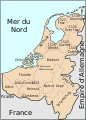
 Locator Duchy of Guelders and County of Zutphen (1350).svg 2,818 × 3,608; 431 KB
-
 Holland 1500.PNG 452 × 551; 682 KB
-
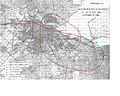
 Modern history; Europe (1904) (14579105790).jpg 1,768 × 2,916; 1.44 MB
-
 422 of 'England under Stuart Rule, etc' (11246288953).jpg 1,267 × 1,916; 534 KB
-
 Napoleonic Central Europe.jpg 3,937 × 2,855; 2.85 MB
-
 17e eeuws kaart met galgpaal.jpg 2,592 × 1,944; 480 KB
-
 Aalbeek 1840.svg 2,105 × 2,980; 161 KB
-
 1eEngelsNederlandseoorlog.png 401 × 535; 14 KB
-
 334 of '(Histoire de la Belgique.)' (11108891003).jpg 1,541 × 2,574; 717 KB
-
 3limburgen.png 1,035 × 1,540; 62 KB
-
 Anglo.Saxon.homelands.250.450.jpg 2,045 × 2,600; 858 KB
-
 AngloDutchWarGer3.png 2,245 × 1,607; 392 KB
-
 Bakker Schut-plan.PNG 664 × 466; 23 KB
-
 Battle of Walcourt 1689.png 456 × 433; 26 KB
-
 Belgian Medieval Dioceses.png 1,664 × 2,284; 140 KB
-
 Belgica1.png 200 × 134; 5 KB
-
 Belgien Luxemburg Limburg Deutscher Bund dt.png 620 × 206; 59 KB
-
 Belgien Luxemburg Limburg Deutscher Bund(2) 01.png 620 × 206; 59 KB
-
 Belgien Luxemburg Limburg Deutscher Bund(2) 02.png 620 × 206; 58 KB
-
 Belgien Luxemburg Limburg Deutscher Bund.png 620 × 206; 50 KB
-
 Belgium-TheNetherlands.PNG 400 × 296; 28 KB
-
 Bemuurde Weerd.png 1,448 × 1,137; 246 KB
-
 Bijlmerramproute.png 511 × 354; 66 KB
-
 Breukeleveen.png 1,108 × 661; 148 KB
-
 Carte Pays-bas espagnol-es.svg 509 × 708; 132 KB
-
 Carte Pays-bas espagnol.svg 509 × 708; 81 KB
-
 Continental.coast.150AD.Germanic.peoples.jpg 2,033 × 2,193; 603 KB
-
 Debruijn holland map.gif 566 × 679; 15 KB
-
 DerdeEngelsNederlandseoorlog.png 345 × 262; 9 KB
-
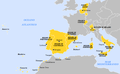
 Dominios de Felipe II-hu.svg 927 × 573; 521 KB
-
 Dominios de Felipe II-it.png 800 × 494; 67 KB
-
 Dominios de Felipe II-pt.svg 927 × 573; 377 KB
-
 Dominios de Felipe II.svg 927 × 573; 719 KB
-
 Dutch Economic Center Antwerp.png 346 × 262; 54 KB
-
 Dutch Hanseatic League.png 415 × 403; 75 KB
-
 Dutch Urban Centers in Holland.png 302 × 337; 60 KB
-
 Dutch Urban Centers in the East.png 249 × 275; 29 KB
-
 Dutch-Port War Result5.PNG 2,753 × 1,400; 154 KB
-
 DutchRepublic.PNG 250 × 115; 5 KB
-
 FatalevluchtBijlmer.JPG 640 × 512; 83 KB
-
 Flevomeer.gif 290 × 340; 5 KB
-
 ForHadriani.PNG 435 × 497; 257 KB
-
 France vs United Provinces 1672 - 1697.jpg 1,500 × 1,957; 523 KB
-
 Gemeente Ruwiel (1818-1964).png 3,668 × 3,646; 1.23 MB
-
 Germanic dialects ca. AD 1 with Arabic color key.jpg 419 × 582; 61 KB
-
 Germanic dialects ca. AD 1.png 2,067 × 2,312; 776 KB
-
 Germanic Groups ca. 0CE.jpg 756 × 600; 183 KB
-
 GERMANICEXPANSION.GIF 458 × 408; 78 KB
-
 Graafschap kessel.svg 255 × 296; 1.09 MB
-
 GraafschapLohn.gif 844 × 516; 46 KB
-
 Guerra de ochenta años en los Paises Bajos, 1573 a-es.svg 1,651 × 2,162; 2.06 MB
-
 Harmelen-1795.png 1,683 × 2,204; 689 KB
-
 Harmelen-1818.png 1,683 × 2,204; 581 KB
-
 Heerlijkheid Vianen.PNG 384 × 343; 10 KB
-
 Holland1350-af.svg 2,050 × 2,110; 267 KB
-
 Holyromanempire.png 687 × 579; 19 KB
-
 Huygendijk.svg 470 × 266; 221 KB
-
 Image-Map Bavaria-Straubing - Karte Straubing-Holland empty.png 1,000 × 984; 140 KB
-
 Kaart DSM.png 661 × 427; 188 KB
-
 Kaart staatkundige indeling omstreeks 1600.jpg 960 × 673; 127 KB
-
 Kaart trekvaarten Zuid-Holland.jpg 3,949 × 3,430; 504 KB
-
 Karte der alten Herrschaft Lohn.png 2,264 × 1,552; 558 KB
-
 Karte von Deutschland, dem Königr. der Niederlande und der Schweiz (2).jpg 5,724 × 4,748; 5.36 MB
-
 Karte von Deutschland, dem Königr. der Niederlande und der Schweiz.jpg 5,821 × 4,769; 7.38 MB
-
 Kingdom of the Netherlands and overseas territories in 1936.png 800 × 351; 87 KB
-
 Koninkrijk.png 480 × 440; 11 KB
-
 LageLanden.PNG 585 × 431; 52 KB
-
 Land van Beveren.gif 672 × 628; 20 KB
-
 LandenVanOvermaas.svg 712 × 770; 904 KB
-
 Limburg grenswijzigingen 20ste eeuw.svg 512 × 438; 402 KB
-
 Limburg1477.png 230 × 231; 98 KB
-
 Limburggrenzen.svg 1,301 × 1,721; 61 KB
-
 LimburgTeilung1839 mk.svg 524 × 765; 80 KB
-
 LimburgTeilung1839.svg 524 × 765; 79 KB
-
 LocationUKN.png 250 × 115; 6 KB
-
 Locator County of Artois (1350).svg 2,818 × 3,608; 422 KB
-
 Locator County of Cleves (1350).svg 2,818 × 3,608; 427 KB
-
 Locator County of Dalhem (1350).svg 2,818 × 3,608; 427 KB
-
 Locator County of Flanders (1350).svg 2,818 × 3,608; 422 KB
-
 Locator County of Holland (1350).svg 2,818 × 3,608; 427 KB
-
 Locator County of Loon (1350).svg 2,818 × 3,608; 427 KB
-
 Locator County of Luxembourg (1350).svg 2,818 × 3,608; 422 KB
-
 Locator County of Zutphen (1350).svg 2,818 × 3,608; 431 KB
-
 Locator Duchy of Guelders (1350).svg 2,818 × 3,608; 427 KB
-
 Locator Lordship of Cuijk (1350).svg 2,818 × 3,608; 427 KB
-
 Locator Lordship of Hertogenrade (1350).svg 2,818 × 3,608; 428 KB
-
 Locator Lordship of Horne (1350).svg 2,818 × 3,608; 427 KB
-
 Locator Lordship of Kessel (1350).svg 2,818 × 3,608; 427 KB
-
 Locator Lordship of Mechelen (1350).svg 2,818 × 3,608; 422 KB
-
 Locator Lorships of Horne and Weert (1350).svg 2,818 × 3,608; 427 KB
-
 Locator Nedersticht of Utrecht (1350).svg 2,818 × 3,608; 422 KB
-
 Locator Oversticht of Urecht (1350).svg 2,818 × 3,608; 427 KB
-
 Locator Prince-Bishopric of Cambrai (1350).svg 2,818 × 3,608; 422 KB
-
 Locator Prince-Bishopric of Liège (1350).svg 2,818 × 3,608; 427 KB
-
 Locator Prince-Bishopric of Tournai (1350).svg 2,818 × 3,608; 427 KB
-
 Locator Prince-Bishopric of Utrecht (1350).svg 2,818 × 3,608; 427 KB
-
 Lohn kaartje.png 799 × 396; 114 KB
-
 Lohn kaartje.svg 799 × 396; 141 KB
-
 Lorena 870-segle XI.png 2,697 × 4,170; 1.99 MB
-
 Lotharingen-959 de.svg 585 × 752; 320 KB
-
 Lotharingen-959 ru.svg 585 × 752; 324 KB
-
 Lotharingen-959-hu.svg 585 × 752; 326 KB
-
 Lotharingen-959-ru.svg 594 × 761; 337 KB
-
 Lotharingen-959.svg 3,161 × 4,201; 598 KB
-
 Lotharingia-959-ar.svg 3,161 × 4,174; 471 KB
-
 Lotharingia-959-el.png 454 × 599; 77 KB
-
 Lotharingia-959-es.svg 3,273 × 4,208; 462 KB
-
 Lotharingia-959-pt.svg 3,161 × 4,174; 277 KB
-
 Lotharingia-959.svg 3,161 × 4,174; 547 KB
-
 Low Countries Locator Bentheim.svg 1,550 × 2,000; 381 KB
-
 Low Countries Locator Berg.svg 1,550 × 2,000; 381 KB
-
 Low Countries Locator Cleves.svg 1,550 × 2,000; 381 KB
-
 Low Countries Locator Duchy of Julich.svg 1,550 × 2,000; 381 KB
-
 Low Countries Locator Flanders and Artois.svg 1,550 × 2,000; 212 KB
-
 Low Countries Locator Flanders.svg 1,550 × 2,000; 381 KB
-
 Low Countries Locator Gelre.svg 1,550 × 2,000; 381 KB
-
 Low Countries Locator Holland.svg 1,550 × 2,000; 381 KB
-
 Low Countries Locator Prince-Bischopric of Liege.svg 1,550 × 2,000; 381 KB
-
 Low Countries Locator Prince-Bischopric Utrecht.svg 1,550 × 2,000; 381 KB
-
 Low Countries Medieval Dioceses-blank.png 1,664 × 2,284; 10.89 MB
-
 Low Countries Medieval Dioceses-NL.png 1,664 × 2,284; 323 KB
-
 Maarsseveen.png 1,406 × 674; 149 KB
-
 Map Bavaria-Straubing - Karte Straubing-Holland.png 1,000 × 984; 256 KB
-
 Map Burgundian Netherlands 1477.png 591 × 657; 198 KB
-
 Map of Liège diocese until 1559.png 1,664 × 2,284; 82 KB
-
 Map of the Habsburg Netherlands by Alexis-Marie Gochet.png 532 × 744; 813 KB
-
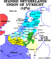
 Map Union of Arras and Utrecht 1579-bg.svg 749 × 872; 62 KB
-
 Map Union of Arras and Utrecht 1579-en.svg 749 × 872; 140 KB
-
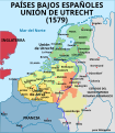 Map Union of Arras and Utrecht 1579-es.svg 750 × 860; 132 KB
-
 Map Union of Arras and Utrecht 1579-fr.svg 750 × 860; 132 KB
-
 Map Union of Arras and Utrecht 1579-gl.svg 750 × 860; 173 KB
-
 Map Union of Arras and Utrecht 1579-hu.svg 750 × 860; 134 KB
-
 Map Union of Arras and Utrecht 1579-nl.svg 749 × 872; 139 KB
-
 Map Union of Arras and Utrecht 1579-no.svg 749 × 872; 139 KB
-
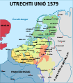
 Map-1579 Union of Utrecht.png 599 × 687; 173 KB
-
 Midden-Limburg omstreeks 1716.png 1,060 × 834; 327 KB
-
 Moerassen in NL 100 nc.jpg 704 × 720; 113 KB
-

-
-
 Nederland-50AD-Slag van Kessel-af.svg 510 × 615; 76 KB
-
 NederlandDuitseBond.png 340 × 435; 26 KB
-
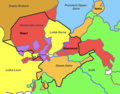
 Nederlanden 1590-1592-es.svg 1,546 × 2,028; 2.3 MB
-
 Nederlanden 1597-es.svg 1,546 × 2,028; 1.77 MB
-
 Nederlandgodsdienst1849-de.PNG 1,270 × 1,796; 218 KB
-
 Nederlandgodsdienst1849-en.PNG 1,270 × 1,796; 217 KB
-
 Nederlandgodsdienst1849.PNG 1,270 × 1,796; 218 KB
-
 Neerdijk.png 1,406 × 713; 147 KB
-
 Netherlands in the time of the Roman empire.png 1,256 × 1,340; 161 KB
-
 Netherlands in time of Caesar.png 1,452 × 1,472; 69 KB
-
 Nieuw-Maarsseveen.png 1,444 × 598; 127 KB
-

-
-

-

-
 NL-Zuiderzeeworks.svg 241 × 285; 182 KB
-
 Nordwestblock.png 632 × 435; 113 KB
-
 Novissima et accuratissima XVII Provinciarum Germaniae Inferioris Tabula.jpg 7,332 × 6,107; 16.39 MB
-
 Obsidio Bredae.jpg 9,405 × 6,525; 17.67 MB
-
 Oostergo.jpg 1,181 × 1,144; 200 KB
-
 Oud-Wulven.png 2,412 × 4,179; 833 KB
-
 Oude-hollandse-waterlinie.png 844 × 1,513; 126 KB
-
 Overmaas-na-1785 (cropped).png 1,104 × 862; 178 KB
-
 Overmaas-na-1785.png 2,000 × 1,891; 359 KB
-
 Overmaas-voor-1785 redemptie.png 2,000 × 1,891; 282 KB
-
 Overmaas-voor-1785.png 2,000 × 1,891; 381 KB
-
 OvermaasPartage 1661 hu.svg 678 × 826; 1.46 MB
-
 OvermaasPartage1661 de.svg 678 × 826; 1.46 MB
-
 OvermaasPartage1661.svg 678 × 826; 1.47 MB
-
 Paises Bajos, 1350-es.svg 2,818 × 3,608; 1.94 MB
-
 Paleogeografie West Nederland 100nC.svg 690 × 532; 2.8 MB
-
 Partition-plan-Flahaut-es.svg 426 × 599; 225 KB
-
 Partition-plan-Flahaut-nl.svg 426 × 599; 312 KB
-
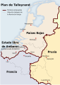
 Partition-plan-Talleyrand-de.svg 426 × 599; 471 KB
-
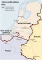 Partition-plan-Talleyrand-en.svg 426 × 599; 312 KB
-
 Partition-plan-Talleyrand-nl.svg 426 × 599; 312 KB
-
 Pijlsweerd.png 2,177 × 2,125; 490 KB
-
 Plain map of the low countries (1350)-NL.png 1,063 × 1,080; 272 KB
-
 PlanFlahaut.png 485 × 692; 79 KB
-
 Political map of Limburg (1350)-NL.svg 866 × 1,206; 888 KB
-
 Political map of the Low Countries (1350)-es.svg 2,818 × 3,608; 1.95 MB
-
 Political map of the Low Countries (1350)-FR.svg 2,818 × 3,608; 815 KB
-
 Political map of the Low Countries (1350)-hu.svg 2,818 × 3,608; 850 KB
-
 Political map of the Low Countries (1350)-NL.svg 2,818 × 3,608; 886 KB
-
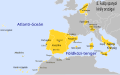
 Political map of the Low Countries Arabic.jpg 3,492 × 4,502; 4.95 MB
-
 PrAgrippinae.PNG 435 × 497; 257 KB
-
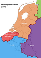
 Reino Unido de los Países Bajos en 1815-es.svg 791 × 1,112; 527 KB
-
 Reiseroute von Johanna von Bayern 1370.png 1,000 × 983; 263 KB
-
 ReligiesNederland.png 800 × 948; 92 KB
-
 Republiek der Zeven Verenigde Nederlanden de.svg 764 × 807; 429 KB
-
 Republiek der Zeven Verenigde Nederlanden es.svg 764 × 807; 755 KB
-
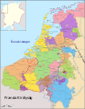
 Republiek der Zeven Verenigde Nederlanden.svg 2,870 × 3,250; 1.11 MB
-
 RHENVS Fluviorum Europae celeberrimus.jpg 3,200 × 1,472; 1.96 MB
-
 Roer Triangle Map.jpg 600 × 454; 156 KB
-
 Romeinen kaart stammen.png 600 × 755; 291 KB
-
 Seelandelengen.png 1,191 × 666; 254 KB
-
 Seelanderheiderland.png 1,191 × 666; 254 KB
-
 Seelandeverledingen.png 1,191 × 666; 254 KB
-
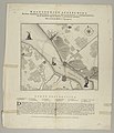
 Siege, Et Plan Geometrique de la Vielle de Bois-Leducq en Braban.jpg 9,347 × 6,605; 17.43 MB
-

-

.svg)

_(14579105790).jpg)
.jpg)


%27_(11108891003).jpg)


.png)


.jpg)


.svg)
.svg)
.svg)
.svg)
.svg)
.svg)
.svg)
.svg)
.svg)
.svg)
.svg)
.svg)
.svg)
.svg)
.svg)
.svg)
.svg)
.svg)
.svg)
.svg)
.svg)


.jpg)


.jpg)
.jpg)
.jpg)


.png)


-NL.png)

-NL.svg)
-es.svg)
-FR.svg)
-hu.svg)
-NL.svg)


.png)
.svg)
_01.png)
_02.png)