Category:Old maps of Nova Scotia
Provinces and territories of Canada: Alberta · British Columbia · Manitoba · New Brunswick · Newfoundland and Labrador · Nova Scotia · Ontario · Prince Edward Island · Quebec · Saskatchewan · Northwest Territories · Nunavut · Yukon
Subcategories
This category has the following 8 subcategories, out of 8 total.
C
H
O
Media in category "Old maps of Nova Scotia"
The following 200 files are in this category, out of 226 total.
(previous page) (next page)-
 (Map of St. Mary's and Petit d'Grat Harbour.) LOC 74694517.jpg 6,030 × 4,031; 2.71 MB
-
 (Map of St. Mary's and Petit d'Grat Harbour.) LOC 74694517.tif 6,030 × 4,031; 69.54 MB
-
 (Maps of Nova Scotia and Halifax harbor and view of lighthouse). LOC 2017585984.jpg 16,933 × 6,617; 10.09 MB
-
 (Maps of Nova Scotia and Halifax harbor and view of lighthouse). LOC 2017585984.tif 16,933 × 6,617; 320.57 MB
-

-

-

-

-

-

-
-
-
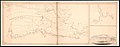
 1925 Air Routes of Newfoundland and Nova Scotia.jpg 591 × 857; 242 KB
-

-

-

-

-

-

-

-

-

-

-
-
 A chart of the peninsula of Nova Scotia. LOC 74691224.jpg 9,807 × 7,326; 8.46 MB
-
 A chart of the peninsula of Nova Scotia. LOC 74691224.tif 9,807 × 7,326; 205.55 MB
-

-

-
 A general plan of Annapolis Royal LOC 74691226.jpg 9,014 × 7,877; 8.99 MB
-
 A general plan of Annapolis Royal LOC 74691226.tif 9,014 × 7,877; 203.14 MB
-
 A Large & particular plan of Shegnecto - Jefferys - btv1b53089919n.jpg 9,559 × 7,052; 11.5 MB
-

-

-

-

-
 A map of the harbour of Louisburg and parts adjacent. LOC 2017593644.jpg 2,828 × 1,836; 658 KB
-
 A map of the harbour of Louisburg and parts adjacent. LOC 2017593644.tif 2,828 × 1,836; 14.86 MB
-

-

-

-

-
-
 A New map of Nova Scotia - Jefferys - btv1b53089994q.jpg 9,163 × 6,948; 9.43 MB
-

-
 A New map of Nova Scotia and Cape Britain... - Jefferys - btv1b53089581f.jpg 7,760 × 6,200; 6.6 MB
-

-

-
 A plan of Louisbourg. LOC 74691225.jpg 9,003 × 6,388; 6.58 MB
-
 A plan of Louisbourg. LOC 74691225.tif 9,003 × 6,388; 164.54 MB
-
 A plan of the city & fortifications of Louisburg. LOC 2017593646.jpg 2,864 × 1,940; 819 KB
-
 A plan of the city & fortifications of Louisburg. LOC 2017593646.tif 2,864 × 1,940; 15.9 MB
-
 A plan of the city of Louisbourg with its fortifications LOC 2010592486.jpg 1,341 × 826; 252 KB
-
 A plan of the city of Louisbourg with its fortifications LOC 2010592486.tif 1,341 × 826; 3.17 MB
-

-
 A plan of the city, and fortifications, of Louisburg; LOC 77694213.jpg 7,590 × 4,710; 6.31 MB
-
 A plan of the city, and fortifications, of Louisburg; LOC 77694213.tif 7,590 × 4,710; 102.28 MB
-

-

-
 A Plan of the fort at Chiegnecto. LOC 74694518.jpg 6,504 × 4,463; 3.89 MB
-
 A Plan of the fort at Chiegnecto. LOC 74694518.tif 6,504 × 4,463; 83.05 MB
-
 A plan of the harbour and town of Louisbourg in the Island of Cape Breton LOC 2017593648.jpg 3,492 × 2,312; 1.28 MB
-
 A plan of the harbour and town of Louisbourg in the Island of Cape Breton LOC 2017593648.tif 3,492 × 2,312; 23.1 MB
-
 A plan of the harbour of Chebucto and town of Halifax. LOC 2017585994.jpg 3,784 × 3,004; 2.1 MB
-
 A plan of the harbour of Chebucto and town of Halifax. LOC 2017585994.tif 3,784 × 3,004; 32.52 MB
-
 A plan of the town & harbour of Halifax in Nova Scotia. LOC 2017585996.jpg 1,396 × 2,188; 549 KB
-
 A plan of the town & harbour of Halifax in Nova Scotia. LOC 2017585996.tif 1,396 × 2,188; 8.74 MB
-

-
 A plan of the town of Halifax in Nova Scotia LOC 2017585990.jpg 5,028 × 4,470; 3.39 MB
-
 A plan of the town of Halifax in Nova Scotia LOC 2017585990.tif 5,028 × 4,470; 64.3 MB
-
 Acadie 1757.gif 1,831 × 1,176; 97 KB
-
 Admiralty Chart No 2163 Canso Harbour, Published 1854.jpg 8,128 × 6,013; 6.68 MB
-
 Admiralty Chart No 2342 Gut of Canso, Published 1856, New Edition 1914.jpg 16,165 × 10,867; 65.29 MB
-

-
 Admiralty Chart No 2410 Nova Scotia Mars Head to Shut-In Island, Published 1855.jpg 8,139 × 12,001; 10.79 MB
-
 Admiralty Chart No 2439 Nova Scotia Shut In Island to Pope Harbour, Published 1856.jpg 11,844 × 7,928; 13.8 MB
-
 Admiralty Chart No 2517 Nova Scotia Green Island to Cape Canso, Published1857.jpg 11,811 × 7,995; 14.34 MB
-
 Admiralty Chart No 2518 Cape Canso to Dover Head, Published 1857.jpg 10,833 × 16,004; 17.59 MB
-
 Admiralty Chart No 2519 Nova Scotia Liscomb Island to Green Island, Published 1857.jpg 9,922 × 14,945; 16.6 MB
-
 Admiralty Chart No 2537 Bay of Fundy East Coast Pubnico to Yarmouth, Published 1857.jpg 11,934 × 8,029; 15.39 MB
-
 Admiralty Chart No 2547 Nova Scotia Country Harbour, Published 1857.jpg 11,945 × 8,029; 14.95 MB
-
 Admiralty Chart No 2560 Whitehaven Nova Scotia, Published 1860.jpg 10,798 × 16,082; 24.95 MB
-
 Admiralty Chart No 2624 Ship Harbour, Published 1859.jpg 9,895 × 15,007; 18.29 MB
-
 Admiralty Chart No 2663 Beaver Harbour, Published 1859.jpg 10,844 × 16,026; 18.48 MB
-
 Admiralty Chart No 2666 St Johns Newfoundland to Halifax with the Outer Banks, Published 1861.jpg 11,911 × 8,074; 12.46 MB
-
 Admiralty Chart No 2670 Halifax to the Delaware, Published 1895, Large Corrections 1928.jpg 16,315 × 11,107; 68.51 MB
-
 Admiralty Chart No 2673 Nicomtau Bay, Published 1859.jpg 10,844 × 16,026; 18.61 MB
-
 Admiralty Chart No 2769 Liscomb and Mary-Joseph Harbours, Published 1860.jpg 12,146 × 8,085; 17.01 MB
-
 Admiralty Chart No 2807 Sheet Harbour, Published 1861.jpg 10,759 × 16,064; 23.54 MB
-
 Admiralty Chart No 2855 Pope Head to Charles Island, Published 1862.jpg 8,957 × 13,368; 14.37 MB
-
 Admiralty Chart No 339 Nova Scotia Baccaro Point to Pubnico Harbour, Published 1857.jpg 11,934 × 8,029; 13.34 MB
-
 Admiralty Chart No 340 Baccaro Point to Ram Island, Published1863.jpg 8,193 × 11,938; 13.93 MB
-
 Admiralty Chart No 341 Nova Scotia Ram Island to Port Metway, Published1864.jpg 11,005 × 16,176; 20.14 MB
-
 Admiralty Chart No 342 Nova Scotia Port Metway to Lunenburg, Published 1866.jpg 12,034 × 8,085; 11.62 MB
-
 Admiralty Chart No 343 Lunenburg to Mars Head, Published 1866.jpg 11,990 × 8,746; 15.05 MB
-
 Admiralty Chart No 729 Nova Scotia S.E. Coast Sambro I. to C. Canso, Published 1867.jpg 11,900 × 8,175; 11.61 MB
-
 Admiralty Chart No 730 Nova Scotia S.E. Coast C. Sable to Sambro I. Published 1867.jpg 9,142 × 13,543; 12.94 MB
-
 Baye Ste. Anne ou le Port Dauphin dans l'Isle Royale. LOC 73696307.jpg 7,532 × 5,424; 4.01 MB
-
 Baye Ste. Anne ou le Port Dauphin dans l'Isle Royale. LOC 73696307.tif 7,532 × 5,424; 116.88 MB
-
 BayOfMaine1713.jpg 2,761 × 1,958; 2.23 MB
-
 Beaubassin1755.jpg 4,434 × 3,366; 4.53 MB
-
 Carte de l Acadie, Isle Royale, et pais voisins.jpg 3,014 × 2,160; 1.05 MB
-
 Carte de l' Accadie et Pais Voisins 1757.jpg 3,047 × 1,982; 828 KB
-
 Carte de l'Acadie et pays voisins. LOC 73696219.jpg 6,537 × 4,969; 3.34 MB
-
 Carte de l'Acadie et pays voisins. LOC 73696219.tif 6,537 × 4,969; 92.93 MB
-
 Carte de l'Acadie, Isle Royale, et païs voisins. LOC 73696218.jpg 6,563 × 4,999; 3.57 MB
-
 Carte de l'Acadie, Isle Royale, et païs voisins. LOC 73696218.tif 6,563 × 4,999; 93.87 MB
-
 Carte de lAcadie, Isle Royale, et Païs Voisins (4231926502).jpg 2,000 × 1,271; 2.48 MB
-
 Coast of Nova Scotia from Barrington Bay to Cape Blancherolte (3046379360).jpg 2,000 × 1,285; 2.48 MB
-
 Conditions forestières de la Nouvelle-Écosse (microforme) (1912) (20646930035).jpg 2,062 × 3,489; 2.06 MB
-
 Darlington map of Maine and Nova Scotia 1680.png 692 × 653; 889 KB
-

-

-

-
 EB9 New Brunswick.png 3,708 × 2,642; 12.27 MB
-
 En Amerique Quebec ; Louisbourg. LOC 2017593664.jpg 3,678 × 4,602; 1.13 MB
-
 En Amerique Quebec ; Louisbourg. LOC 2017593664.tif 3,678 × 4,602; 48.43 MB
-
 Gscmcm 381 e 1893 mn01.pdf 3,529 × 2,539; 1.54 MB
-
 Gscmcm 656 e 1899 mn01.pdf 6,414 × 1,447; 1.76 MB
-
 Gscmcm 832 e 1904 xs01.pdf 5,327 × 3,131; 3.33 MB
-
 Halifax dockyard with proposed improvements, LOC 74694515.jpg 15,183 × 6,596; 6.46 MB
-
 Halifax dockyard with proposed improvements, LOC 74694515.tif 15,183 × 6,596; 286.52 MB
-
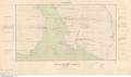
 HantsCountyTownshipMap1879.jpg 1,030 × 804; 173 KB
-

-

-

-
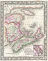
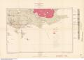
 Map of Nova Scotia, Canada, 1829.jpg 8,814 × 4,505; 9.02 MB
-

-
 L'Acadie (IA McGillLibrary-123903-2179).pdf 2,095 × 1,666; 8.11 MB
-
 Nova Scotia and Newfoundland (IA McGillLibrary-rbsc-maps G3410 1851 R3-17133).pdf 3,125 × 2,410; 70.24 MB
-

-

-
-
-
-
-
-
-
-
-
-
-

-
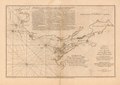
 Nova Scotia - Canso Harbour (IA McGillLibrary-rbsc map bayfield-108-19280).pdf 4,062 × 3,006; 12.59 MB
-
 North America, Nova Scotia - Whitehaven (IA McGillLibrary-rbsc map bayfield-109-19281).pdf 2,697 × 4,018; 72.7 MB
-
-
 Nova Scotia - Nicomtau Bay and parts adjacent (IA McGillLibrary-rbsc map bayfield-111-19288).pdf 2,710 × 4,006; 59.01 MB
-
 North America, Nova Scotia - Beaver Harbour (IA McGillLibrary-rbsc map bayfield-112-19291).pdf 2,710 × 4,006; 56.43 MB
-
-
-
-
 A New Map of Nova Scotia (IA McGillLibrary-rbsc map G3415-1829-N48-18861).pdf 8,952 × 5,887; 13.43 MB
-
 Mi'kmaq History Month (21192149713).jpg 4,500 × 3,527; 2.49 MB
-
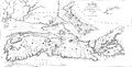
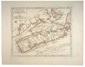
 MitchellMap-SouthernNovaScotia.jpg 2,904 × 2,336; 2.6 MB
-

-
 New France, New Englande, New Scotlande, and New Foundlande (2675734090).jpg 2,000 × 1,696; 2.69 MB
-
 Newbrunswickmap.png 4,182 × 3,137; 37.56 MB
-
 Northern part of the Gut of Canso, part of the island of Cape Bocton, LOC 74694514.jpg 6,026 × 11,062; 6.5 MB
-
 Northern part of the Gut of Canso, part of the island of Cape Bocton, LOC 74694514.tif 6,026 × 11,062; 190.71 MB
-
 Nouvelle Ecosse ou partie orientale du Canada. LOC 74692529.jpg 8,574 × 6,473; 8.74 MB
-
 Nouvelle Ecosse ou partie orientale du Canada. LOC 74692529.tif 8,574 × 6,473; 158.79 MB
-
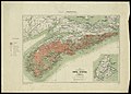
 Nova Scotia 1862 0450001.jpg 12,056 × 9,664; 20.17 MB
-
 Nova Scotia and Newfoundland (13407302013).jpg 2,500 × 1,913; 2.03 MB
-
 Nova Scotia LOC 2017585981.jpg 2,872 × 1,824; 748 KB
-
 Nova Scotia LOC 2017585981.tif 2,872 × 1,824; 14.99 MB
-
 A new map of Nova Scotia, New Brunswick and Cape Breton, 1794 (NYPL b14115138-1567516).jpg 6,598 × 5,428; 4.64 MB
-

-
 Panoramic view of the city of Halifax, Nova Scotia 1879. LOC 73693337.jpg 11,184 × 6,352; 15.51 MB
-

-

-
-
 Plan de la baie de Gabarus située a la côte S.E. de l'Île Royale LOC 73696321.jpg 10,947 × 7,485; 11.42 MB
-
 Plan de la baie de Gabarus située a la côte S.E. de l'Île Royale LOC 73696321.tif 10,947 × 7,485; 234.43 MB
-
 Plan de la baye de Chibouctou nommée par les Anglois Halifax, 1763. LOC 73696222.jpg 5,248 × 3,824; 2.6 MB
-
 Plan de la baye de Chibouctou nommée par les Anglois Halifax, 1763. LOC 73696222.tif 5,248 × 3,824; 57.42 MB
-
 Plan de la ville de du port de Louisbourg levé en 1756. LOC 73696292.jpg 7,263 × 5,325; 6.38 MB
-
 Plan de la ville de du port de Louisbourg levé en 1756. LOC 73696292.tif 7,263 × 5,325; 110.65 MB
-
 Plan de la ville de Louisbourg dans l'Isle Royale. LOC 73696225.jpg 6,534 × 5,014; 4.25 MB
-
 Plan de la ville de Louisbourg dans l'Isle Royale. LOC 73696225.tif 6,534 × 5,014; 93.73 MB
-
 Plan de la ville et du port de Louisbourg levé en 1756 (5961375444).jpg 2,000 × 1,516; 2.75 MB
-
 Plan de la ville et du port de Louisbourg levé en 1756. LOC 73696293.jpg 7,639 × 5,597; 6.54 MB
-
 Plan de la ville et du port de Louisbourg levé en 1756. LOC 73696293.tif 7,639 × 5,597; 122.32 MB
-
 Plan des Havens von Chebucto und der Stadt Halifax LOC 2017585993.jpg 4,482 × 3,084; 2 MB
-
 Plan des Havens von Chebucto und der Stadt Halifax LOC 2017585993.tif 4,482 × 3,084; 39.55 MB
-

-

-
 Plan du Cap Breton, dit Louisbovrg avec ces environs pries LOC 74694645.jpg 24,435 × 6,573; 27.02 MB
-
 Plan du Cap Breton, dit Louisbovrg avec ces environs pries LOC 74694645.tif 24,435 × 6,573; 459.51 MB
-

-

-
 Plan du port de Chibouctou à la côte de l'Acadie avec les côtes voisines. LOC 73696323.jpg 7,696 × 5,470; 4.19 MB
-
 Plan du port de Chibouctou à la côte de l'Acadie avec les côtes voisines. LOC 73696323.tif 7,696 × 5,470; 120.44 MB
-

-

-
-

-
 Plan of Annapolis Royal in Nova Scotia. LOC 2017585991.jpg 8,139 × 5,668; 5.38 MB
-
 Plan of Annapolis Royal in Nova Scotia. LOC 2017585991.tif 8,139 × 5,668; 131.98 MB
-

-
 Plan of the lines constructing at Halifax for the defense of His Majesty's naval yard. LOC 74694516.tif 14,076 × 5,791; 233.21 MB
-
 Plan of the Naval-yard at Halifax. LOC 74691493.jpg 8,744 × 6,528; 4.96 MB
_LOC_74694517.jpg)


.jpg)
)%27_(11243522715).jpg)
.jpg)
%27_(11258142084).jpg)
.jpg)
%27_(11231807596).jpg)
_(With_maps_and_illustrations.)%27_(11216776383).jpg)


_(cropped).jpg)
.jpg)
.jpg)


.jpg)


.jpg)


.jpg)
.jpg)
_(1912)_(20646930035).jpg)

_(1901)_(14782487794).jpg)


_-_btv1b8491032t.jpg)


.jpg)


.jpg)


.jpg)

.jpg)
.jpg)


.jpg)


._LOC_2017585984.jpg)