Category:Old maps of Ontario
Provinces and territories of Canada: Alberta · British Columbia · Manitoba · New Brunswick · Newfoundland and Labrador · Nova Scotia · Ontario · Prince Edward Island · Quebec · Saskatchewan · Northwest Territories · Nunavut · Yukon
Subcategories
This category has the following 9 subcategories, out of 9 total.
Media in category "Old maps of Ontario"
The following 42 files are in this category, out of 42 total.
-
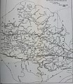
 1877OntarioCounty.jpg 700 × 1,174; 642 KB
-

-

-
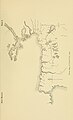
 39 of 'Muskoka through a Camera; an album of the Muskoka Lakes' (11250589536).jpg 4,766 × 4,785; 6.28 MB
-

-
 Annual report (1903) (17808020573).jpg 2,603 × 4,271; 652 KB
-

-
 Annual report of the Fruit Growers' Association of Ontario, 1902 (1903) (14746933846).jpg 3,824 × 2,336; 1.21 MB
-
 Carte des pays situes à l'ouest du Canada 1791.jpg 1,920 × 1,376; 894 KB
-

-

-
 Electric railway journal (1910) (14574235388).jpg 2,981 × 2,302; 1.04 MB
-
 Erie Welland Canals-1850.tif 2,771 × 1,709; 4.54 MB
-
 Genticore plate, Upper Canada.png 1,280 × 800; 1.27 MB
-
 Grand-River-Niagara-Part1.tif 4,685 × 3,986; 17.83 MB
-
 Grand-River-Niagara-Part2.tif 4,685 × 3,986; 17.83 MB
-

-

-
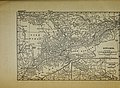
 Map of Sarnia and Point Edwards, 1880.jpg 2,500 × 1,871; 2.01 MB
-

-

-
 Merrickville Locks - 1829.jpg 600 × 245; 41 KB
-
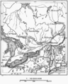
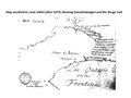
 Niagara Frontier - 1818 from a collection at Brock U.jpg 3,000 × 2,333; 2.67 MB
-
 NOTL-StC-25k-1937.jpg 10,380 × 7,760; 15.4 MB
-
 Ontario Sessional Papers, 1907, No.45-74 (1907) (14766448582).jpg 2,608 × 3,008; 796 KB
-
 Ontario Sessional Papers, 1914, No.3-9 (1914) (14580084177).jpg 1,850 × 3,664; 719 KB
-
 Ontario Sessional Papers, 1918, No.47-49 (1918) (14583644767).jpg 1,828 × 2,872; 703 KB
-
 P025 - N° 524. Canada Oriental. - Liv4-Ch05.png 1,442 × 1,794; 321 KB
-

-
-
 Port Dalhousie in 1876.jpg 1,881 × 1,863; 613 KB
-
 Port Dalhousie in 1876.tif 1,881 × 1,863; 42.04 MB
-

-
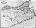
 Province of Canada, 1850.webp 558 × 416; 148 KB
-
 Rouge Trail Map 1673 Louis Jolliet 1673.pdf 1,500 × 1,125; 167 KB
-
 Rouge Trail Map 1673 Louis Jolliet 1673.png 600 × 450; 56 KB
-

-
 StCatharines-1809.jpg 3,648 × 4,888; 2.79 MB
-
 StCatharines-1809.tif 3,648 × 4,888; 8.02 MB
-
 The Pan-American geologist (1894) (14767265475).jpg 1,642 × 2,560; 820 KB
-
 The Route of the Rideau Canal, 1830.jpg 400 × 233; 45 KB
-
 WellandCanal1833.tif 4,595 × 2,959; 12.97 MB

%27_(11030111593).jpg)
%27_(11236039406).jpg)
.jpg)

_(17808020573).jpg)
_(19364284255).jpg)
_(14746933846).jpg)

_(1901)_(14598142330).jpg)
_(1901)_(14781700231).jpg)
_(14574235388).jpg)

.jpg)
_of_Cox%E2%80%99s,_Nicholsons%E2%80%99_and_Clowes%E2%80%99_rapids_on_the_Rideau_River_in_1827.jpg)

,_which_was_the_portage_route_from_the_Holland_Marsh_to_Lake_Ontario.jpeg)


_(14766448582).jpg)
_(14580084177).jpg)
_(14583644767).jpg)


_(14580904249).jpg)


_(14767265475).jpg)

.jpg)