Category:Old maps of the Northwest Territories
Provinces and territories of Canada: Alberta · British Columbia · Manitoba · New Brunswick · Newfoundland and Labrador · Nova Scotia · Ontario · Prince Edward Island · Quebec · Saskatchewan · Northwest Territories · Nunavut · Yukon
Subcategories
This category has only the following subcategory.
Media in category "Old maps of the Northwest Territories"
The following 14 files are in this category, out of 14 total.
-

-
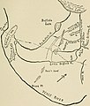
 The Old Northwest; the beginnings of our colonial system (1899) (14578268677).jpg 2,336 × 1,764; 479 KB
-

-

-
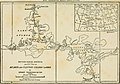
 6 of 'The Routes and Mineral Resources of North Western Canada' (11246802964).jpg 2,529 × 2,413; 1.11 MB
-
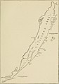
 Mackenzie - Map - Great Slave Lake.png 800 × 501; 948 KB
-
 Manitoba and Northwest Territories (1900).jpg 3,510 × 2,550; 9.76 MB
-

-

-
-
-
-

-

.jpg)
_(14578268677).jpg)
.jpg)
.jpg)
.jpg)

.jpg)
.jpg)
_(19711267574).jpg)
_(20145772360).jpg)
_(20147305199).jpg)
_(20147337299).jpg)
_(20333952695).jpg)
_(20339966191).jpg)