Commons:Wiki Loves Monuments in Switzerland/St. Gallen/N-Z
Neckertal
| Location | Upload | Photo | Object | Cat. | Coordinates | KGS-Nr | |
|---|---|---|---|---|---|---|---|
| Neckertal | 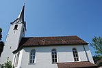
|
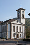
Reformierte Kirche Brunnadern | B | 47°20′05″N 9°07′53″E / 47.3347°N 9.13145°E | 14042 | ||
| Neckertal | 
|
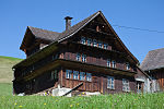
Furth: Haus Näf | A | 47°19′41″N 9°09′01″E / 47.327958°N 9.15026°E | 8194 | ||
| Neckertal | 
|
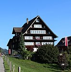
Furth: Oberes Türmlihaus | A | 47°19′40″N 9°09′23″E / 47.327679°N 9.156351°E | 8195 | ||
| Neckertal | 
|
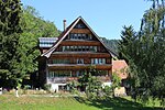
Furth: Unteres Türmlihaus | A | 47°19′39″N 9°09′18″E / 47.327454°N 9.155126°E | 10141 | ||
| Neckertal | 
|
Ehemalige Propstei St. Peter und Paul | B | 47°19′04″N 9°10′27″E / 47.317911°N 9.174188°E | 8362 | ||
| Neckertal | 
|
Furth, Alter Hirschen (1619) | B | 47°19′33″N 9°09′11″E / 47.325828°N 9.153142°E | 8108 | ||
| Neckertal | 
|
Gasthaus Rössli | B | 47°21′45″N 9°08′09″E / 47.362464°N 9.135942°E | 14044 | ||
| Neckertal | 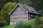
|
Haus Bädli (um 1770, Fassadenmalereien) | B | 47°18′57″N 9°10′20″E / 47.315755°N 9.172186°E | 8361 | ||
| Neckertal | 
|
Holzbrücke Anzenwil (1862) | B | 47°22′26″N 9°07′19″E / 47.373898°N 9.121871°E | 8197 | ||
| Neckertal | 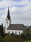
|
Paritätische Kirche St. Jakobus | B | 47°21′44″N 9°08′09″E / 47.362151°N 9.135853°E | 14043 | ||
| Neckertal | 
|
Rotes Haus (1622, 1716) | B | 47°19′03″N 9°10′28″E / 47.317566°N 9.174428°E | 8364 | ||
| Neckertal | 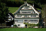
|
Spreitenbach, Fabrikantenhaus | B | 47°19′37″N 9°08′46″E / 47.327029°N 9.146194°E | 8109 | ||
| Neckertal | 
|
Wald, Fabrikantenhaus (1770/71), | B | 47°19′45″N 9°13′36″E / 47.329158°N 9.226585°E | 8363 | ||
| Neckertal | 
|
Spreitenbach/Furth | ISOS | 47°19′38″N 9°08′55″E / 47.32735°N 9.14863°E | |||
| Neckertal | 
|
Mogelsberg | ISOS | 47°22′00″N 9°06′59″E / 47.366666666°N 9.116388888°E | |||
Nesslau
| Location | Upload | Photo | Object | Cat. | Coordinates | KGS-Nr | |
|---|---|---|---|---|---|---|---|
| Nesslau | 
|
Neu St. Johann, Ehemaliges Benediktinerkloster | A | 47°13′45″N 9°11′37″E / 47.229135°N 9.193494°E | 8176 | ||
| Nesslau | 
|
Neu St. Johann, Haus | A | 47°13′50″N 9°11′39″E / 47.230654°N 9.194191°E | 10142 | ||
| Nesslau | 
|
Ennetbühl | ISOS | 47°14′25″N 9°13′18″E / 47.2403°N 9.2216°E | |||
Niederbüren
| Location | Upload | Photo | Object | Cat. | Coordinates | KGS-Nr | |
|---|---|---|---|---|---|---|---|
| Niederbüren | 
|
Textilmuseum Sorntal | A | 47°28′26″N 9°13′53″E / 47.4738°N 9.231525°E | 8519 | ||
| Niederbüren | 
|
Wohnhaus («Gasthaus zur alten Herberge») | A | 47°28′00″N 9°12′13″E / 47.466655°N 9.20357°E | 10143 | ||
| Niederbüren | 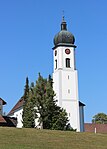
|
St. Michael | B | 47°27′54″N 9°12′28″E / 47.465006°N 9.207866°E | 8204 | ||
Niederhelfenschwil
| Location | Upload | Photo | Object | Cat. | Coordinates | KGS-Nr | |
|---|---|---|---|---|---|---|---|
| Niederhelfenschwil | 
|
Katholische Pfarrkirche St. Johannes Baptist | A | 47°28′34″N 9°11′14″E / 47.476117°N 9.187098°E | 8205 | ||
| Niederhelfenschwil | 
|
Kobesenmühle | B | 47°28′23″N 9°11′41″E / 47.473194°N 9.194764°E | 14047 | ||
| Niederhelfenschwil | 
|
Schloss Zuckenriet | A | 47°29′19″N 9°09′49″E / 47.488677°N 9.163647°E | 8206 | ||
Oberbüren
| Location | Upload | Photo | Object | Cat. | Coordinates | KGS-Nr | |
|---|---|---|---|---|---|---|---|
| Oberbüren | 
|
Kloster St. Gallenberg | B | 47°27′39″N 9°09′24″E / 47.460964°N 9.156545°E | 8208 | ||
| Oberbüren | 
|
Archiv der Benediktinerinnen-Abtei St.Gallenberg | B | 47°27′39″N 9°09′23″E / 47.460968°N 9.156448°E | 9541 | ||
| Oberbüren | 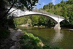
|
Billwil, Betonbrücke über die Thur (1904, Maillart) | B | 47°27′35″N 9°09′49″E / 47.459645°N 9.163728°E | 8207 | ||
| Oberbüren | 
|
Grosses Haus | B | 47°27′05″N 9°09′40″E / 47.45139°N 9.16103°E | 8209 | ||
Oberhelfenschwil
| Location | Upload | Photo | Object | Cat. | Coordinates | KGS-Nr | |
|---|---|---|---|---|---|---|---|
| Oberhelfenschwil | 
|
Kirche Oberhelfenschwil | B | 47°21′22″N 9°06′43″E / 47.356°N 9.11194°E | 8212 | ||
| Oberhelfenschwil | 
|
Burgruine Neu-Toggenburg | B | 47°19′47″N 9°06′46″E / 47.329677°N 9.112801°E | 8210 | ||
| Oberhelfenschwil | 
|
Burgruine Rüdberg | B | 47°20′59″N 9°05′18″E / 47.34973°N 9.088412°E | 8211 | ||
Oberriet
| Location | Upload | Photo | Object | Cat. | Coordinates | KGS-Nr | |
|---|---|---|---|---|---|---|---|
| Oberriet | 
|
Montlingerberg, prähistorische Höhensiedlung | A | 47°20′14″N 9°35′14″E / 47.337117°N 9.587123°E | 8213 | ||
| Oberriet | 
|
Ruine Wichenstein | A | 47°19′38″N 9°33′14″E / 47.327113°N 9.5539°E | 8215 | ||
| Oberriet | 
|
Burgruine Blatten | B | 47°18′29″N 9°33′53″E / 47.308011°N 9.564819°E | 8214 | ||
| Oberriet | 
|
Katholische Kirche St. Margaretha (1810) | B | 47°19′06″N 9°33′51″E / 47.318292°N 9.564253°E | 8216 | ||
| Oberriet | 
|
Kobelwald, katholische Kirche St. Sebastian | B | 47°19′08″N 9°32′51″E / 47.318891°N 9.547395°E | 14048 | ||
| Oberriet | 
|
Montlingen, katholische Kirche St. Johannes der Täufer | B | 47°20′05″N 9°35′26″E / 47.334805°N 9.590471°E | 8217 | ||
| Oberriet | 
|
Rothus (Gemeindemuseum) | B | 47°19′31″N 9°34′06″E / 47.325261°N 9.568238°E | 8218 | ||
| Oberriet | 
|
Zehntenhaus zur Burg (1539) | B | 47°19′00″N 9°33′50″E / 47.316755°N 9.56377°E | 8219 | ||
Oberuzwil
| Location | Upload | Photo | Object | Cat. | Coordinates | KGS-Nr | |
|---|---|---|---|---|---|---|---|
| Oberuzwil | 
|
Reformierte Kirche Oberuzwil | B | 47°25′52″N 9°07′14″E / 47.4312°N 9.1206°E | 8221 | ||
| Oberuzwil | 
|
Bürgerheim Bisacht | B | 47°24′54″N 9°07′04″E / 47.415071°N 9.117698°E | 8220 | ||
| Oberuzwil | Katholische Kirche St. Gallus | Katholische Kirche St. Gallus | B | 47°25′47″N 9°07′39″E / 47.429773°N 9.127482°E | 14049 | ||
| Oberuzwil | 
|
Niederglatt | ISOS | 47°25′44″N 9°10′52″E / 47.4288°N 9.1811°E | |||
Pfäfers
| Location | Upload | Photo | Object | Cat. | Coordinates | KGS-Nr | |
|---|---|---|---|---|---|---|---|
| Pfäfers | 
|
Burg Wartenstein (Pfäfers) | A | 46°59′39″N 9°30′39″E / 46.9943°N 9.51079°E | 8225 | ||
| Pfäfers | 
|
Altes Bad mit Kapelle | A | 46°58′26″N 9°29′17″E / 46.973803°N 9.487957°E | 8222 | ||
| Pfäfers | 
|
Vättis, Drachenloch, paläolithische Wohnhöhle | A | 46°55′32″N 9°24′51″E / 46.925593°N 9.414103°E | 8224 | ||
| Pfäfers | 
|
Kapelle St. Georg (um 1430, 1713) | B | 46°59′35″N 9°30′37″E / 46.993179°N 9.510357°E | 8226 | ||
| Pfäfers | 
|
St. Margrethenberg, Kapelle St. Margaretha 1705 und äbtisches Wohnhaus | B | 46°58′07″N 9°30′47″E / 46.968609°N 9.513063°E | 8227 | ||
| Pfäfers | 
|
Valens, katholische Kirche St. Philipp und Jakob | B | 46°58′07″N 9°28′50″E / 46.968607°N 9.480621°E | 8229 | ||
| Pfäfers | 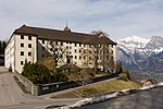
|
Kloster Pfäfers | A | 46°59′26″N 9°30′07″E / 46.990556°N 9.502083°E | 8223 | ||
| Pfäfers | 
|
Vättis | ISOS | 46°58′59″N 9°29′59″E / 46.983055555°N 9.499722222°E | |||
Quarten
| Location | Upload | Photo | Object | Cat. | Coordinates | KGS-Nr | |
|---|---|---|---|---|---|---|---|
| Quarten | 
|
Unterterzen, Kornmühle | B | 47°06′41″N 9°14′50″E / 47.11136°N 9.247121°E | 8231 | ||
Rapperswil-Jona
| Location | Upload | Photo | Object | Cat. | Coordinates | KGS-Nr | |
|---|---|---|---|---|---|---|---|
| Rapperswil-Jona | 
|
Kirche St. Martin Busskirch | B | 47°13′01″N 8°50′01″E / 47.217°N 8.83353°E | 8160 | ||
| Rapperswil-Jona | 
|
Schloss Rapperswil | A | 47°13′36″N 8°49′06″E / 47.226666666°N 8.818333333°E | 8234 | ||
| Rapperswil-Jona | 
|
Kloster Mariazell-Wurmsbach | B+ISOS | 47°13′12″N 8°51′54″E / 47.22°N 8.865°E | 8166 | ||
| Rapperswil-Jona | 
|
Altes Zeughaus (Rapperswil) | B | 47°13′40″N 8°49′36″E / 47.227777777°N 8.826666666°E | 10146 | ||
| Rapperswil-Jona | 
|
Schloss Meienberg | B | 47°14′06″N 8°49′49″E / 47.2351°N 8.8304°E | 8163 | ||
| Rapperswil-Jona | 
|
Villa Grünfels | B | 47°13′52″N 8°50′03″E / 47.2312°N 8.83412°E | 8165 | ||
| Rapperswil-Jona | 
|
Spinnerei Brändlin | B | 47°14′06″N 8°50′17″E / 47.235136°N 8.838008°E | 9294 | ||
| Rapperswil-Jona | 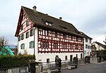
|
Pfrundhäuser (Rapperswil) | B | 47°13′39″N 8°49′02″E / 47.2275°N 8.81713°E | 8243 | ||
| Rapperswil-Jona | 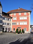
|
Haus zum Alten Sternen | B | 47°13′42″N 8°49′09″E / 47.2283°N 8.81921°E | 8235 | ||
| Rapperswil-Jona | 
|
Curti-Haus | B | 47°13′35″N 8°48′49″E / 47.2264°N 8.81374°E | 8245 | ||
| Rapperswil-Jona | 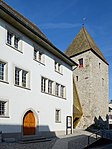
|
Breny-Haus und Breny-Turm | B | 47°13′42″N 8°49′07″E / 47.2283°N 8.81851°E | 8237 | ||
| Rapperswil-Jona | 
|
Römischer Gutshof Salet | B | 47°13′39″N 8°53′39″E / 47.2276°N 8.89407°E | 8162 | ||
| Rapperswil-Jona | 
|
Hochschule für Technik Rapperswil | B | 47°13′23″N 8°48′59″E / 47.223054°N 8.816405°E | 8239 | ||
| Rapperswil-Jona | [[File:|150x150px|Holzbrücke Rapperswil–Hurden]] | Holzbrücke Rapperswil–Hurden | A | 47°13′14″N 8°48′43″E / 47.220558333°N 8.811883333°E | 9669 | ||
| Rapperswil-Jona | 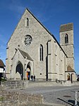
|
Stadtpfarrkirche St. Johann | B | 47°13′39″N 8°48′59″E / 47.2274°N 8.81642°E | 8240 | ||
| Rapperswil-Jona | 
|
Rathaus | A | 47°13′35″N 8°48′59″E / 47.2263°N 8.81638°E | 8233 | ||
| Rapperswil-Jona | 
|
Kirche St. Dionys-Wurmsbach | A+ISOS | 47°13′38″N 8°51′42″E / 47.227327777°N 8.861666666°E | 8158 | ||
| Rapperswil-Jona | 
|
Stadtmuseum Rapperswil-Jona | B | 47°13′41″N 8°49′04″E / 47.22794°N 8.81768°E | 11600 | ||
| Rapperswil-Jona | 
|
Archiv für Schweizer Landschaftsarchitektur | B | 47°13′23″N 8°48′59″E / 47.223°N 8.81632°E | 8945 | ||
| Rapperswil-Jona | 
|
Stadtarchiv Rapperswil-Jona | B | 47°13′35″N 8°48′59″E / 47.2263°N 8.81638°E | 10588 | ||
| Rapperswil-Jona | 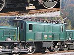
|
SBB-Elektrolokomotive Nr. 13 302, sog. Krokodil (1 Be 6/8 III), (Serie 1921-1927) (Siehe Horgen, ZH: B 7507) | B | 47°13′35″N 8°49′32″E / 47.226523°N 8.825633°E | 14791 | ||
| Rapperswil-Jona | 
|
Kloster Rapperswil | B | 47°13′36″N 8°49′06″E / 47.2267°N 8.81833°E | 8241 | ||
| Rapperswil-Jona | 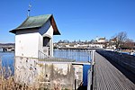
|
Heilig Hüsli | B | 62°00′00″N 8°48′54″E / 47222°N 8.81488°E | 8238 | ||
| Rapperswil-Jona | 
|
Rapperswil | ISOS | 47°13′35″N 8°49′06″E / 47.226388888°N 8.818333333°E | |||
| Rapperswil-Jona | 
|
Polenmuseum | A | 47°13′36″N 8°49′06″E / 47.226666666°N 8.818333333°E | 8573 | ||
| Rapperswil-Jona | 
|
Centum Prata | A | 47°14′19″N 8°48′59″E / 47.238641666°N 8.816358333°E | 8242 | ||
| Rapperswil-Jona | [[File:|150x150px|Rapperswil-Jona-Technikum]] | Rapperswil-Jona-Technikum | A+UNESCO | 47°13′19″N 8°48′54″E / 47.222°N 8.81489°E | 9652 | ||
Rebstein
| Location | Upload | Photo | Object | Cat. | Coordinates | KGS-Nr | |
|---|---|---|---|---|---|---|---|
| Rebstein | 
|
Burg | B | 47°23′55″N 9°34′52″E / 47.3985°N 9.5811°E | 14050 | ||
| Rebstein | 
|
Katholische Kirche St. Sebastian (1960, Metzger) | B | 47°23′54″N 9°34′51″E / 47.39833°N 9.580714°E | 8246 | ||
| Rebstein | 
|
Reformierte Kirche (1782) | B | 47°23′58″N 9°35′03″E / 47.399581°N 9.584077°E | 8247 | ||
Rheineck
| Location | Upload | Photo | Object | Cat. | Coordinates | KGS-Nr | |
|---|---|---|---|---|---|---|---|
| Rheineck | 
|
Evangelische Kirche Rheineck | B | 47°27′56″N 9°35′19″E / 47.4655°N 9.58862°E | 8253 | ||
| Rheineck | 
|
Löwenhof | A | 47°28′05″N 9°35′12″E / 47.467941°N 9.586675°E | 8248 | ||
| Rheineck | 
|
Altes Amtshaus | B | 47°27′59″N 9°35′23″E / 47.466399°N 9.589784°E | 8250 | ||
| Rheineck | 
|
Burgruine Alt-Rheineck (12. Jh.) | B | 47°27′51″N 9°35′08″E / 47.464192°N 9.585555°E | 8249 | ||
| Rheineck | 
|
Katholische Kirche St. Theresia (1933) | B | 47°28′07″N 9°34′28″E / 47.468671°N 9.574457°E | 8251 | ||
| Rheineck | 
|
Klingelburg (17. Jh.) | B | 47°27′51″N 9°34′36″E / 47.464034°N 9.576592°E | 8252 | ||
| Rheineck | 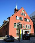
|
Rathaus (1555) mit Archiv | B | 47°27′59″N 9°35′26″E / 47.466387°N 9.590446°E | 8254 | ||
| Rheineck | 
|
Seidengazefabrik, Verwaltungsgebäude (Dufour-Schloss) und Appreturgebäude (1903) | B | 47°28′03″N 9°34′31″E / 47.467423°N 9.575296°E | 8255 | ||
| Rheineck | 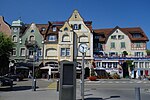
|
Rheineck | ISOS | 47°28′12″N 9°35′00″E / 47.47005°N 9.5834°E | |||
Rorschach
Rorschacherberg
| Location | Upload | Photo | Object | Cat. | Coordinates | KGS-Nr | |
|---|---|---|---|---|---|---|---|
| Rorschacherberg | 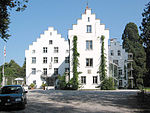
|
Schloss Wartegg | B | 47°28′43″N 9°31′48″E / 47.4785°N 9.53004°E | 8266 | ||
| Rorschacherberg | 
|
Schloss Wartensee | B | 47°28′18″N 9°31′52″E / 47.4717°N 9.53104°E | 8267 | ||
| Rorschacherberg | 
|
Loretokapelle Wilen-Wartegg mit Kaplanei | B | 47°28′38″N 9°31′39″E / 47.477309°N 9.527638°E | 14054 | ||
| Rorschacherberg | 
|
St. Annaschloss (13. und 16. Jh.) | B | 47°27′52″N 9°29′42″E / 47.464308°N 9.495006°E | 8268 | ||
| Rorschacherberg | 
|
Zentralfriedhof | B | 47°28′13″N 9°29′59″E / 47.470341°N 9.499751°E | 14055 | ||
| Rorschacherberg | 
|
Schlosslandschaft Rorschacherberg | ISOS | 47°28′14″N 9°30′58″E / 47.47064°N 9.51613°E | |||
Rüthi
| Location | Upload | Photo | Object | Cat. | Coordinates | KGS-Nr | |
|---|---|---|---|---|---|---|---|
| Rüthi | 
|
Katholische Kirche St. Valentin (1734) mit Pfarrhaus | B | 47°17′13″N 9°32′19″E / 47.286847°N 9.538684°E | 8269 | ||
| Rüthi | 
|
Rüthi | ISOS | 47°17′45″N 9°32′14″E / 47.2958°N 9.5373°E | |||
Sargans
| Location | Upload | Photo | Object | Cat. | Coordinates | KGS-Nr | |
|---|---|---|---|---|---|---|---|
| Sargans | 
|
Schloss Sargans | A | 47°03′00″N 9°26′15″E / 47.05°N 9.4375°E | 8270 | ||
| Sargans | 
|
Marienkapelle | B | 47°03′31″N 9°27′09″E / 47.0585°N 9.45243°E | 8276 | ||
| Sargans | Gonzen Bergwerke: Minen, Ruinen und Schotterwerk | Gonzen Bergwerke: Minen, Ruinen und Schotterwerk | A | 47°03′27″N 9°27′05″E / 47.057576°N 9.451358°E | 8272 | ||
| Sargans | 
|
Hof Ratell mit Kapelle | B | 47°03′19″N 9°26′42″E / 47.055157°N 9.445118°E | 14056 | ||
| Sargans | 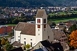
|
Katholische Kirche St. Oswald und Cassian (1709) | B | 47°03′01″N 9°26′06″E / 47.050393°N 9.435027°E | 8273 | ||
| Sargans | 
|
Malerva, römische Villa (Museum) | B | 47°03′09″N 9°26′41″E / 47.052566°N 9.444587°E | 8274 | ||
| Sargans | 
|
Splee-Kapelle St. Sebastian (1502, 18. Jh.) | B | 47°02′56″N 9°26′22″E / 47.048784°N 9.439574°E | 8275 | ||
| Sargans | 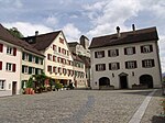
|
Sargans | ISOS | 47°02′53″N 9°26′23″E / 47.0481°N 9.4398°E | |||
Schänis
| Location | Upload | Photo | Object | Cat. | Coordinates | KGS-Nr | |
|---|---|---|---|---|---|---|---|
| Schänis | 
|
Burg Niederwindegg | B | 47°08′40″N 9°03′11″E / 47.1444°N 9.05306°E | 8280 | ||
| Schänis | 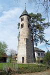
|
Gallusturm (Schänis) | A | 47°09′40″N 9°02′48″E / 47.1612°N 9.04674°E | 8278 | ||
| Schänis | 
|
Kloster Schänis | A | 47°09′36″N 9°02′42″E / 47.159872222°N 9.045080555°E | 8282 | ||
| Schänis | 
|
Gasterholz, eisenzeitliche Höhensiedlung | B | 47°11′50″N 9°02′34″E / 47.197164°N 9.042787°E | 8281 | ||
| Schänis | 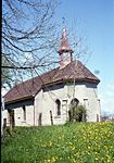
|
Kapelle St. Sebastian in den Eichen | B | 47°09′03″N 9°02′46″E / 47.150731°N 9.046064°E | 14057 | ||
| Schänis | 
|
Letzi | B | 47°11′39″N 9°02′47″E / 47.194236°N 9.046263°E | 8283 | ||
| Schänis | 
|
Maseltrangen, katholische Kirche St. Johannes Nepomuk | B | 47°11′25″N 9°03′06″E / 47.190239°N 9.051606°E | 14058 | ||
| Schänis | 
|
Maseltrangen | ISOS | 47°11′20″N 9°03′44″E / 47.1888°N 9.0621°E | |||
| Schänis | 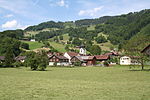
|
Schänis | ISOS | 47°09′32″N 9°02′48″E / 47.1588°N 9.0466°E | |||
| Schänis | 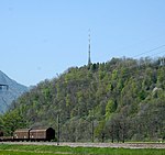
|
Biberlichopf | A | 47°07′57″N 9°04′06″E / 47.132488888°N 9.068361111°E | 8277 | ||
Schmerikon
| Location | Upload | Photo | Object | Cat. | Coordinates | KGS-Nr | |
|---|---|---|---|---|---|---|---|
| Schmerikon | 
|
Haus zum Hirzen (um 1620, sog. Schlössli) | B | 47°13′33″N 8°56′38″E / 47.225759°N 8.943806°E | 8285 | ||
| Schmerikon | 
|
Katholische Kirche St. Jost (1906, Turm 1500) | B | 47°13′36″N 8°56′27″E / 47.226787°N 8.940929°E | 8286 | ||
| Schmerikon | 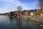
|
Schmerikon | ISOS | 47°13′31″N 8°57′00″E / 47.225277777°N 8.95°E | |||
Schwyz
| Location | Upload | Photo | Object | Cat. | Coordinates | KGS-Nr | |
|---|---|---|---|---|---|---|---|
| Schwyz | [[File:|150x150px|Holzbrücke Rapperswil–Hurden]] | Holzbrücke Rapperswil–Hurden | A | 47°13′14″N 8°48′43″E / 47.220558333°N 8.811883333°E | 9669 | ||
Sennwald
| Location | Upload | Photo | Object | Cat. | Coordinates | KGS-Nr | |
|---|---|---|---|---|---|---|---|
| Sennwald | Burg Forstegg | B | 47°14′44″N 9°29′45″E / 47.2456°N 9.49583°E | 8287 | |||
| Sennwald | 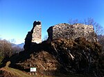
|
Burg Hohensax | B | 47°13′49″N 9°26′37″E / 47.2303°N 9.44361°E | 8288 | ||
| Sennwald | 
|
Sax, Reformierte Kirche (um 1500) | B | 47°13′56″N 9°27′33″E / 47.232086°N 9.459253°E | 8290 | ||
| Sennwald | 
|
Sennwald, In Bächen, Hammerschmiede (19. Jh.) | B | 47°15′24″N 9°30′05″E / 47.256532°N 9.501412°E | 8291 | ||
| Sennwald | 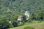
|
Sennwald, reformierte Kirche | B | 47°15′56″N 9°30′29″E / 47.265593°N 9.507948°E | 14059 | ||
Sevelen
| Location | Upload | Photo | Object | Cat. | Coordinates | KGS-Nr | |
|---|---|---|---|---|---|---|---|
| Sevelen | 
|
Reformierte Kirche Sevelen | B | 47°07′17″N 9°29′09″E / 47.1214°N 9.48576°E | 8293 | ||
| Sevelen | 
|
Alte Rheinbrücke Vaduz–Sevelen | B | 47°07′57″N 9°30′43″E / 47.132532°N 9.511928°E | 8292 | ||
St. Margrethen
| Location | Upload | Photo | Object | Cat. | Coordinates | KGS-Nr | |
|---|---|---|---|---|---|---|---|
| St. Margrethen | 
|
Alte Kirche St. Margaretha | A | 47°27′20″N 9°37′18″E / 47.455571°N 9.621688°E | 8358 | ||
| St. Margrethen | 
|
Brüggershof | B | 47°27′45″N 9°35′35″E / 47.462613°N 9.593067°E | 14075 | ||
| St. Margrethen | 
|
Burgruine Grimmenstein (13. Jh.) | B | 47°27′10″N 9°36′46″E / 47.452795°N 9.612886°E | 8359 | ||
| St. Margrethen | 
|
Katholische Kirche St. Margaretha (1910) am Rosenberg | B | 47°27′02″N 9°37′51″E / 47.450622°N 9.630757°E | 8360 | ||
| St. Margrethen | 
|
Schlösschen Bergsteig | B | 47°26′58″N 9°37′42″E / 47.44939°N 9.628359°E | 14076 | ||
| St. Margrethen | 
|
Wasenhof | B | 47°27′16″N 9°37′18″E / 47.454518°N 9.621725°E | 14074 | ||
Steinach
| Location | Upload | Photo | Object | Cat. | Coordinates | KGS-Nr | |
|---|---|---|---|---|---|---|---|
| Steinach | 
|
Steinerburg | B | 47°29′07″N 9°25′41″E / 47.485361111°N 9.428127777°E | 8365 | ||
| Steinach | 
|
Gredhaus (1473, 1560, ehemaliges Kornhaus) | B | 47°30′17″N 9°26′33″E / 47.504725°N 9.44253°E | 8366 | ||
| Steinach | 
|
Katholische Kirche St. Jakobus d. Ae. und Andreas (1745, 1770) | B | 47°30′09″N 9°26′25″E / 47.502604°N 9.440326°E | 8367 | ||
| Steinach | 
|
Lanterhaus | B | 47°30′17″N 9°26′25″E / 47.504781°N 9.440354°E | 14077 | ||
Thal
Tübach
| Location | Upload | Photo | Object | Cat. | Coordinates | KGS-Nr | |
|---|---|---|---|---|---|---|---|
| Tübach | 
|
Kapuzinerinnenkloster St. Scholastika | A+ISOS | 47°28′51″N 9°27′13″E / 47.480969°N 9.453619°E | 8373 | ||
| Tübach | 
|
Kirche Mariahilf (1746, Turm 1768) | B | 47°29′05″N 9°27′13″E / 47.48471°N 9.453734°E | 8374 | ||
| Tübach | 
|
Villa Waldegg | B | 47°28′44″N 9°27′18″E / 47.478869°N 9.454906°E | 14083 | ||
Untereggen
| Location | Upload | Photo | Object | Cat. | Coordinates | KGS-Nr | |
|---|---|---|---|---|---|---|---|
| Untereggen | 
|
Schloss Sulzberg | B+ISOS | 47°27′50″N 9°27′58″E / 47.4639°N 9.46611°E | 8376 | ||
| Untereggen | 
|
Katholische Kirche St. Maria Magdalena (1784) | B | 47°27′18″N 9°27′09″E / 47.455067°N 9.452599°E | 8375 | ||
Uznach
| Location | Upload | Photo | Object | Cat. | Coordinates | KGS-Nr | |
|---|---|---|---|---|---|---|---|
| Uznach | 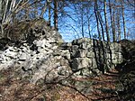
|
Ruine Uznaberg | B | 47°14′01″N 8°57′46″E / 47.2336°N 8.96278°E | 8377 | ||
| Uznach | 
|
Ehemalige Seidenweberei Schubiger | B | 47°13′27″N 8°59′09″E / 47.224151°N 8.985755°E | 14086 | ||
| Uznach | 
|
Ehemalige Spinnerei Uznaberg | B | 47°13′49″N 8°57′56″E / 47.230313°N 8.965607°E | 14085 | ||
| Uznach | [[File:|150x150px|Katholische Friedhofkirche Hl. Kreuz mit Kapelle (um 1500)]] | Katholische Friedhofkirche Hl. Kreuz mit Kapelle (um 1500) | B | 47°13′39″N 8°58′42″E / 47.22738°N 8.97831°E | 8378 | ||
| Uznach | 
|
Tröckneturm Rotfarb | B | 47°13′11″N 8°59′51″E / 47.219719°N 8.997511°E | 14084 | ||
| Uznach | 
|
Uznaberg, Kapelle St. Joseph (1679, 1709) | B | 47°13′50″N 8°58′05″E / 47.230425°N 8.967988°E | 8380 | ||
| Uznach | 
|
Wirtschaft zum Hof (um 1730) | B | 47°13′41″N 8°58′38″E / 47.228036°N 8.977098°E | 8381 | ||
Uzwil
| Location | Upload | Photo | Object | Cat. | Coordinates | KGS-Nr | |
|---|---|---|---|---|---|---|---|
| Uzwil | 
|
Villa Waldbühl | A | 47°26′43″N 9°07′48″E / 47.4453°N 9.12999°E | 8382 | ||
| Uzwil | 
|
Hauser & Wirth Collection Henau | A | 47°27′45″N 9°07′13″E / 47.462543°N 9.120297°E | 8518 | ||
| Uzwil | 
|
Henau, Turm der Kirche Mariä Himmelfahrt (15. Jh.) | B | 47°27′07″N 9°07′10″E / 47.452002°N 9.11946°E | 8383 | ||
| Uzwil | 
|
Katholische Kirche Christkönig | B | 47°26′41″N 9°08′32″E / 47.444697°N 9.142251°E | 14087 | ||
Vaduz
| Location | Upload | Photo | Object | Cat. | Coordinates | KGS-Nr | |
|---|---|---|---|---|---|---|---|
| Vaduz | 
|
Alte Rheinbrücke Vaduz–Sevelen | B | 47°07′57″N 9°30′43″E / 47.132532°N 9.511928°E | 8292 | ||
Vilters-Wangs
| Location | Upload | Photo | Object | Cat. | Coordinates | KGS-Nr | |
|---|---|---|---|---|---|---|---|
| Vilters-Wangs | 
|
Alte Mühle | B | 47°01′25″N 9°26′51″E / 47.023478°N 9.447525°E | 14088 | ||
| Vilters-Wangs | 
|
Katholische Kirche St. Medardus (1787) mit Friedhofkapelle | B | 47°01′23″N 9°26′54″E / 47.023121°N 9.448367°E | 8384 | ||
| Vilters-Wangs | 
|
Severgall, prähistorische Höhensiedlung | B | 47°01′06″N 9°27′47″E / 47.018229°N 9.463038°E | 8385 | ||
Wahlkreis Sarganserland
| Location | Upload | Photo | Object | Cat. | Coordinates | KGS-Nr | |
|---|---|---|---|---|---|---|---|
| Wahlkreis Sarganserland | 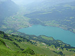
|
Walenstadt | ISOS | 47°07′24″N 9°18′54″E / 47.1234°N 9.315°E | |||
Wahlkreis St. Gallen
| Location | Upload | Photo | Object | Cat. | Coordinates | KGS-Nr | |
|---|---|---|---|---|---|---|---|
| Wahlkreis St. Gallen | 
|
St. Gallen | ISOS | 47°25′24″N 9°22′38″E / 47.423333333°N 9.377222222°E | |||
Wahlkreis Wil
| Location | Upload | Photo | Object | Cat. | Coordinates | KGS-Nr | |
|---|---|---|---|---|---|---|---|
| Wahlkreis Wil | 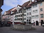
|
Wil | ISOS | 47°27′59″N 9°02′59″E / 47.466388888°N 9.049722222°E | |||
Waldkirch
| Location | Upload | Photo | Object | Cat. | Coordinates | KGS-Nr | |
|---|---|---|---|---|---|---|---|
| Waldkirch | 
|
St. Johannes Baptist Kirche | A | 47°28′26″N 9°20′11″E / 47.473855°N 9.336405°E | 8386 | ||
| Waldkirch | 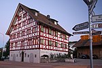
|
Gasthaus Kreuz (1688) | B | 47°28′07″N 9°17′07″E / 47.468476°N 9.285199°E | 8387 | ||
| Waldkirch | 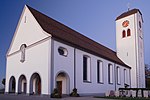
|
Katholische Kirche St. Blasius (1722) | B | 47°28′10″N 9°17′06″E / 47.469468°N 9.285034°E | 8388 | ||
| Waldkirch | Wannenbrücke | Wannenbrücke | B | 47°28′33″N 9°21′04″E / 47.475861°N 9.351206°E | 8389 | ||
| Waldkirch | Wannenbrücke | Wannenbrücke | B | 47°28′33″N 9°21′04″E / 47.475861°N 9.351206°E | 8428 | ||
Walenstadt
| Location | Upload | Photo | Object | Cat. | Coordinates | KGS-Nr | |
|---|---|---|---|---|---|---|---|
| Walenstadt | 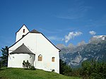
|
St.-Georgs-Kapelle | A | 47°06′06″N 9°21′04″E / 47.1018°N 9.35111°E | 9655 | ||
| Walenstadt | 
|
Kapelle St. Wolfgang (um 1745) | B | 47°07′30″N 9°18′56″E / 47.124967°N 9.315418°E | 8392 | ||
| Walenstadt | 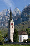
|
Katholische Kirche St. Luzius und Florinus (um 1700, Chor 1882) | B | 47°07′29″N 9°19′03″E / 47.124626°N 9.317568°E | 8391 | ||
| Walenstadt | 
|
Paxmal | B | 47°08′31″N 9°16′13″E / 47.14199°N 9.270244°E | 8393 | ||
| Walenstadt | 
|
Stadtbungert (mittelalterliche Allmend mit Ringmauern) | B | 47°07′31″N 9°18′49″E / 47.125142°N 9.313499°E | 8394 | ||
| Walenstadt | 
|
Tscherlach, Kapelle St. Johannes Ev. (1641) | B | 47°07′06″N 9°20′00″E / 47.118427°N 9.333431°E | 8395 | ||
Wartau
| Location | Upload | Photo | Object | Cat. | Coordinates | KGS-Nr | |
|---|---|---|---|---|---|---|---|
| Wartau | 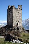
|
Burg Wartau | B | 47°05′55″N 9°29′26″E / 47.0987°N 9.49062°E | 8400 | ||
| Wartau | 
|
Oberschan | ISOS | 47°05′57″N 9°28′31″E / 47.09929°N 9.47517°E | |||
| Wartau | 
|
Gretschins-Herrenfeld / Ochsenberg, prähistorische Siedlung / Opferplatz / mittelalterliche Burg, Ruine | A | 47°05′54″N 9°29′26″E / 47.098455°N 9.490448°E | 8396 | ||
| Wartau | 
|
Sogenanntes Walser Rathaus auf Palfries | A | 47°05′48″N 9°24′04″E / 47.096759°N 9.401101°E | 8397 | ||
| Wartau | 
|
Burgstelle (13. Jh.), Brocha Burg | B | 47°06′13″N 9°29′26″E / 47.10367°N 9.490648°E | 8401 | ||
| Wartau | 
|
Gretschins, reformierte Kirche St. Martin | B | 47°05′50″N 9°29′10″E / 47.097307°N 9.486201°E | 14089 | ||
| Wartau | 
|
Oberschan, Moos, mesolithische Station | B | 47°06′43″N 9°27′45″E / 47.111816°N 9.462623°E | 8398 | ||
| Wartau | 
|
Rathaus Azmoos | B | 47°04′48″N 9°28′36″E / 47.079938°N 9.476764°E | 14090 | ||
| Wartau | 
|
Fontnas | ISOS | 47°05′27″N 9°29′55″E / 47.0909°N 9.4985°E | |||
| Wartau | 
|
Gretschins | ISOS | 47°05′54″N 9°29′50″E / 47.0983°N 9.4973°E | |||
| Wartau | 
|
Azmoos | ISOS | 47°04′55″N 9°28′33″E / 47.082°N 9.47579°E | |||
Wattwil
Weesen
| Location | Upload | Photo | Object | Cat. | Coordinates | KGS-Nr | |
|---|---|---|---|---|---|---|---|
| Weesen | 
|
Zwinglikirche (Weesen) | B | 47°08′03″N 9°05′37″E / 47.1343°N 9.09363°E | 14096 | ||
| Weesen | 
|
Altweesen, spätrömisches Kastell / mittelalterliche Wüstung | A | 47°07′58″N 9°05′34″E / 47.132715°N 9.092667°E | 9656 | ||
| Weesen | 
|
Dominikanerinnenkloster Maria Zuflucht (Ende 17. Jh.) mit Klosterarchiv | B | 47°08′07″N 9°05′47″E / 47.135405°N 9.096442°E | 8408 | ||
| Weesen | 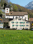
|
Katholische Bühlkirche Hl. Kreuz (Ortsgemeindearchiv), mit Kaplanei | B | 47°08′03″N 9°05′39″E / 47.134178°N 9.094163°E | 8409 | ||
| Weesen | 
|
Villa Kurfürst | B | 47°08′01″N 9°05′44″E / 47.133539°N 9.095461°E | 14095 | ||
| Weesen | 
|
Weesen | ISOS | 47°07′59″N 9°06′00″E / 47.133055555°N 9.1°E | |||
Widnau
| Location | Upload | Photo | Object | Cat. | Coordinates | KGS-Nr | |
|---|---|---|---|---|---|---|---|
| Widnau | 
|
Katholische Kirche St. Joseph (1903) | B | 47°24′15″N 9°38′22″E / 47.404156°N 9.639394°E | 8411 | ||
Wil
Wildhaus-Alt St. Johann
| Location | Upload | Photo | Object | Cat. | Coordinates | KGS-Nr | |
|---|---|---|---|---|---|---|---|
| Wildhaus-Alt St. Johann | 
|
Zwinglis Geburtshaus | A | 47°12′04″N 9°20′24″E / 47.201°N 9.34002°E | 8422 | ||
| Wildhaus-Alt St. Johann | 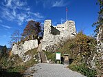
|
Wildenburg | B | 47°12′19″N 9°21′36″E / 47.2053°N 9.36°E | 8423 | ||
| Wildhaus-Alt St. Johann | 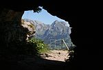
|
Wildenmannlisloch | A | 47°10′04″N 9°15′19″E / 47.167777777°N 9.255277777°E | 8071 | ||
| Wildhaus-Alt St. Johann | 
|
Katholische Kirche St. Bartholomäus (1776) | B | 47°12′16″N 9°21′05″E / 47.204324°N 9.351527°E | 8424 | ||
| Wildhaus-Alt St. Johann | 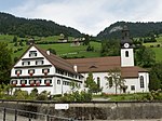
|
Propstei / ehemaliges Benediktinerkloster | B | 47°11′41″N 9°17′07″E / 47.194644°N 9.285313°E | 8072 | ||
Wittenbach
| Location | Upload | Photo | Object | Cat. | Coordinates | KGS-Nr | |
|---|---|---|---|---|---|---|---|
| Wittenbach | 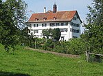
|
Schloss Dottenwil | B | 47°28′38″N 9°22′36″E / 47.4772°N 9.3766°E | 14099 | ||
| Wittenbach | Wannenbrücke | Wannenbrücke | B | 47°28′33″N 9°21′04″E / 47.475861°N 9.351206°E | 8389 | ||
| Wittenbach | Wannenbrücke | Wannenbrücke | B | 47°28′33″N 9°21′04″E / 47.475861°N 9.351206°E | 8428 | ||
| Wittenbach | 
|
Ehemaliges Gasthaus Drei Eidgenossen | B | 47°28′13″N 9°22′22″E / 47.47014°N 9.372761°E | 14100 | ||
| Wittenbach | 
|
Haus Unterlöhren | B | 47°28′53″N 9°21′39″E / 47.481271°N 9.36077°E | 14101 | ||
| Wittenbach | 
|
Katholische Kirche St. Ulrich (1675, 1812) mit Kapelle St. Johannes Nepomuk (1758) | B | 47°27′49″N 9°22′44″E / 47.463522°N 9.379021°E | 8426 | ||
| Wittenbach | 
|
Schlössli Egg (1624) | B | 47°27′50″N 9°22′55″E / 47.46397°N 9.381824°E | 8427 | ||
| Wittenbach | 
|
Villa Martini | B | 47°27′14″N 9°23′49″E / 47.453924°N 9.397056°E | 14102 | ||
| Wittenbach | 
|
Kulturlandschaft Dottenwil/Zwingensteinhueb | ISOS | 47°28′29″N 9°23′12″E / 47.4747°N 9.3866°E | |||
| Wittenbach | 
|
Unterlören | ISOS | 47°28′49″N 9°22′15″E / 47.4804°N 9.3708°E | |||
Züberwangen
| Location | Upload | Photo | Object | Cat. | Coordinates | KGS-Nr | |
|---|---|---|---|---|---|---|---|
| Züberwangen | 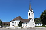
|
Kirche St. Maria Magdalena | B | 47°27′57″N 9°05′02″E / 47.465937°N 9.083789°E | 8431 | ||
Zuzwil
| Location | Upload | Photo | Object | Cat. | Coordinates | KGS-Nr | |
|---|---|---|---|---|---|---|---|
| Zuzwil | 
|
Ehemalige Bäckerei Zünd | B | 47°28′40″N 9°06′40″E / 47.477797°N 9.111199°E | 8430 | ||
| Zuzwil | 
|
Rotes Haus | B | 47°28′28″N 9°06′49″E / 47.474387°N 9.113732°E | 8429 | ||

