File:Africa-locator.jpg
No higher resolution available.
Africa-locator.jpg (209 × 219 pixels, file size: 35 KB, MIME type: image/jpeg)
Captions
Captions
Add a one-line explanation of what this file represents
Summary edit
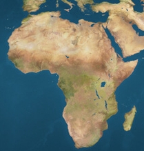
| Description | Africa locator map |
| Date | |
| Source | http://gw.marketingden.com/planets/images/earthmaps/earthmap1k.jpg |
| Author | jimht at shaw dot ca, modified by Obersachse |
| Permission (Reusing this file) |
http://gw.marketingden.com/planets/earth.html |
| Other versions | Image:Earthmap1000x500compac.jpg |
| I, the copyright holder of this work, release this work into the public domain. This applies worldwide. In some countries this may not be legally possible; if so: I grant anyone the right to use this work for any purpose, without any conditions, unless such conditions are required by law. |
Borders: top 43.2° N, buttom 36°S, left 21.6°W, right 54°E
File history
Click on a date/time to view the file as it appeared at that time.
| Date/Time | Thumbnail | Dimensions | User | Comment | |
|---|---|---|---|---|---|
| current | 20:16, 28 March 2008 | | 209 × 219 (35 KB) | Obersachse (talk | contribs) | == Description == {{Information| |Description = Africa locator map |Source = http://gw.marketingden.com/planets/images/earthmaps/earthmap1k.jpg |Date = 2008-03-28 |Author = jimht at shaw dot ca, '''modified by Obersachse''' |Permission |
You cannot overwrite this file.
File usage on Commons
More than 100 pages use this file. The following list shows the first 100 pages that use this file only. A full list is available.
- Template:AfricaMapsDecade
- Category:1470s establishments in Africa
- Category:14th-century maps of Africa
- Category:1500s establishments in Africa
- Category:1500s maps of Africa
- Category:1510s establishments in Africa
- Category:1510s maps of Africa
- Category:1520s maps of Africa
- Category:1530s maps of Africa
- Category:1540s maps of Africa
- Category:1550s establishments in Africa
- Category:1550s maps of Africa
- Category:1560s maps of Africa
- Category:1570s maps of Africa
- Category:1580s maps of Africa
- Category:1590s maps of Africa
- Category:15th-century maps of Africa
- Category:1600s maps of Africa
- Category:1610s establishments in Africa
- Category:1610s maps of Africa
- Category:1620s maps of Africa
- Category:1630s establishments in Africa
- Category:1630s maps of Africa
- Category:1640s establishments in Africa
- Category:1640s maps of Africa
- Category:1650s establishments in Africa
- Category:1650s maps of Africa
- Category:1660s establishments in Africa
- Category:1660s maps of Africa
- Category:1670s establishments in Africa
- Category:1670s maps of Africa
- Category:1680s establishments in Africa
- Category:1680s maps of Africa
- Category:1690s establishments in Africa
- Category:1690s maps of Africa
- Category:16th-century maps of Africa
- Category:1700s maps of Africa
- Category:1710s maps of Africa
- Category:1720s establishments in Africa
- Category:1720s maps of Africa
- Category:1730s establishments in Africa
- Category:1730s maps of Africa
- Category:1740s maps of Africa
- Category:1750s maps of Africa
- Category:1760s establishments in Africa
- Category:1760s maps of Africa
- Category:1770s maps of Africa
- Category:1780s establishments in Africa
- Category:1780s maps of Africa
- Category:1790s maps of Africa
- Category:17th-century maps of Africa
- Category:1800s maps of Africa
- Category:1810s maps of Africa
- Category:1820s maps of Africa
- Category:1830s establishments in Africa
- Category:1830s maps of Africa
- Category:1840s establishments in Africa
- Category:1840s maps of Africa
- Category:1850s establishments in Africa
- Category:1850s maps of Africa
- Category:1860s maps of Africa
- Category:1870s establishments in Africa
- Category:1870s maps of Africa
- Category:1880s establishments in Africa
- Category:1880s maps of Africa
- Category:1890s establishments in Africa
- Category:1890s maps of Africa
- Category:18th-century maps of Africa
- Category:1900s establishments in Africa
- Category:1900s maps of Africa
- Category:1910s establishments in Africa
- Category:1910s maps of Africa
- Category:1920s establishments in Africa
- Category:1920s maps of Africa
- Category:1930s establishments in Africa
- Category:1930s maps of Africa
- Category:1940s establishments in Africa
- Category:1940s maps of Africa
- Category:1950s establishments in Africa
- Category:1950s maps of Africa
- Category:1960s establishments in Africa
- Category:1960s maps of Africa
- Category:1970s establishments in Africa
- Category:1970s maps of Africa
- Category:1980s establishments in Africa
- Category:1980s maps of Africa
- Category:1990s establishments in Africa
- Category:1990s maps of Africa
- Category:19th-century maps of Africa
- Category:2000s establishments in Africa
- Category:2000s maps of Africa
- Category:2007 maps of Africa
- Category:2010s establishments in Africa
- Category:2010s maps of Africa
- Category:2013 maps of Africa
- Category:2014 maps of Africa
- Category:2015 maps of Africa
- Category:2016 maps of Africa
- Category:20th-century maps of Africa
- Category:21st-century maps of Africa
View more links to this file.
File usage on other wikis
The following other wikis use this file:
- Usage on am.wikipedia.org
- Usage on be-tarask.wikipedia.org
- Катэгорыя:Эрытрэя
- Катэгорыя:Краіны Афрыкі
- Катэгорыя:Афрыка
- Катэгорыя:Канарскі архіпэляг
- Катэгорыя:Каба-Вэрдэ
- Паўднёва-Афрыканская Рэспубліка
- Намібія
- Дэмакратычная Рэспубліка Конга
- Экватарыяльная Гвінэя
- Катэгорыя:Экватарыяльная Гвінэя
- Этыёпія
- Катэгорыя:Этыёпія
- Чад
- Цэнтральна-Афрыканская Рэспубліка
- Катэгорыя:Цэнтральна-Афрыканская Рэспубліка
- Уганда
- Туніс
- Катэгорыя:Мовы Афрыкі
- Катэгорыя:Ангола
- Альжыр
- Нігерыя
- Катэгорыя:Альжыр
- Катэгорыя:Туніс
- Катэгорыя:Нігерыя
- Катэгорыя:Кенія
- Катэгорыя:Намібія
- Катэгорыя:Дэмакратычная Рэспубліка Конга
- Катэгорыя:Паўднёва-Афрыканская рэспубліка
- Катэгорыя:Уганда
- Катэгорыя:Чад
- Батсвана
- Рэспубліка Конга
- Катэгорыя:Рэспубліка Конга
- Судан
- Катэгорыя:Судан
- Лібія
- Катэгорыя:Лібія
- Катэгорыя:Нігер
- Малі
- Катэгорыя:Малі
- Катэгорыя:Маўрытанія
- Катэгорыя:Танзанія
- Мазамбік
- Катэгорыя:Мазамбік
- Катэгорыя:Замбія
- Самалі
- Катэгорыя:Самалі
- Катэгорыя:Мадагаскар
- Камэрун
View more global usage of this file.