File:Place Clairefontaine Luxembourg 02.jpg

Size of this preview: 800 × 430 pixels. Other resolutions: 320 × 172 pixels | 640 × 344 pixels | 1,024 × 550 pixels | 1,280 × 688 pixels | 2,560 × 1,375 pixels | 3,983 × 2,140 pixels.
Original file (3,983 × 2,140 pixels, file size: 5.16 MB, MIME type: image/jpeg)
Captions
Captions
Add a one-line explanation of what this file represents
Summary
edit
| Description |
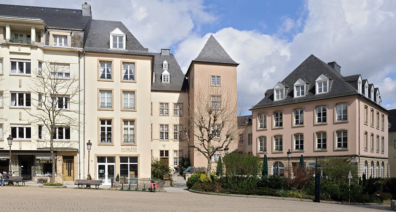
English: Luxembourg City: place de Clairefontaine, eastern end. The tower was part of the second forttress walls erected by Count Giselbert around 1050. Together with the neighbouring Maison Mohr-de-Waldt the tower had been listed as a cultural heritage monuments in 1981, but has been destroied during building works. The current one is a reconstruction.
Français : Luxembourg-ville, place de Clairefontaine, immeubles de la face est de la place. La tour faisait partie des seconds remparts de la forteresse érigés par le comte Giselbert vers 1050. La tour et la maison Mohr-de-Waldt y attenante avaient été classées monuments historiques en 1981, mais la tour fût détruite lors de travaux en profondeur. La tour actuelle est une reconstruction.
Lëtzebuergesch: Stad Lëtzebuerg, Clairefontaine-Plaz: Gebaier op der Säit am Osten zou. Den Tuerm (riets vun der Mëtt vum Bild) ass en Iwwerrescht vun der zweeter Festungsmauer, déi ëm 1050 ënner dem Grof Giselbert gebaut gouf. Den Tuerm an d'Maison Mohr-de-Waldt nieewendru goufen 1981 als Monument historique klasséiert, mee den Tuerm ass bei "Renovéierungs"aarbechten zerstéiert ginn, wat haut do steet ass en Neibau. |
| Date | |
| Source | Own work |
| Author | Cayambe |
| Camera location | | View this and other nearby images on: OpenStreetMap |
|---|
Licensing
edit
I, the copyright holder of this work, hereby publish it under the following licenses:
This file is licensed under the Creative Commons Attribution-Share Alike 3.0 Unported license.
- You are free:
- to share – to copy, distribute and transmit the work
- to remix – to adapt the work
- Under the following conditions:
- attribution – You must give appropriate credit, provide a link to the license, and indicate if changes were made. You may do so in any reasonable manner, but not in any way that suggests the licensor endorses you or your use.
- share alike – If you remix, transform, or build upon the material, you must distribute your contributions under the same or compatible license as the original.

|
Permission is granted to copy, distribute and/or modify this document under the terms of the GNU Free Documentation License, Version 1.2 or any later version published by the Free Software Foundation; with no Invariant Sections, no Front-Cover Texts, and no Back-Cover Texts. A copy of the license is included in the section entitled GNU Free Documentation License. |
You may select the license of your choice.
This image has been assessed using the Quality image guidelines and is considered a Quality image.
|
File history
Click on a date/time to view the file as it appeared at that time.
| Date/Time | Thumbnail | Dimensions | User | Comment | |
|---|---|---|---|---|---|
| current | 08:14, 5 April 2011 | | 3,983 × 2,140 (5.16 MB) | Cayambe (talk | contribs) | {{Information |Description ={{en|1=Luxembourg City: place de Clairefontaine, eastern end. The tower was part of the second ramparts of the fortress erected by Count Giselbert around 1050. Both the tower and the neighbouring Maison Mohr-de-Waldt are lis |
You cannot overwrite this file.
File usage on Commons
The following 6 pages use this file:
- User:Cayambe/Luxembourg/Luxembourg City
- User:Cayambe/Luxembourg/Luxembourg City/City Centre
- User talk:Cayambe/Archive2
- Commons:Quality images/Subject/Places/Man made structures/Buildings, Exterior/Part 1
- Commons:Quality images candidates/Archives April 2011
- Commons talk:Quality images/Subject/Places/Man made structures
File usage on other wikis
The following other wikis use this file:
- Usage on lb.wikipedia.org