Category:1550s maps of France
Countries of Europe: France‡ · Germany · Hungary · Italy · Lithuania · Netherlands‡ · Poland · Portugal‡ · Romania · Russia‡ · Slovakia · Spain‡ · Switzerland · Turkey‡ · Ukraine
‡: partly located in Europe
‡: partly located in Europe
Subcategories
This category has the following 3 subcategories, out of 3 total.
- 1558 maps of France (1 F)
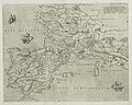
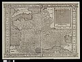
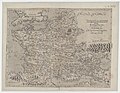
Media in category "1550s maps of France"
The following 14 files are in this category, out of 14 total.
-
 Geographiae Claudii Ptolemaei Alexandrini (Münster, 1552) 35.jpg 10,482 × 6,663; 6.84 MB
-
 1554 map of France and the Iberian Peninsula.jpg 11,818 × 9,452; 27.01 MB
-

-
 Bay of Biscay RMG F1416.tiff 6,496 × 5,483; 101.9 MB
-
 Houghton 51-2529 - Totius Galliae descriptio, 1558.jpg 2,389 × 1,800; 1.99 MB
-

-

-
-

-

-
-

-

-
_35.jpg)

.jpg)


_-_Orontius_F(ine)_delphinas_faciebat_1553_-_btv1b531953612.jpg)
_delphinas_faciebat_1553_-_btv1b72002306_(1_of_5).jpg)


._Sebastianus_a_Regibus_Clodiensis_incidebat_-_btv1b8492890b.jpg)