Category:1570s maps of France
Countries of Europe: Albania · Armenia‡ · Austria · Azerbaijan‡ · Belgium · Bosnia and Herzegovina · Croatia · Cyprus‡ · France‡ · Georgia‡ · Germany · Greece · Hungary · Italy · Latvia · Lithuania · Netherlands‡ · Poland · Portugal‡ · Romania · Russia‡ · Slovakia · Slovenia · Spain‡ · Turkey‡ · Ukraine
Limited recognition: Abkhazia‡
‡: partly located in Europe
Limited recognition: Abkhazia‡
‡: partly located in Europe
Former administrative regions of Metropolitan France (until end of 2015):
Alsace
Alsace
Subcategories
This category has the following 4 subcategories, out of 4 total.
- 1575 maps of France (2 F)
.
Media in category "1570s maps of France"
The following 14 files are in this category, out of 14 total.
-
 Map of France (1574).jpg 1,137 × 963; 319 KB
-
 Map of ancient France (1578).jpg 771 × 615; 137 KB
-

-
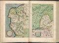 Atlas Ortelius KB PPN369376781-020av-020br.jpg 3,000 × 2,194; 4.26 MB
-

-

-
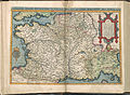 Atlas Ortelius KB PPN369376781-016av-016br.jpg 3,000 × 2,194; 4.73 MB
-
-
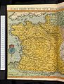
 Gallia Nuova Tavola (France).jpg 1,359 × 1,026; 321 KB
-
 1575-carte 'le vrai portait de la ville d'Orléans'.JPG 390 × 300; 27 KB
-
 Tabula Europae III (France) southeast.jpg 800 × 600; 135 KB
-
 Tabula Europae III (France).jpg 800 × 600; 143 KB
-

-

.jpg)
.jpg)


.jpg)
.jpg)


.jpg)

_southeast.jpg)
.jpg)

