Category:1570s maps of the Netherlands
Countries of Europe: Albania · Armenia‡ · Austria · Azerbaijan‡ · Belgium · Bosnia and Herzegovina · Croatia · Cyprus‡ · France‡ · Georgia‡ · Germany · Greece · Hungary · Italy · Latvia · Lithuania · Netherlands‡ · Poland · Portugal‡ · Romania · Russia‡ · Slovakia · Slovenia · Spain‡ · Turkey‡ · Ukraine
Limited recognition: Abkhazia‡
‡: partly located in Europe
Limited recognition: Abkhazia‡
‡: partly located in Europe
Media in category "1570s maps of the Netherlands"
The following 9 files are in this category, out of 9 total.
-
 Atlas Ortelius KB PPN369376781-026av-026br.jpg 3,000 × 2,194; 4.81 MB
-
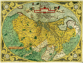 Descriptio Germaniae inferioris Nederlanden 1573.png 1,778 × 1,352; 7.32 MB
-
 Dollardkaart 1574 cartouche.jpg 524 × 376; 139 KB
-
 UBBasel Map 1578 Kartenslg AA 64.tif 11,976 × 9,838, 2 pages; 337.11 MB
-
 Map - Special Collections University of Amsterdam - OTM- HB-KZL 34.02.61.tif 6,384 × 4,571; 83.49 MB
-
 Zeventien provincien.png 1,500 × 1,143; 5.27 MB
-
 Descriptio Germaniae Inferioris Nederlanden Map by Abraham Ortelius 1573.jpg 6,817 × 5,153; 15.69 MB
-
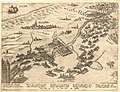
 Karte der Umgebung von Haarlem.jpg 3,000 × 1,808; 589 KB
-
 Print, map (BM 1870,1008.1233).jpg 2,500 × 1,910; 1.17 MB


.jpg)