Category:1560s maps of Portugal
Countries of Europe: Albania · Belgium · Bosnia and Herzegovina · Croatia · Cyprus‡ · Denmark · France‡ · Germany · Greece · Hungary · Italy · Latvia · Lithuania · Netherlands‡ · Norway · Poland · Portugal‡ · Romania · Russia‡ · Serbia · Slovenia · Spain‡ · Sweden · Turkey‡ · Ukraine
‡: partly located in Europe
‡: partly located in Europe
Subcategories
This category has only the following subcategory.
Media in category "1560s maps of Portugal"
The following 13 files are in this category, out of 13 total.
-

-
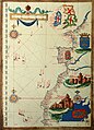
 1563 lazaro luis 04 atlantic nord.jpg 2,000 × 1,496; 1.03 MB
-
 Sebastião Lopes 1575.jpg 2,232 × 3,100; 4.32 MB
-

-

-

-

-
 Hispaniae descriptio - Dominicus Zenoi Venetus Restituit - btv1b550048450.jpg 6,962 × 5,559; 6.15 MB
-
 Hispaniae Descriptio de Domenico Zenoi (1560).jpg 15,678 × 12,175; 28.6 MB
-
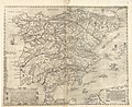 Mapa de Paulo di Forlani (1560).jpg 5,668 × 4,652; 5.52 MB
-
 Mercator 1569 world map detail Spain.jpg 428 × 427; 89 KB
-
 Península Ibérica no portolano de Giacomo Maggiolo (1563).jpg 2,544 × 1,935; 2.88 MB
-


.jpg)
.jpg)

.jpg)
-JM_(pormenor_com_Troia).jpg)