Category:15th-century maps of Turkey
Subcategories
This category has the following 7 subcategories, out of 7 total.
#
- 1430s maps of Turkey (1 F)
I
Media in category "15th-century maps of Turkey"
The following 7 files are in this category, out of 7 total.
-
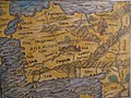
 1450 ¿ Carta Catalana jpeg copy.G.jpg 1,205 × 734; 278 KB
-
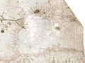
 15th century map of Turkey region.jpg 2,048 × 1,536; 884 KB
-
-

-

-
-
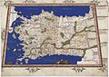 Ptolemy Cosmographia 1467 - Asia Minor Turkey.jpg 1,537 × 1,085; 1.3 MB


.B.jpg)
.F.jpg)
.H.jpg)
.J.jpg)
