Category:Old maps of Turkey
Use the appropriate category for maps showing all or a large part of Turkey. See subcategories for smaller areas:
| If the map shows | Category to use |
|---|---|
| Turkey on a recently created map | Category:Maps of Turkey or its subcategories |
| Turkey on a map created more than 70 years ago | Category:Old maps of Turkey or its subcategories |
| the history of Turkey on a recently created map | Category:Maps of the history of Turkey or its subcategories |
| the history of Turkey on a map created more than 70 years ago | Category:Old maps of the history of Turkey or its subcategories |
Subcategories
This category has the following 25 subcategories, out of 25 total.
- 12th-century maps of Turkey (1 F)
*
D
I
K
- Karte von Kleinasien (LoC collection) (1 P, 59 F)
M
O
- Old maps of Thrace (27 F)
P
S
Media in category "Old maps of Turkey"
The following 200 files are in this category, out of 254 total.
(previous page) (next page)-
 11 - Dodekanes, westl Kreta; Scheda-Karte europ Türkei.jpg 5,972 × 6,054; 40.93 MB
-

-

-
 1450 ¿ Carta Catalana jpeg copy.C.jpg 555 × 732; 130 KB
-
 1450 ¿ Carta Catalana jpeg copy.E.jpg 555 × 401; 73 KB
-
 1646 map of the Aegean Sea by Robert Dudley.pdf 4,454 × 2,952; 1.89 MB
-

-

-

-

-

-
 1800 Belgorod map Turkey in Europe and Hungary by Mathew Carey BPL 12328 detail.png 1,239 × 601; 1.21 MB
-
 1800 Wilkinson Map of the 4 Eastern Churches rectified.jpg 1,678 × 1,308; 895 KB
-
 1800 Wilkinson Map of the 4 Eastern Churches.jpg 1,802 × 1,378; 1.95 MB
-

-

-

-
-
 (1825) MAP OF THE WESTERN DIVISION OF GRECIAN COLONIES AND CONQUESTS.jpg 2,888 × 2,034; 3.33 MB
-

-
 1832 Delamarche Map of Greece and the Balkans - Geographicus - Greece-d-32.jpg 2,700 × 2,390; 1.46 MB
-
 GIBBON(1862) p3.008 WESTERN ASIA.jpg 2,897 × 2,049; 2.93 MB
-
-

-
 G1895 pg028 MAP OF TURKEY IN ASIA.jpg 2,945 × 1,875; 2.57 MB
-
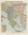 1918 map of the Balkans - Flemmings Kriegskarte der Balkanländer.tif 8,311 × 10,149; 40.64 MB
-

-
 1927-Ratio of Prime Adults-Turkey.png 827 × 558; 296 KB
-

-
 24 of 'Turkey in Europe ... With two maps' (11120329324).jpg 4,739 × 4,102; 3.18 MB
-

-

-

-
 A description of the East, and some other countries (1743) (14770157571).jpg 2,368 × 2,232; 1.48 MB
-

-
 A new map of ancient Greece Thrace, Moesia, Ilyricum and the isles adjoyning. NYPL1630713.tiff 7,230 × 5,428; 112.28 MB
-

-

-

-

-
 Alanya by Piri Reis color.jpg 600 × 909; 718 KB
-
 Alanya by Piri Reis.jpg 577 × 810; 182 KB
-
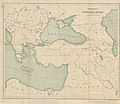
 AmCyc Turkey in Asia - map.jpg 3,258 × 2,300; 4.69 MB
-
 Ana Vatan - (Turkey). LOC 2010593205.jpg 15,793 × 10,476; 22.5 MB
-
 Anavatan 1927.jpg 9,999 × 6,428; 11.77 MB
-
 Ankara. LOC 82692659.jpg 9,262 × 10,583; 10.73 MB
-
 Ankara. LOC 82692659.tif 9,262 × 10,583; 280.44 MB
-
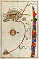
 Antalya by Piri Reis.jpg 816 × 560; 429 KB
-

-
 Argonauts path Carli.jpg 1,125 × 620; 240 KB
-
 Armenia map detail, from- Shepherd-c-020 (cropped).jpg 667 × 523; 167 KB
-
 Armenia, Colchis, Iberia, Albania, Etc.jpg 3,231 × 2,079; 2.09 MB
-
 Armenia-1916-front.jpg 2,000 × 1,303; 656 KB
-
 Armenian population map 1896 cropped Kurdistan.jpg 1,606 × 1,013; 985 KB
-
 Armenian population map 1896 cropped Lazistan.jpg 417 × 400; 100 KB
-
 ARTAZ-AMATUNIK ARMENIA ADERBIJAN.jpg 693 × 1,262; 503 KB
-
 Asia Minor and the Caucasus 1919.jpg 1,000 × 900; 296 KB
-

-
 Atlas of ancient and classical geography (1909) (14595738528).jpg 3,612 × 2,404; 2.62 MB
-

-

-
 Atlas Van der Hagen-KW1049B13 004-NATOLIA, quae olim ASIA MINOR.jpeg 5,500 × 4,244; 3.62 MB
-
 Azerbazkan espahboz.JPG 1,100 × 850; 281 KB
-
 Natolia (NYPL b15404146-1632232).tiff 7,230 × 5,428; 112.28 MB
-
 Baron E. Nolde's Reise durch Innerarabien, Kurdistan und Armenien 1893.png 2,383 × 3,610; 6.52 MB
-

-

-
-
 Brockhaus' Konversations-Lexikon (1892) (14597889919).jpg 2,672 × 1,674; 882 KB
-
 Bulgakyoj 1906.jpg 902 × 219; 164 KB
-
 C. 1270 Europe (Southeastern).jpg 2,320 × 1,174; 1.83 MB
-
 Califate 750.png 1,229 × 1,028; 1.93 MB
-
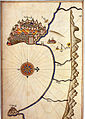
 Cape Adrasan and the Riviera of Finike by Piri Reis.jpg 549 × 814; 201 KB
-
 Cape Bozburun near Marmaris and Datça by Piri Reis.jpg 557 × 809; 644 KB
-
 Carte de l'Asie Minevre ou de la Natolie et du Pont Euxin 01.jpg 7,523 × 6,521; 17.12 MB
-
 Carte de l'Asie Minevre ou de la Natolie et du Pont Euxin 02.jpg 7,744 × 6,400; 16.96 MB
-

-
 Carte du Voyage - Godard - Faultrier Victor - 1857.jpg 1,500 × 1,173; 395 KB
-

-
 Chester Concessions 1923~.jpg 4,030 × 2,940; 3.98 MB
-
 Christians in the Black Sea region (1896).JPG 956 × 636; 67 KB
-
 Constantinople conference east.jpg 2,000 × 3,752; 1.73 MB
-

-
 Cornelis De Jode. Primae Partis Asiae accurata delineatio. 1579.jpg 2,122 × 1,320; 3.1 MB
-
 Cyprus and Asia Minor South Coast.jpg 958 × 560; 158 KB
-
 D4. Adana. NYPL1994593.tiff 7,111 × 5,357, 2 pages; 109.05 MB
-

-
 Die Europaeische Türkei, Griechenland und die Ionischen Inseln.jpg 5,570 × 4,553; 9.19 MB
-
 Dispersion yoruk et turkmène en anatolie.jpg 968 × 497; 345 KB
-
 Eastern Turkey and vicinity. LOC 2002620909.jpg 5,064 × 3,280; 1.92 MB
-
 Eastern Turkey and vicinity. LOC 2002620909.tif 5,064 × 3,280; 47.52 MB
-
 Eastern Turkey and vicinity. LOC 2002620911.jpg 5,070 × 3,280; 2.17 MB
-
 Eastern Turkey and vicinity. LOC 2002620911.tif 5,070 × 3,280; 47.58 MB
-
 Eastern Turkey and Western Caucasus 1922-1923.jpg 192 × 240; 27 KB
-
 Eastern Turkey(Cilicia, Western Armenia)1938-1939.jpg 625 × 563; 105 KB
-
 EB1911 Hittites - archaeological sites.jpg 1,753 × 1,120; 555 KB
-
 EB1911 Turkey.jpg 2,450 × 1,770; 1.81 MB
-
 EB9 Tigris.jpg 1,268 × 999; 173 KB
-
 Empire Ottoman - division administrative LOC 2007633930.jpg 10,638 × 7,775; 12.38 MB
-
 Empire Ottoman - division administrative LOC 2007633930.tif 10,638 × 7,775; 236.64 MB
-

-

-
 Europaeische Türkey Und Griechenland nebst den Ionischen Inseln.jpg 4,502 × 5,452; 7.47 MB
-
 Europe map 1919 cropped.JPG 738 × 437; 120 KB
-
 Fotothek df tg 0005110 Geographie ^ Karte.jpg 800 × 666; 308 KB
-
 G1895 pg028 MAP OF TURKEY IN ASIA-ar.jpg 2,857 × 1,779; 1.2 MB
-

-
 Gegeichnet von I.C.M. Reinecke. Theil des Türkischen Reichs. 1804.jpg 4,975 × 2,662; 2.02 MB
-
 Gelibolu by Piri Reis.jpg 1,667 × 2,184; 1.78 MB
-

-
 General-Karte von der Europäischen Türkei 09.jpg 8,294 × 6,003; 18.24 MB
-
 General-Karte von der Europäischen Türkei 10.jpg 8,223 × 6,019; 16.65 MB
-
 General-Karte von der Europäischen Türkei 11.jpg 8,219 × 6,019; 18.98 MB
-
-
 Gerard de Jode version, Prime Partos Asia (Antwerp, 1577).A.jpg 7,900 × 4,333; 2.47 MB
-
 Greece Physical Map 1880.jpg 5,652 × 4,798; 2.6 MB
-

-
 Géographie Buffier-carte de la Turquie d'Asie-NB.jpg 7,106 × 8,844; 5.47 MB
-
 Géographie Buffier-carte de la Turquie d'Asie.jpg 7,106 × 8,844; 6.74 MB
-
 Géographie Buffier-carte de la Turquie d'Europe-NB.jpg 8,921 × 7,304; 6.66 MB
-
 Géographie Buffier-carte de la Turquie d'Europe.jpg 8,921 × 7,304; 7.09 MB
-
 Heinrich Kiepert. Graecia cum insulis et oris maris Aegaei. Troas et Hellespontus.jpg 7,121 × 5,663; 7.47 MB
-
 Helespont ou Detroit Des Dardanelles.jpg 8,546 × 4,001; 11.23 MB
-
 Hellespont or channel of the Dardanelles LOC 2018588034.jpg 4,960 × 2,929; 2.06 MB
-
 Hellespont or channel of the Dardanelles LOC 2018588034.tif 4,960 × 2,929; 41.56 MB
-
 Heraclea-Pontica.png 539 × 403; 170 KB
-

-
 Imbris 1829 year map.jpg 3,714 × 2,472; 3.9 MB
-
 John Ogilby. Natolia, quae olim Asia Minor. 1673.jpg 800 × 665; 153 KB
-
 Jouvet et Cie. Grece. Caucase et Crimee. 1882. (A).jpg 3,128 × 1,966; 1.83 MB
-
 Kaart van Perzië, objectnr A 16211.jpg 11,500 × 6,769; 58.17 MB
-
 Karamania Chart III from Cape Karaboornoo to Cape Anamour. RMG F0138.tiff 6,657 × 5,372; 102.31 MB
-
 Kitab-i Bahriye Marmaris.jpg 348 × 500; 52 KB
-
 KR 24 Estats de l'Empire du grand seigneur dit sultan et Ottomans empereur.jpg 2,280 × 1,659; 447 KB
-

-

-

-
 L1573 (2) comp.jpg 713 × 1,024; 173 KB
-
 La Turquie en Europa by Abraham Du Bois 1714.jpg 1,600 × 1,298; 552 KB
-
 The lands of the Saracen (IA landsofsaracen00tayl 0) (page 11 crop).jpg 1,679 × 2,505; 348 KB
-
 Le tour du monde - nouveau journal des voyages (1860) (14793804563).jpg 2,832 × 1,920; 882 KB
-
 Le Tour du monde-03-p147.jpg 1,262 × 856; 339 KB
-
 Le Tour du monde-03-p403.jpg 1,238 × 853; 306 KB
-
 Letts, Son & Co. Russia 9. 1883 (A).jpg 2,816 × 2,449; 2.02 MB
-
 Letts, Son & Co. Russia 9. 1883.jpg 6,720 × 6,110; 9.22 MB
-
-
 Lynch map Bitlis and environs.jpg 613 × 894; 239 KB
-
 Machakhela map 1900.jpg 9,101 × 5,743; 48.42 MB
-
 Map - Special Collections University of Amsterdam - OTM- HB-KZL 33.06.18.tif 8,140 × 6,521; 151.87 MB
-
 Map - Special Collections University of Amsterdam - OTM- HB-KZL 33.08.48.tif 7,728 × 6,521; 144.18 MB
-
 Map - Special Collections University of Amsterdam - OTM- HB-KZL 33.08.49.tif 7,358 × 6,346; 133.59 MB
-
 Map - Special Collections University of Amsterdam - OTM- HB-KZL 33.08.60.tif 4,232 × 2,955; 35.78 MB
-
 Map - Special Collections University of Amsterdam - OTM- HB-KZL 33.08.66.tif 7,466 × 6,369; 136.05 MB
-
 Map - Special Collections University of Amsterdam - OTM- HB-KZL 33.08.68.tif 6,941 × 6,026; 119.67 MB
-
 Map - Special Collections University of Amsterdam - OTM- HB-KZL 34.27.04.tif 9,688 × 6,480; 179.61 MB
-
 Map Caucasus War (1809-1817) by Anosov (K).jpg 1,332 × 1,151; 518 KB
-
 Map of Anatolia, Description de L'Universe (Alain Manesson Mallet, 1683).jpg 725 × 1,078; 172 KB
-
 Map of Asia Citerior, National Library of Armenia.jpg 2,200 × 1,502; 396 KB
-
 Map of Asia Minor, Description de L'Universe (Alain Manesson Mallet, 1683).jpg 725 × 1,077; 165 KB
-
 Map of eastern Turkey in Asia, Syria and western Persia (ethnographical). LOC 2007633929.jpg 10,714 × 9,183; 14.71 MB
-
 Map of eastern Turkey in Asia, Syria and western Persia (ethnographical). LOC 2007633929.tif 10,714 × 9,183; 281.49 MB
-
 Map of Gallipoli region, 1915. Withtwentyninthd00creirich 0267.jpg 2,016 × 2,499; 2.82 MB
-

-
 Map of Part of Caria and Lycia Hoskyn 1842 s572id13663650 0409.jpg 7,214 × 4,933; 2.29 MB
-
 Map of Pontus.jpg 3,289 × 2,122; 1.03 MB
-
 Map of Pontus.png 640 × 290; 141 KB
-
 Map of Romania in 1791 by Reilly 016.jpg 1,275 × 959; 474 KB
-
 Map of the Dardanelles Campaign 1915 Withtwentyninthd00creirich 0002.jpg 2,223 × 3,529; 831 KB
-
 Map of the German Post Office in Turkey.jpg 2,062 × 2,912; 933 KB
-

-
 Map of the peninsula of Erythrae - Arundell Francis Vyvyan Jago - 1828.jpg 1,129 × 777; 295 KB
-
 Map of the sinking of Ben My Chree.jpg 1,000 × 700; 163 KB
-
 Map of the sinking of Paris II.jpg 1,000 × 710; 147 KB
-
 Map of Yalova Orhangazi Gemlik.png 856 × 584; 310 KB
-
 Map to accompany Travels in Russia, Persia, &c - Alcock Thomas - 1831.jpg 2,000 × 1,232; 681 KB
-
 Map, pictorial of Gallipoli campaign EPH951.jpg 8,176 × 6,132; 11.22 MB
-
 Map-031.jpg 405 × 600; 26 KB
-
 Map-of-Turkey-and-Cyprus.jpg 693 × 558; 128 KB
-
 Maps of Anatolia, of Egypt, and of Carthage by Abraham Ortelius.jpeg 1,553 × 1,184; 538 KB
-
 Mideast1920 cropped.JPG 885 × 745; 215 KB
-
 Natolia, quae olim Asia Minor (8343806424).jpg 800 × 658; 127 KB
-

-

-
 Near East ancient map.jpg 638 × 415; 377 KB
-
 Niebuhr1778bd2 Urfa to the Tigris.jpg 2,604 × 1,704; 1,002 KB
-

-
 Nikolaos Sopnianos, Totius Graeciae Descriptio.jpg 2,201 × 1,420; 3.71 MB
-
 Nph-cent2jpg.jpg 4,247 × 3,265; 5.14 MB
-

-
 Old german map of Turkey.jpg 1,456 × 888; 662 KB
-

-

-

-
 Phrygia p20.jpg 1,195 × 897; 359 KB
-
 Piri Reis - Map of the Islands of Semendrek and Imroz in the Aegean Sea - Google Art Project.jpg 8,529 × 12,459; 17.54 MB
-
 Pontus.png 1,500 × 1,200; 1.2 MB
-
 Putzger Kleinasien Zuschnitt.jpg 3,804 × 2,835; 6.76 MB
-
 Reconstruction in Turkey (1918) (14785137513).jpg 2,848 × 2,078; 786 KB
-
 Region of Mersina and Guzney 1907.jpg 1,580 × 2,450; 1.8 MB
-
 Republic of Pontus map.svg 760 × 491; 111 KB

%27_(11106854356).jpg)
%27_(11248260265).jpg)


_and_the_Balkans_-_Geographicus_-_TurkeyEurope-t-1814.jpg)


_MAP_OF_THE_WESTERN_DIVISION_OF_GRECIAN_COLONIES_AND_CONQUESTS.jpg)


_p3.008_WESTERN_ASIA.jpg)
_in_Antiquity_-_Geographicus_-_AsiaMinor-spruner-1865_(Lycia_inset_cropped).jpg)
_in_Antiquity_-_Geographicus_-_AsiaMinor-spruner-1865.jpg)


.jpg)
.jpg)
.jpg)
%27_(11105259203).jpg)

_(14770157571).jpg)
_(14759981611).jpg)


._LOC_2010593205.jpg)


.jpg)


.jpg)
_(14595738528).jpg)
.jpg)
.jpg)


_(14597889919).jpg)
.jpg)


.jpg)

.jpeg)

.JPG)

.jpg)


1938-1939.jpg)


.A.jpg)

.jpg)


)%27_(11001262225).jpg)


.jpg)


_comp.jpg)

_(page_11_crop).jpg)
_(14793804563).jpg)


.jpg)


_by_Anosov_(K).jpg)
.jpg)

.jpg)
._LOC_2007633929.jpg)


.jpg)


.jpg)
.D.jpg)
.E.jpg)


.jpg)

.jpg)

.jpg)


_(14785137513).jpg)

