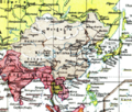
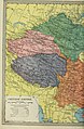
Category:Old maps of Mongolia
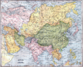
Countries of Asia: Afghanistan · Armenia‡ · Azerbaijan‡ · Bahrain · Bangladesh · Bhutan · Brunei · Cambodia · People's Republic of China · Cyprus‡ · East Timor · Egypt‡ · Georgia‡ · India · Indonesia‡ · Iran · Iraq · Israel · Japan · Jordan · Kazakhstan‡ · Kuwait · Kyrgyzstan · Laos · Lebanon · Malaysia · Maldives · Mongolia · Myanmar · Nepal · Oman · Pakistan · Philippines · Qatar · Russia‡ · Saudi Arabia · Singapore · Sri Lanka · Syria · Tajikistan · Thailand · Turkey‡ · Turkmenistan · United Arab Emirates · Uzbekistan · Vietnam · Yemen
Limited recognition: Taiwan · State of Palestine – Other territories: Hong Kong · Macau
‡: partly located in Asia
Limited recognition: Taiwan · State of Palestine – Other territories: Hong Kong · Macau
‡: partly located in Asia
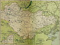
Use the appropriate category for maps showing all or a large part of Mongolia. See subcategories for smaller areas:
| If the map shows | Category to use |
|---|---|
| Mongolia on a recently created map | Category:Maps of Mongolia or its subcategories |
| Mongolia on a map created more than 70 years ago | Category:Old maps of Mongolia or its subcategories |
| the history of Mongolia on a recently created map | Category:Maps of the history of Mongolia or its subcategories |
| the history of Mongolia on a map created more than 70 years ago | Category:Old maps of the history of Mongolia or its subcategories |
Subcategories
This category has the following 8 subcategories, out of 8 total.
Media in category "Old maps of Mongolia"
The following 131 files are in this category, out of 131 total.
-

-
-
 Guang Yutu 1588 Vol 2 Pg 114 Gobi 2.jpg 4,440 × 4,658; 3.9 MB
-
 Guang Yutu 1588 Vol 2 Pg 113 Gobi 1.jpg 4,420 × 4,658; 4.09 MB
-
-
-
 Der Jesuiten-Atlas der Kanghsi-Zeit - China und die Aussenlaender LOC 74650033-5.jpg 5,835 × 9,690; 5.63 MB
-
 Der Jesuiten-Atlas der Kanghsi-Zeit - China und die Aussenlaender LOC 74650033-5.tif 5,835 × 9,690; 161.77 MB
-
 Der Jesuiten-Atlas der Kanghsi-Zeit - China und die Aussenlaender LOC 74650033-8.jpg 7,114 × 8,854; 6.89 MB
-
 Der Jesuiten-Atlas der Kanghsi-Zeit - China und die Aussenlaender LOC 74650033-8.tif 7,114 × 8,854; 180.21 MB
-
 Der Jesuiten-Atlas der Kanghsi-Zeit - China und die Aussenlaender LOC 74650033-7.jpg 10,582 × 9,763; 10.6 MB
-
 Der Jesuiten-Atlas der Kanghsi-Zeit - China und die Aussenlaender LOC 74650033-7.tif 10,582 × 9,763; 295.58 MB
-

-
 Cartes particulières de la Tartarie chinoise - D'Anville - btv1b5973048b.jpg 5,861 × 3,701; 2.18 MB
-
 Anville Nouvel atlas de la Chine - Page62 tartarie 3 ortous.jpg 4,196 × 2,596; 3.16 MB
-
 Anville Nouvel atlas de la Chine - Page64 tartarie 4 chamo.jpg 4,229 × 2,624; 2.88 MB
-
 Anville Nouvel atlas de la Chine - Page70 tartarie 7 kalkas.jpg 4,208 × 2,564; 4.35 MB
-
 Anville Nouvel atlas de la Chine - Page72 tartarie 8 elut.jpg 4,136 × 2,552; 4.29 MB
-
 Anville Nouvel atlas de la Chine - Page79 tartarie 11 niptchou.jpg 4,218 × 2,580; 3.43 MB
-

-
-
 Cartes particulières de la Tartarie chinoise - D'Anville - btv1b5963110z (03 of 12).jpg 5,840 × 3,872; 3.55 MB
-
 Cartes particulières de la Tartarie chinoise - D'Anville - btv1b5963110z (04 of 12).jpg 5,808 × 3,872; 2.67 MB
-
 Cartes particulières de la Tartarie chinoise - D'Anville - btv1b5963110z (05 of 12).jpg 5,816 × 3,856; 3.84 MB
-
 Cartes particulières de la Tartarie chinoise - D'Anville - btv1b5963110z (07 of 12).jpg 5,816 × 3,856; 3.4 MB
-
 Cartes particulières de la Tartarie chinoise - D'Anville - btv1b5963110z (08 of 12).jpg 5,816 × 3,848; 3.29 MB
-
 Cartes particulières de la Tartarie chinoise - D'Anville - btv1b5963110z (11 of 12).jpg 5,896 × 3,888; 3.41 MB
-
 Cartes particulières de la Tartarie chinoise - D'Anville - btv1b5963111c (03 of 12).jpg 5,784 × 3,760; 3.73 MB
-
 Cartes particulières de la Tartarie chinoise - D'Anville - btv1b5963111c (04 of 12).jpg 5,808 × 3,760; 3.01 MB
-
 Cartes particulières de la Tartarie chinoise - D'Anville - btv1b5963111c (05 of 12).jpg 5,792 × 3,816; 3.6 MB
-
 Cartes particulières de la Tartarie chinoise - D'Anville - btv1b5963111c (07 of 12).jpg 5,752 × 3,752; 3.03 MB
-
 Cartes particulières de la Tartarie chinoise - D'Anville - btv1b5963111c (08 of 12).jpg 5,760 × 3,760; 3.41 MB
-
 Cartes particulières de la Tartarie chinoise - D'Anville - btv1b5963111c (11 of 12).jpg 5,816 × 3,776; 3.26 MB
-
-

-

-

-

-

-

-

-
 1749 map Chinese Tartary by Tobias Mayer.jpg 19,690 × 12,721; 45.11 MB
-

-
 KKR-20 La CHINE avec la Korée et les Parties de la Tartarie.jpg 3,148 × 2,584; 1.1 MB
-
-
 Tatariae Sinensis mappa geographica 1749 24374665.jpg 13,080 × 7,036; 22.5 MB
-

-

-

-

-
 A map of Chinese Tartary, with Corea (NYPL b13919861-5207424).jpg 8,013 × 6,638; 44.64 MB
-
 A map of Chinese Tartary, with Corea (NYPL b13919861-5207424).tiff 10,326 × 7,758, 2 pages; 229.46 MB
-

-

-

-
-

-
-

-

-

-

-

-
-

-

-
 Huang chao zhi sheng di yu quan tu - btv1b531099218 (29 of 38).jpg 6,246 × 4,554; 2.88 MB
-
 Tian xia zong yu tu. LOC 2002626780-19.jpg 3,746 × 3,133; 928 KB
-
 Tian xia zong yu tu. LOC 2002626780-19.tif 3,746 × 3,133; 33.58 MB
-
 1904 map of Asia.png 3,927 × 3,172; 32.7 MB
-

-
 1912 China map from National Geographic.jpg 6,980 × 5,326; 10.65 MB
-
 STANFORD(1917) p12 Index map (14783818285).jpg 3,456 × 2,228; 920 KB
-
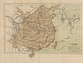
 STANFORD(1917) p67-68 PLATE22. MONGOLIA (14597137480).jpg 4,783 × 3,600; 8.46 MB
-
 1922 Map of the Far Eastern Republic.jpg 2,400 × 1,474; 1.26 MB
-
 Outer Mongolia (Khalkha).jpg 2,809 × 1,847; 1.16 MB
-
 1930 Map of the Republic of China.JPG 1,171 × 817; 272 KB
-

-
 1947 Zhonghua Minguo Quantu.png 3,044 × 2,000; 13.79 MB
-

-

-

-
 AltaiUrianhai7Hoshuu.jpg 8,681 × 6,585; 17.57 MB
-
 Atlas Van der Hagen-KW1049B13 014-MAGNI MOGOLIS IMPERIVM.jpeg 5,500 × 4,459; 3.75 MB
-
 China - political (1922).jpg 9,344 × 7,284; 16.04 MB
-
 China Proper 1944.png 1,314 × 835; 1.31 MB
-
 China und Japan.jpg 5,592 × 4,574; 8.82 MB
-
 Chinese empire and Japan. LOC 2006629414.jpg 5,783 × 4,879; 4.99 MB
-
 Chinese empire and Japan. LOC 2006629414.tif 5,783 × 4,879; 80.72 MB
-
 Colton's China. LOC 2006629408.jpg 6,896 × 5,614; 7.97 MB
-
 Colton's China. LOC 2006629408.tif 6,896 × 5,614; 110.76 MB
-
 D049- Mongolie centrale-liv2-ch11.png 1,452 × 1,912; 268 KB
-
 Dominio Cinese, Ta Chung Hua Min Kuo, e Impero Giapponese, Dai Nihon.jpg 7,976 × 6,377; 13 MB
-
 Empires chinois et japonais LOC 2006629415.tif 6,400 × 4,822; 88.29 MB
-
 Glass slide map of Tibet, Sinkiang, Mongolia and China in 1925 or 1926.jpg 7,552 × 6,627; 16.88 MB
-
 Inner Mongolian Barga region (1910).jpg 2,560 × 1,867; 2.92 MB
-
 Le Tour du monde-11-p252.jpg 2,847 × 1,962; 1.16 MB
-
 Magnae Tartariae, Magni Mogolis Imperii, Iaponiae et Chinae nova descriptio.jpg 6,952 × 4,710; 14.67 MB
-
 Map of Asia from the Interwar period, ca. 1932-36.jpg 1,600 × 1,200; 1.32 MB
-
 Map of Asia, Mitchell's School Atlas LOC 2007633727-13 (cropped).jpg 3,117 × 2,378; 1.79 MB
-
 Map of Mongolia (1914) Korostovets, Ilyin's Cartographic Establishment.jpg 7,094 × 5,173; 12.2 MB
-
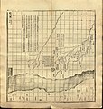
 Map of Mongolia showing ore mines, coal mines, and railroads LOC 2012585896.jpg 4,334 × 3,356; 2.79 MB
-
 Map of Mongolia showing ore mines, coal mines, and railroads LOC 2012585896.tif 4,334 × 3,356; 41.61 MB
-

-
 Map of Tartary, Thibet, and China.png 2,951 × 2,262; 6.01 MB
-
 Map of the Far East of the USSR, Northern China (Manchuria) and Mongolia.tif 1,404 × 1,024; 4.11 MB
-

-

-
 Map-of-Unified-Mongolia-1917.jpg 9,147 × 6,199; 59.47 MB
-
 Mitchell's school atlas LOC 2007633727-13.jpg 3,402 × 2,814; 1.97 MB
-
 Mitchell's school atlas LOC 2007633727-13.tif 3,402 × 2,814; 27.39 MB
-
 Mongolia. LOC 80691549.jpg 4,148 × 3,144; 1.44 MB
-
 Mongolia. LOC 80691549.tif 4,148 × 3,144; 37.31 MB
-
 Mongolia. LOC 96684078.jpg 3,289 × 2,542; 687 KB
-
 Mongolia. LOC 96684078.tif 3,289 × 2,542; 23.92 MB
-
 Mongolia. LOC 96684079.jpg 3,294 × 2,546; 854 KB
-
 Mongolia. LOC 96684079.tif 3,294 × 2,546; 23.99 MB
-
 Mongolie. L'Empire Chinois et du Japon (1833) (cropped).jpg 1,839 × 1,498; 1,020 KB
-
 Nei wai Mengguo tu. LOC 2006626294.jpg 15,555 × 7,613; 16.14 MB
-
 Nei wai Mengguo tu. LOC 2006626294.tif 15,555 × 7,613; 338.8 MB
-
 O.S.S. Theaters of Operation - DPLA - 250c488c52e01121915458ef83e1b2b5.jpg 12,512 × 9,000; 5.13 MB
-
 Pieni 2 0791 China.png 514 × 437; 611 KB
-

-
 Qing China 1844.png 903 × 685; 1.37 MB
-

-
-

-
 Жоңғарияның картасы(Й.Г.Ренат).tif 4,854 × 3,822; 136.48 MB
-

-
 Монголия-Манжго.png 811 × 580; 1.22 MB
-
 Моңғолияның картасы (Й.Г.Ренат).tif 3,808 × 4,206; 115.36 MB
.jpg)


.jpg)
.jpg)


_de_la_Tartarie_chinoise_-_par_J.-B._d%27Anville_-_btv1b84686557_(2_of_6).jpg)
_de_la_Tartarie_chinoise_-_par_J.-B._d%27Anville_-_btv1b84686557_(4_of_6).jpg)
.jpg)
.jpg)
.jpg)
.jpg)
.jpg)
.jpg)
.jpg)
.jpg)
.jpg)
.jpg)
.jpg)
.jpg)
.jpg)
.jpg)
.jpg)
.jpg)
.jpg)
.jpg)
.jpg)


.jpg)


_-_Geographicus_-_TartarieChine-bonne-1770.jpg)


.jpg)


.jpg)


_vol_1_(page_7_crop)_(cropped).jpg)

_p12_Index_map_(14783818285).jpg)
_p67-68_PLATE22._MONGOLIA_(14597137480).jpg)

.jpg)


.jpg)
.jpg)


.jpg)


.jpg)


.jpg)
_Korostovets,_Ilyin%27s_Cartographic_Establishment.jpg)

.jpg)

_(14576990459)_(cropped).jpg)
_vol_1_(page_7_crop).jpg)


_(cropped).jpg)


_from_book_-_Present-Day_Conditions_in_China;_Notes_Designed_to_Show_the_Moral_and_Spiritual_Claims_of_the_Chinese_Empire_(IA_presentdaycondit00broo)_(page_1_crop).jpg)

_-_The_Chinese_Empire._A_General_%26_Missionary_Survey_(page_551_crop).jpg)
_(14576990459).jpg)
_(page_278_crop).jpg)
.jpg)

%27_(11045234074).jpg)