Category:Old maps of Cyprus
Countries of Asia: Afghanistan · Armenia‡ · Azerbaijan‡ · Bahrain · Bangladesh · Bhutan · Brunei · Cambodia · People's Republic of China · Cyprus‡ · East Timor · Egypt‡ · Georgia‡ · India · Indonesia‡ · Iran · Iraq · Israel · Japan · Jordan · Kazakhstan‡ · Kuwait · Kyrgyzstan · Laos · Lebanon · Malaysia · Maldives · Mongolia · Myanmar · Nepal · Oman · Pakistan · Philippines · Qatar · Russia‡ · Saudi Arabia · Singapore · Sri Lanka · Syria · Tajikistan · Thailand · Turkey‡ · Turkmenistan · United Arab Emirates · Uzbekistan · Vietnam · Yemen
Limited recognition: Taiwan · State of Palestine – Other territories: Hong Kong · Macau
‡: partly located in Asia
Limited recognition: Taiwan · State of Palestine – Other territories: Hong Kong · Macau
‡: partly located in Asia
Countries of Europe: Albania · Andorra · Armenia‡ · Austria · Azerbaijan‡ · Belarus · Belgium · Bosnia and Herzegovina · Bulgaria · Croatia · Cyprus‡ · Czech Republic · Denmark · Estonia · Finland · France‡ · Georgia‡ · Germany · Greece · Hungary · Iceland · Republic of Ireland · Italy · Kazakhstan‡ · Latvia · Liechtenstein · Lithuania · Luxembourg · Malta · Moldova · Monaco · Montenegro · Netherlands‡ · North Macedonia · Norway · Poland · Portugal‡ · Romania · Russia‡ · San Marino · Serbia · Slovakia · Slovenia · Spain‡ · Sweden · Switzerland · Turkey‡ · Ukraine · United Kingdom · Vatican City
Specific status: Faroe Islands · Gibraltar · Bailiwick of Guernsey · Isle of Man · Jersey · Svalbard – Limited recognition: Kosovo · Transnistria
‡: partly located in Europe
Specific status: Faroe Islands · Gibraltar · Bailiwick of Guernsey · Isle of Man · Jersey · Svalbard – Limited recognition: Kosovo · Transnistria
‡: partly located in Europe
Use the appropriate category for maps showing all or a large part of Cyprus. See subcategories for smaller areas:
| If the map shows | Category to use |
|---|---|
| Cyprus on a recently created map | Category:Maps of Cyprus or its subcategories |
| Cyprus on a map created more than 70 years ago | Category:Old maps of Cyprus or its subcategories |
| the history of Cyprus on a recently created map | Category:Maps of the history of Cyprus or its subcategories |
| the history of Cyprus on a map created more than 70 years ago | Category:Old maps of the history of Cyprus or its subcategories |
Subcategories
This category has the following 12 subcategories, out of 12 total.
Media in category "Old maps of Cyprus"
The following 61 files are in this category, out of 61 total.
-
 1572 Europa Ortelius.B.jpg 673 × 441; 328 KB
-
 Famagusta by Giacomo Franco.jpg 1,259 × 745; 368 KB
-
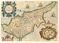
 Abraham Ortelius, Cyprus Insula (FL35071147 2529562).jpg 13,033 × 11,289; 207.98 MB
-
 Ammoxostos.jpg 613 × 494; 266 KB
-
 Atlas Ortelius KB PPN369376781-073av-073br.jpg 3,000 × 2,194; 4.58 MB
-
 Atlas Van der Hagen-KW1049B13 007-CYPRVS INSVLA.jpeg 5,500 × 4,295; 4.12 MB
-
-
 Carte Geologique Europe cropped Cyprus.JPG 260 × 184; 33 KB
-

-

-
 Cypri Insulae - 16th century map of Cyprus.jpg 5,944 × 4,144; 13.11 MB
-
 Cyprus A. de La Motraye. Mare Nigrum (17 century) (cropped).jpg 715 × 314; 44 KB
-
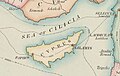
 Cyprus and Asia Minor South Coast.jpg 958 × 560; 158 KB
-
 Cyprus Insula. NYPL1632215.tiff 7,230 × 5,428; 112.28 MB
-
 Cyprus, administrative divisions. LOC 2010588616.jpg 4,361 × 3,340; 1.51 MB
-
 Cyprus, administrative divisions. LOC 2010588616.tif 4,361 × 3,340; 41.67 MB
-
 Cyprus, physiography. LOC 2010588614.jpg 4,270 × 3,247; 1.55 MB
-
 Cyprus, physiography. LOC 2010588614.tif 4,270 × 3,247; 39.67 MB
-
 Cyprus. LOC 2005626484.jpg 3,252 × 2,383; 538 KB
-
 Cyprus. LOC 2005626484.tif 3,252 × 2,383; 22.17 MB
-
 Cyprus. LOC 2005626486.jpg 3,265 × 2,500; 553 KB
-
 Cyprus. LOC 2005626486.tif 3,265 × 2,500; 23.35 MB
-
 Cyprus. LOC 2010588613.jpg 4,324 × 3,384; 1.51 MB
-
 Cyprus. LOC 2010588613.tif 4,324 × 3,384; 41.86 MB
-
-
 D383-Ile de Cypre.-L2-Ch9.png 1,314 × 934; 149 KB
-

-
 Drummond Zypern Karpas.png 1,678 × 808; 1.54 MB
-

-
 Gulf of Larnaka (Salines).png 1,024 × 1,477; 115 KB
-
 Houghton 51-2553 - Hans Rogel, Insola Cypern.jpg 2,305 × 2,029; 2.19 MB
-
 Insularium Illustratum (Additional MS 15760, ff.47v-48r).jpeg 7,767 × 5,655; 46.49 MB
-
 Isle de Chipre - btv1b532345486.jpg 18,425 × 9,392; 19.29 MB
-
 Isle de Chipres - btv1b53230811k.jpg 7,102 × 5,859; 4.59 MB
-
 Isle de Chypre - btv1b53230815c.jpg 7,894 × 6,162; 5.9 MB
-
 Isle de Chypre - btv1b53230816t.jpg 8,110 × 5,045; 5.73 MB
-
 Isle de Chypre - btv1b532308178.jpg 7,403 × 4,362; 4.51 MB
-
 Isle de Cipre - Bosio Giacomo & Boissat Pierre De - 1659.jpg 1,500 × 1,081; 1.14 MB
-
 Isle de Cipre - Raigniauld fec(it) - btv1b106790100.jpg 3,288 × 3,016; 1.82 MB
-
 Isle de Cipre - Raigniauld, fec. - btv1b8592858c.jpg 4,689 × 3,529; 3.46 MB
-

-
 Isula de Cipro RMG F1725.tiff 6,903 × 5,184; 102.38 MB
-
 Kaart van Cyprus Cyprus Insula (titel op object), RP-P-2018-1163.jpg 5,194 × 4,408; 3.46 MB
-
 The lands of the Saracen (IA landsofsaracen00tayl 0) (page 11 crop).jpg 1,679 × 2,505; 348 KB
-
 LANG(1878) p010 AGRICULTURAL MAP detail.png 334 × 651; 278 KB
-
 Magius Voyages et aventures detail 12 03.jpg 1,170 × 1,275; 545 KB
-
 Map - Special Collections University of Amsterdam - OTM- HB-KZL 33.08.60.tif 4,232 × 2,955; 35.78 MB
-
 Map Cyprus1.jpg 620 × 449; 152 KB
-
 Map of Cyprus and inset map of Lemnos by Abraham Ortelius.jpeg 1,595 × 1,181; 619 KB
-
 Map-of-Turkey-and-Cyprus.jpg 693 × 558; 128 KB
-
 Meyers b4 s0386 b1.png 760 × 506; 138 KB
-
-
 Pieter van der Aa Cyprus.jpg 1,728 × 1,325; 484 KB
-
 Putzger Kleinasien.jpg 5,385 × 3,539; 11.89 MB
-
 Robert - Asia Minor cropped Cyprus.JPG 533 × 255; 36 KB
-
 Ruines de Baffa et de Koukla ou du nouveau et du vieux Paphos (34423194821).jpg 6,007 × 3,839; 14.34 MB
-

-
 Shepherd-c-020 cropped Cyprus.jpg 273 × 134; 16 KB
-

-
 Карта Малой Азии.png 8,500 × 4,137; 3.76 MB
-
 Турция, конец XIX века.jpg 6,562 × 5,104; 28.46 MB


.jpg)


_-_par_le_Sr_Henry_Michelot,_pilote_r%C3%A9al_des_gal%C3%A8res_du_Roy_-_btv1b530281039_(12_of_55)_(cropped).jpg)
.jpg)

_(cropped).jpg)


.jpg)

_(20928323685).jpg)


.png)

.jpeg)


_-_btv1b106790100.jpg)


,_RP-P-2018-1163.jpg)
_(page_11_crop).jpg)
_p010_AGRICULTURAL_MAP_detail.png)


.I.jpg)


.jpg)


_-_par_le_Sr_Henry_Michelot,_pilote_r%C3%A9al_des_gal%C3%A8res_du_Roy_-_btv1b530281039_(12_of_55)_(cropped).jpg)

