Category:Old maps of Austria
Countries of Europe: Albania · Andorra · Armenia‡ · Austria · Azerbaijan‡ · Belarus · Belgium · Bosnia and Herzegovina · Bulgaria · Croatia · Cyprus‡ · Czech Republic · Denmark · Estonia · Finland · France‡ · Georgia‡ · Germany · Greece · Hungary · Iceland · Republic of Ireland · Italy · Kazakhstan‡ · Latvia · Liechtenstein · Lithuania · Luxembourg · Malta · Moldova · Monaco · Montenegro · Netherlands‡ · North Macedonia · Norway · Poland · Portugal‡ · Romania · Russia‡ · San Marino · Serbia · Slovakia · Slovenia · Spain‡ · Sweden · Switzerland · Turkey‡ · Ukraine · United Kingdom · Vatican City
Specific status: Faroe Islands · Gibraltar · Bailiwick of Guernsey · Isle of Man · Jersey · Svalbard – Limited recognition: Kosovo · Transnistria
‡: partly located in Europe
Specific status: Faroe Islands · Gibraltar · Bailiwick of Guernsey · Isle of Man · Jersey · Svalbard – Limited recognition: Kosovo · Transnistria
‡: partly located in Europe
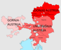
States of Austria:  Burgenland ·
  Carinthia ·
  Lower Austria ·
  Salzburg ·
  Styria ·
  Tyrol ·
  Upper Austria ·
  Vienna ·
  Vorarlberg
Use the appropriate category for maps showing all or a large part of Austria. See subcategories for smaller areas:
| If the map shows | Category to use |
|---|---|
| Austria on a recently created map | Category:Maps of Austria or its subcategories |
| Austria on a map created more than 70 years ago | Category:Old maps of Austria or its subcategories |
| the history of Austria on a recently created map | Category:Maps of the history of Austria or its subcategories |
| the history of Austria on a map created more than 70 years ago | Category:Old maps of the history of Austria or its subcategories |
Subcategories
This category has the following 28 subcategories, out of 28 total.
*
.
- Old maps of Burgenland (37 F)
C
D
- Details of old maps of Austria (55 F)
F
G
- Maps of Greater Austria (10 F)
H
- Hafen am Bäumle - memorial (10 F)
K
- Kosler's Map (10 F)
O
P
T
W
Media in category "Old maps of Austria"
The following 172 files are in this category, out of 172 total.
-

-
 Lazius - Austriae descrip.jpg 2,263 × 1,700; 2.55 MB
-

-
 Sanson - Partie du cercle d'Autriche (1681).jpg 10,417 × 6,754; 79.74 MB
-

-
 Scherer - Austria, Stiria, Carinthia, Carniola (1699)-1.jpg 4,169 × 2,740; 3.27 MB
-
 Scherer - Austria, Stiria, Carinthia, Carniola (1699)-2.jpg 4,172 × 2,752; 3.3 MB
-
 Tabula Ducatus Carnioliae, Vindorum Marchiae et Histriae.jpg 6,897 × 5,764; 47.63 MB
-
 PLAN EIN STICK VON DER DANAW.jpg 2,880 × 1,043; 440 KB
-

-
 Peter Anichs letzte Karte von der Innsbrucker Umgebung von 1766.jpg 1,268 × 1,080; 354 KB
-
 Map of Austria in 1791 by Reilly 118.jpg 899 × 713; 308 KB
-
 Map of Austria in 1791 by Reilly 119.jpg 1,545 × 984; 752 KB
-
 Map of Austria in 1791 by Reilly 120.jpg 1,269 × 1,011; 633 KB
-
 Map of Austria in 1791-1792 by Reilly 121.jpg 1,128 × 864; 485 KB
-
 Map of Austria in 1791-1792 by Reilly 122.jpg 1,275 × 918; 600 KB
-
 Map of Austria in 1791-1792 by Reilly 123.jpg 1,377 × 999; 694 KB
-
 Map of Austria in 1791-1792 by Reilly 124.jpg 1,141 × 1,046; 515 KB
-
 Map of Austria in 1791-1792 by Reilly 126.jpg 1,170 × 936; 543 KB
-
 Map of Austria in 1791-1792 by Reilly 127.jpg 1,134 × 944; 491 KB
-
 Map of Austria in 1791-1792 by Reilly 128.jpg 1,197 × 828; 485 KB
-
 Map of Austria in 1791-1792 by Reilly 129.jpg 1,092 × 903; 455 KB
-
 Map of Austria in 1791-1792 by Reilly 129b.jpg 500 × 410; 71 KB
-
 Reilly 145.jpg 1,087 × 957; 423 KB
-
 Reilly 146.jpg 1,125 × 1,008; 542 KB
-
 Reilly 148.jpg 1,340 × 997; 480 KB
-
 Reilly 154.jpg 1,098 × 888; 420 KB
-
 Cercle d'Autriche. LOC 2002624013.jpg 4,476 × 3,388; 2.42 MB
-
 Cercle d'Autriche. LOC 2002624013.tif 4,476 × 3,388; 43.39 MB
-
 Reilly 156.jpg 1,151 × 991; 520 KB
-
 Reilly Allgemeiner Postatlas Österreich.jpg 500 × 332; 29 KB
-
 1801 Cary Map of Austria - Geographicus - Austria-cary-1801.jpg 5,000 × 4,488; 7.86 MB
-
 Der Oesterreichische Kreis 1806.jpg 2,503 × 1,862; 1.38 MB
-
 St. Oswald im Drauwalde Kataster Titelblatt.jpg 1,976 × 1,849; 434 KB
-
 St. Oswald im Drauwalde Kataster Übersichtsblatt.jpg 550 × 632; 135 KB
-
 Seeland Franziszeischer Kataster.jpg 2,004 × 1,656; 208 KB
-
 Karte von Deutschland, dem Königr. der Niederlande und der Schweiz - Budweis, Passau.jpg 5,815 × 4,829; 9.49 MB
-
 Karte von Deutschland, dem Königr. der Niederlande und der Schweiz - Wien, Olmütz.jpg 5,821 × 4,754; 8.54 MB
-
-
 Basovica bei Triest Franzisz Kataster.jpg 904 × 1,561; 151 KB
-
 Karte der Glocknergruppe 1871.jpg 6,141 × 7,332; 15.35 MB
-
 Aufnahmeblatt 4756-2a Purkersdorf, Tullnerbach, Troppberg.jpg 10,208 × 7,322; 42.67 MB
-
 Aufnahmeblatt 4756-4-b 1872 Mödling, Perchtoldsdorf.jpg 9,616 × 7,327; 37.5 MB
-
 Aufnahmeblatt 4756-4a Sulz, Kaltenleutgeben, Höllenstein.jpg 10,192 × 7,283; 45.17 MB
-
 Aufnahmeblatt 4756-4c Heiligenkreuz, Hoher Lindkogel.jpg 10,318 × 7,428; 46.03 MB
-
 Aufnahmeblatt 4756-4d Baden, Gruntramsdorf.jpg 10,299 × 7,318; 62.95 MB
-
 Aufnahmeblatt 4757-3b Rauchenwarth.jpg 10,287 × 7,330; 38.89 MB
-
 Karte der centralen Ortlergruppe.jpg 9,014 × 6,289; 19.96 MB
-
 Aufnahmeblatt 4657-3a Bisamberg.jpg 10,311 × 7,415; 40.15 MB
-
 Aufnahmeblatt 4657-3b Gross Ebersdorf, Gross Engersdorf.jpg 10,288 × 7,319; 34.51 MB
-
 Aufnahmeblatt 4757-1-b 1873 GrEnzersdorf.jpg 10,207 × 7,411; 55.98 MB
-
 Aufnahmeblatt 4757-2 Orth, Leopoldsdorf, Eckartsau.jpg 10,289 × 7,902; 38.66 MB
-
 Aufnahmeblatt 4757-3a Vösendorf, Biedermannsdorf, Himberg.jpg 10,256 × 7,319; 37.13 MB
-
 Aufnahmeblatt 4757-3c Münchendorf.jpg 10,279 × 7,405; 33.28 MB
-
 Aufnahmeblatt 4757-3d Ebergassing, Gramatneusiedl.jpg 10,301 × 7,423; 36.89 MB
-
 Aufnahmeblatt 4757-4a Fischamend, Schwadorf.jpg 10,324 × 7,427; 42.08 MB
-
 Aufnahmeblatt 4757-4b Kroatisch Haslau, Regelsbrunn, Wildungsmauer.jpg 10,311 × 7,366; 38.98 MB
-
 Aufnahmeblatt 4757-4c Trautmannsdorf, Stixneusiedl.jpg 10,318 × 7,392; 43.26 MB
-
 Aufnahmeblatt 4758-1 Engelhartstetten, Hainburg, Schlosshof.jpg 10,256 × 7,351; 46.52 MB
-
 Karte der Dolomitalpen.jpg 10,370 × 8,107; 31.44 MB
-
 Specialkarte der Ostalpen Section Similaun.jpg 5,229 × 5,804; 11.24 MB
-
 Specialkarte der Ostalpen Section Wildspitze.jpg 5,308 × 5,859; 11.71 MB
-
 Specialkarte der Ostalpen Section Weisskugel.jpg 5,688 × 6,096; 10.09 MB
-
 Karte der Rofangruppe.jpg 3,133 × 4,818; 5.11 MB
-
 Specialkarte der Ostalpen Section Glockthurm.jpg 5,512 × 6,050; 10.86 MB
-
 Specialkarte der Ostalpen Section Hoch Wilde.jpg 5,512 × 6,050; 11.31 MB
-
 Specialkarte der Ostalpen Section Timbler Joch.jpg 5,512 × 6,050; 11.32 MB
-
 Umgebungen von Klagenfurt.jpg 5,008 × 3,826; 8.55 MB
-
 Specialkarte der Ostalpen Section Schrankogel.jpg 5,338 × 5,726; 10.35 MB
-
 Specialkarte der Ostalpen Section Feuerstein.jpg 5,382 × 5,770; 11.97 MB
-
 Specialkarte der Ostalpen Section Habicht.jpg 5,421 × 5,811; 12.13 MB
-
 Der Mandron und Lobbia Gletscher 1820.jpg 4,343 × 3,287; 9.29 MB
-
 Der Mandron und Lobbia Gletscher 1878.jpg 4,343 × 3,287; 7.81 MB
-
 Karte vom Kaisergebirge.jpg 6,570 × 4,993; 9.48 MB
-
 Spruner-Menke Handatlas 1880 Karte 36.jpg 10,601 × 8,743; 24.51 MB
-
 Specialkarte der centralen Zillerthaler Gebirgsgruppe westliches Blatt.jpg 7,331 × 10,069; 25.79 MB
-
 Special-Karte der Venediger-Gruppe.jpg 9,910 × 9,228; 34.8 MB
-

-
 Meyers b9 s0067a.jpg 1,636 × 2,048; 518 KB
-
 Meyers b9 s0067b.jpg 1,562 × 2,048; 594 KB
-

-
 Specialkarte des Karwendelgebirges.jpg 11,201 × 9,890; 41.64 MB
-
 Historische AV-Karte, Fuscher Kamm.jpg 1,128 × 1,652; 734 KB
-
 Karte des Sonnblick und Umgebung.jpg 8,468 × 7,899; 23.74 MB
-
 Gewerbliche Unterrichts-Anstalten in Österreich 1899.jpg 4,156 × 3,349; 6.91 MB
-

-
 Austria-Hungary LOC 2007627460.jpg 8,471 × 6,365; 9.61 MB
-
 Austria-Hungary LOC 2007627460.tif 8,471 × 6,365; 154.26 MB
-
 Seebergsattel ArbEx Franz Kat.jpg 965 × 1,668; 69 KB
-

-
 Panství habsburské v XVI. století.jpg 952 × 823; 191 KB
-
 Austria, zones of occupation LOC 2017585412.jpg 4,369 × 3,284; 1.64 MB
-
 Austria, zones of occupation LOC 2017585412.tif 4,369 × 3,284; 41.05 MB
-
 2 - Karte Innviertel 1779 1.jpg 2,560 × 1,920; 2.21 MB
-
 3 - Karte Innviertel 1779 2.jpg 2,560 × 1,920; 2.18 MB
-

-

-
-

-
 Austria archiducatus (8341846367).jpg 800 × 645; 142 KB
-
 Austria. LOC 00556470.jpg 3,241 × 2,514; 1.13 MB
-
 Austria. LOC 00556470.tif 3,241 × 2,514; 23.31 MB
-
 Austria. LOC 00556471.jpg 4,366 × 3,392; 2.13 MB
-
 Austria. LOC 00556471.tif 4,366 × 3,392; 42.37 MB
-
 Austria. LOC 2017585409.jpg 9,160 × 4,815; 2.84 MB
-
 Austria. LOC 2017585409.tif 9,160 × 4,815; 126.19 MB
-
 Austriae archiducatus pars inferior - CBT 5877974.jpg 5,888 × 4,761; 10.02 MB
-

-

-
 Austria (NYPL b15404146-1632179).jpg 7,230 × 5,428; 6.51 MB
-
 Austria (NYPL b15404146-1632179).tiff 7,230 × 5,428; 112.28 MB
-
 Umgebung von bozen.jpg 599 × 538; 127 KB
-
 BuehlStollhofenerLinien.jpg 2,500 × 1,916; 1.08 MB
-

-
 C. 1890 Austro-Hungarian Empire.jpg 1,720 × 1,368; 1.26 MB
-
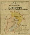 Caporetto kroki.jpg 437 × 508; 35 KB
-
 Carniola.jpg 2,894 × 2,286; 1.68 MB
-

-
 D047 - N° 323. Route du Brenner. - liv3-ch07.png 1,000 × 1,906; 449 KB
-
 D128- N° 340. Vienne et le Danube au moyen âge - liv3-ch08.png 1,436 × 1,156; 242 KB
-
 D324- N° 480. Italia Irredenta. - Liv4-Ch01.png 1,442 × 1,246; 186 KB
-
 D561 - Aquileja, Grado et les Alpes Juliennes. -liv3-ch6.png 1,448 × 2,020; 721 KB
-
 Der Ueblethalferner und seine Umgebung 1871.jpg 3,476 × 3,178; 3.45 MB
-
 Der Österreichische Kaiser-Staat.jpg 10,037 × 7,912; 26.71 MB
-

-
 Erzherzogthum Oesterreich.jpg 5,452 × 4,463; 7.47 MB
-

-
 FranzLA Preitenegg.jpg 7,696 × 7,044; 12.87 MB
-

-
 Herman Moll New Map of Germany.jpg 760 × 469; 118 KB
-
 Histor. Karte Zillertal.jpg 1,717 × 1,226; 846 KB
-
 Historische Ortlerkarte.jpg 1,243 × 2,190; 917 KB
-
 Josephinische Landesaufnahme Aspang.JPEG 7,424 × 4,919; 21.57 MB
-
 Josephinische Landesaufnahme Aspnang, Edlitz, Pittental.JPEG 7,408 × 4,933; 23.05 MB
-
 Josephinische Landesaufnahme Gloggnitz, Kirchberg.JPEG 7,424 × 4,985; 22.07 MB
-
 Josephinische Landesaufnahme Kirchschlag in der Buckligen Welt.JPEG 7,448 × 4,958; 16.2 MB
-
 Josephinische Landesaufnahme Prein.JPEG 7,400 × 4,973; 16.14 MB
-
 Josephinische Landesaufnahme Puchberg, Schneeberg.JPEG 7,360 × 4,928; 22.37 MB
-
 Josephinische Landesaufnahme Rax, Höllental, Naßwald.jpg 7,360 × 4,955; 33.89 MB
-
 Josephinische Landesaufnahme Sulz Alland Perchtoldsdorf.JPEG 7,384 × 4,915; 17.15 MB
-
 Josephinische Landesaufnahme Wechsel Kranichberg.JPEG 7,392 × 4,923; 17.57 MB
-
 Josephinische Landesaufnahme Wismath.JPEG 7,408 × 4,972; 16.92 MB
-
 Karl Andreas Stein, General Karte des Erzherzogthums Oesterreich 01-east-title (FL37099364 2529240).jpg 14,152 × 15,766; 347.45 MB
-
 Karl Andreas Stein, General Karte des Erzherzogthums Oesterreich 02-west (FL37099375 2529240).jpg 13,968 × 15,780; 357.98 MB
-
 Karte des Floitengletscher 1870.jpg 3,918 × 3,239; 2.37 MB
-
 Karte von Tirol, Steyermark und Illyrien 1832.jpg 7,733 × 5,848; 8 MB
-
 Karwendel Karte Hugo Petters.TIF 3,774 × 3,252; 5.51 MB
-
 Klagenfurt Annabichl Katasterplan Spittalmuehle.jpg 2,462 × 1,500; 548 KB
-
 LA3 1872 Grinzing.jpg 1,825 × 1,369; 1.72 MB
-
 LA3 1875 Kaisermühlen.jpg 4,441 × 3,331; 6.83 MB
-
 Map of Austria after Anschluss.jpg 1,467 × 925; 627 KB
-
 Map of Austria by Abraham Ortelius.jpeg 3,033 × 2,353; 2.34 MB
-
 Map of Austria Margraviate.png 800 × 774; 387 KB
-
 MapOfOetztalGlaciers bySonklar 1860.jpg 800 × 726; 182 KB
-
 Karte der Umgebung von Meran.jpg 459 × 464; 96 KB
-

-
 Ortelius Tirol-Carniola-Histria 1575.jpg 2,141 × 1,500; 3.93 MB
-

-
 S(acri) R(omani) I(mperii) Circulus Austriacus.jpg 7,600 × 6,528; 16.67 MB
-
 Spezialkarte 4756 aus 1876 Baden und Neulengbach.jpg 7,077 × 5,670; 30.76 MB
-
 Spezialkarte 4757 Wien 1937 mit Gitternetz.jpg 13,896 × 10,616; 50.6 MB
-
 Spezialkarte 4856 Wiener Neustadt.jpg 7,233 × 5,628; 37.27 MB
-
 Spezialkarte 4857 Eisenstadt.jpg 7,080 × 5,551; 27.27 MB
-
 Spezialkarte 4956 Neunkirchen und Aspang.jpg 7,259 × 5,642; 43.79 MB
-
 Spezialkarte 4957 Ödenburg.jpg 6,972 × 5,373; 26.09 MB
-
 Stielers Handatlas 1891 20.jpg 5,050 × 4,200; 7.28 MB
-
 Süd-Östliches Deutschland nebst einem Theile des nördlichen Italien.jpg 5,561 × 4,524; 10.02 MB
-
 Topographia Austriacarum (Merian) 017.jpg 2,000 × 1,661; 664 KB
-
 Toskanatrakt Salzburg Landkartensaal Austria.jpg 2,084 × 4,624; 10.61 MB
-
 Trodioba Austrije.png 1,150 × 950; 162 KB
-
 Tyskland, Österrike och Tjeckoslovakien (1930).jpg 2,229 × 1,608; 1.12 MB
-
 Wolfgang Lazius, Austria Archiducatus (FL37099038 2526983).jpg 13,691 × 11,838; 234.81 MB
%27_(11287142265).jpg)

.3.(2).jpg)
.jpg)
_(14771941814).jpg)
-1.jpg)
-2.jpg)

_-_Geographicus_-_Austriacus-hmhr-1747.jpg)


%27_(11094576464).jpg)


_(14781392521).jpg)


_(14781787722).jpg)


.jpg)


.jpg)
.jpg)
.jpg)


_(20426041762).jpg)


.jpg)


.jpg)
.jpg)


_R(omani)_I(mperii)_Circulus_Austriacus.jpg)


_017.jpg)


.jpg)
.jpg)
.jpg)