Category:Old maps of Italy
Countries of Europe: Albania · Andorra · Armenia‡ · Austria · Azerbaijan‡ · Belarus · Belgium · Bosnia and Herzegovina · Bulgaria · Croatia · Cyprus‡ · Czech Republic · Denmark · Estonia · Finland · France‡ · Georgia‡ · Germany · Greece · Hungary · Iceland · Republic of Ireland · Italy · Kazakhstan‡ · Latvia · Liechtenstein · Lithuania · Luxembourg · Malta · Moldova · Monaco · Montenegro · Netherlands‡ · North Macedonia · Norway · Poland · Portugal‡ · Romania · Russia‡ · San Marino · Serbia · Slovakia · Slovenia · Spain‡ · Sweden · Switzerland · Turkey‡ · Ukraine · United Kingdom · Vatican City
Specific status: Faroe Islands · Gibraltar · Bailiwick of Guernsey · Isle of Man · Jersey · Svalbard – Limited recognition: Kosovo · Transnistria
‡: partly located in Europe
Specific status: Faroe Islands · Gibraltar · Bailiwick of Guernsey · Isle of Man · Jersey · Svalbard – Limited recognition: Kosovo · Transnistria
‡: partly located in Europe
Use the appropriate category for maps showing all or a large part of Italy. See subcategories for smaller areas:
| If the map shows | Category to use |
|---|---|
| Italy on a recently created map | Category:Maps of Italy or its subcategories |
| Italy on a map created more than 70 years ago | Category:Old maps of Italy or its subcategories |
| the history of Italy on a recently created map | Category:Maps of the history of Italy or its subcategories |
| the history of Italy on a map created more than 70 years ago | Category:Old maps of the history of Italy or its subcategories |
Subcategories
This category has the following 18 subcategories, out of 18 total.
*
- Italy (Map collection KNAG) (38 F)
.
C
D
- Details of old maps of Italy (18 F)
O
- Old maps of Po Delta (3 F)
P
Media in category "Old maps of Italy"
The following 200 files are in this category, out of 336 total.
(previous page) (next page)-

-
 0 Italie - Corse - Sardaigne - Galleria delle carte geografiche.JPG 3,224 × 2,588; 3.85 MB
-
 Europe 526-600.jpg 907 × 1,427; 410 KB
-
 Partage de l'Empire carolingien au Traité de Verdun en 843.JPG 3,597 × 3,308; 3.66 MB
-
 Zapadofranska rise.jpg 513 × 430; 182 KB
-
 SalernoPrincipato annomille.jpg 411 × 441; 56 KB
-
 105 of 'Pröver paa en Jordbeskrivelse' (11037677284).jpg 2,448 × 3,069; 1.25 MB
-
 12 of 'L'Italia geografica illustrata, etc' (11208825055).jpg 4,252 × 5,433; 5.41 MB
-

-
 Cales nell'Italia di Tolomeo.jpg 1,538 × 1,084; 1.23 MB
-
 Sixth map of Europe (Italy, Corsica), in full gold border (NYPL b12455533-427023).tif 4,928 × 3,845; 54.43 MB
-
 Bodleian Libraries, Italy.jpg 1,000 × 675; 125 KB
-
 Sexta Europa Tabula.jpg 10,312 × 7,280; 25.58 MB
-
 Tabula Sexta dEuropa.jpg 597 × 499; 108 KB
-
 Sexta Europae tabula (7537878890).jpg 2,000 × 1,518; 3.11 MB
-
 Sexta Europae Tabula.jpg 4,658 × 3,636; 2.63 MB
-
 ImperiiCaroliMagni.jpg 5,500 × 3,726; 2.44 MB
-
 1827 Finley Map of Italy - Geographicus - Italy-finley-1827.jpg 2,347 × 3,000; 2.11 MB
-

-

-
 1865 Spruner Map of Italy under Augustus Caesar - Geographicus - Italia-spruner-1865.jpg 3,500 × 2,766; 2.59 MB
-

-
 19 of 'Italy and the Italians. ... With map and illustrations' (11245493463).jpg 1,481 × 2,169; 672 KB
-
 Heinrich Kiepert. Italiae pars media.jpg 7,143 × 5,672; 8.42 MB
-
 Italien 1905 (cropped).png 169 × 183; 23 KB
-
 Italien 1905.png 1,471 × 2,000; 1.68 MB
-

-

-
 284 of 'Viaggio antiquario ne'contorni di Roma' (11004243196).jpg 2,986 × 2,468; 1.57 MB
-
 299 of 'Die Erde. Eine allgemeine Erd- und Länderkunde, etc' (11234853596).jpg 1,135 × 2,387; 784 KB
-

-

-
 91 of 'Cassell's Illustrated Universal History' (11155489474).jpg 2,912 × 1,915; 1.16 MB
-

-

-

-

-

-
 A complete geographical dictionary Fleuron T112946-6.png 1,457 × 1,378; 131 KB
-
 A general history for colleges and high schools (1889) (14578050648).jpg 3,280 × 2,008; 914 KB
-
 A general history for colleges and high schools (1889) (14741682646).jpg 3,296 × 2,092; 1.03 MB
-
 A map of Italy Wellcome V0049914.jpg 3,434 × 2,388; 4.01 MB
-

-

-
 A new map of Italy, distinguishing all the sovereignties in it, ... NYPL1630452.tiff 7,230 × 5,116; 105.83 MB
-

-

-
 A trip through Italy, Sicily, Tunisia, Algeria and southern France (1918) (14759165696).jpg 3,044 × 2,204; 1.26 MB
-

-
 Ali Macar Reis'in kent ve kaleleri gösteren İtalya haritası.jpg 422 × 611; 524 KB
-
-

-
 Angelo Celli, Malaria according to the new researches Wellcome L0026233.jpg 1,255 × 1,624; 728 KB
-
 Atlas Ortelius KB PPN369376781-059av-059br.jpg 3,000 × 2,194; 4.83 MB
-
 Atlas Ortelius KB PPN369376781-070av-070br.jpg 3,000 × 2,194; 4.94 MB
-
 Atlas Van der Hagen-KW1049B12 049-TOTIUS ITALIAE TABULA.jpeg 5,500 × 4,537; 4.2 MB
-
 Atlas Van der Hagen-KW1049B12 079-REGNO DI NAPOLI.jpeg 5,500 × 4,298; 3.74 MB
-
 Dominii Veneti in Italia (NYPL b13654243-psnypl map 311).tiff 5,366 × 4,810; 73.85 MB
-
 Italia (NYPL b15404146-1632188).jpg 7,230 × 5,428; 6.67 MB
-
 Bartholomew's war map of Italy and the Balkan States (5008442).jpg 5,000 × 3,756; 4.16 MB
-

-
 Beloch - Italia ante bellum Marsicum.png 2,852 × 2,352; 3.37 MB
-
 Bollettino del R. Comitato geologico d'Italia. (1919) (20398437141).jpg 3,424 × 3,028; 3.22 MB
-
 Bollettino del R. Comitato geologico d'Italia. (1920) (20365977866).jpg 2,784 × 2,844; 3.35 MB
-
 Bouillet - Atlas universel, Carte 70.png 2,683 × 3,425; 10.75 MB
-
 Brockhaus and Efron Jewish Encyclopedia e8 483-0.jpg 1,091 × 1,619; 232 KB
-
 C. 1870 Unification of Italy.jpg 1,220 × 1,322; 1.13 MB
-
 C. 1911 Europe.jpg 1,555 × 1,236; 1.79 MB
-

-

-

-

-
-
 Carta postale e stradale dell'Italia LOC 2018588026.jpg 9,398 × 9,021; 17.87 MB
-
 Carta postale e stradale dell'Italia LOC 2018588026.tif 9,398 × 9,021; 242.56 MB
-
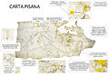 Cartapisana cz.jpg 3,334 × 2,349; 1.39 MB
-
 Carte du Voyage - Godard - Faultrier Victor - 1857.jpg 1,500 × 1,173; 395 KB
-
 Carte Générale De L'Italie.jpg 9,738 × 7,044; 18.09 MB
-
 Carte italie 1843.jpg 2,483 × 3,389; 4.18 MB
-
 Carte Pisane Portolan.jpg 3,481 × 1,848; 2.15 MB
-
 Carte von Alt Italien.jpg 4,428 × 6,008; 8.64 MB
-
 Cartiglio cluver 1672.jpg 294 × 316; 36 KB
-
 Cartografie in Nederland, kaart van Italië, NG-501-51.jpg 5,874 × 4,826; 4.95 MB
-

-
 Charte von Italien (5376031450).jpg 861 × 1,024; 767 KB
-
 Coppo italia.jpg 1,000 × 714; 261 KB
-
 Crusades 1905.jpg 1,468 × 1,176; 252 KB
-
 Dalmaziaitaliana.jpg 1,150 × 1,038; 1.2 MB
-
 Defense Overlay - Foce del Pescara - DPLA - aa64b0f1797e71239c47b27e093c1a7f.jpg 4,136 × 5,625; 2.25 MB
-
 Defense Overlay - Porto Recanati - DPLA - af1d7be32a8270fbaac2e4f3413d340c.jpg 3,816 × 5,330; 1.73 MB
-
 Dep-fr-it.jpg 741 × 756; 415 KB
-
 Esquisse d'une carte géologique d'Italie.jpg 7,552 × 10,112; 44.59 MB
-
 Ethnographische Panoramaskizze durch das antike Etrurien mit Verortung der Stämme 02.jpg 7,919 × 6,197; 10.17 MB
-
 Ethnographische Panoramaskizze durch das antike Etrurien mit Verortung der Stämme.jpg 7,911 × 6,212; 9.37 MB
-
 Europe 526-600 japref.jpg 900 × 1,400; 325 KB
-
 Europe since 1815 (1910) (14764830605).jpg 1,822 × 2,900; 622 KB
-
Fermorestando Italia.webm 3 min 22 s, 640 × 480; 9.14 MB
-
 Fifty years of Europe, 1870-1919 (1919) (14597434069).jpg 1,206 × 1,992; 591 KB
-
 Fossalta 1892.jpg 2,480 × 3,507; 2.85 MB
-
 Fürstentum tarent 1250.jpg 5,500 × 4,298; 13.06 MB
-
 General Karte von Italien. 1-1 850 000... (2 Auflage) - von F. Handtke - btv1b53021211s.jpg 10,118 × 9,850; 16.35 MB
-
 General-Karte von Italien... (2 Auflage) - gezeichnet von F. Handtke - btv1b53022719m.jpg 11,689 × 9,556; 17.1 MB
-

-

-
 Girolamo ruscelli, carta tolemaica dell'italia (tabula V), venezia 1561-64 ca.jpg 3,714 × 2,646; 4.99 MB
-
 Guide to Italy and Sicily (1911) (14579376209).jpg 2,880 × 4,060; 2.64 MB
-
 Guide to Italy and Sicily (1911) (14743011486).jpg 2,828 × 2,876; 1.85 MB
-
 Guide to Italy and Sicily (1911) (14762844511).jpg 4,164 × 2,776; 2.67 MB
-
 Guide to Italy and Sicily (1911) (14766019555).jpg 4,764 × 2,864; 2.95 MB
-
 Guide to Italy and Sicily (1911) (14785892713).jpg 4,384 × 2,824; 2.65 MB
-
 Heinrich Kiepert. Italia. Undecim regiones Italiae ab Augusto Imp. institutae.jpg 5,567 × 6,949; 6.97 MB
-
 Historische kaart van Griekenland en Italië, RP-P-1936-265.jpg 5,124 × 4,292; 3.17 MB
-

-
 Italia - btv1b53042051n.jpg 5,297 × 4,233; 5.5 MB
-
 Italia - btv1b530430226.jpg 7,960 × 6,083; 8.14 MB
-
 Italia - da Giacomo Gastaldi - btv1b53223616s.jpg 11,906 × 7,710; 12.8 MB
-
 Italia - di Matteo Greuter... - btv1b525056959 (13 of 24).jpg 10,294 × 7,734; 10.61 MB
-
 Italia - disegnata da Carlo Cerri... - btv1b53023112j.jpg 14,916 × 19,129; 58.17 MB
-
 Italia - Gli Stati d´Italia.jpg 7,402 × 6,308; 15.88 MB
-
 Italia antica - di Cl. Tolomeo - btv1b5963841x.jpg 5,968 × 4,624; 5.01 MB
-
 Italia antiqua - auctore d'Anville ; Ancient Italy, by d'Anville - btv1b8469297h.jpg 9,154 × 10,296; 15.31 MB
-
 Italia antiqua - btv1b5963847d.jpg 2,808 × 2,384; 1.01 MB
-

-

-

-
-
 Italia Augustiniana ... cum conventibus distributa - btv1b530431019.jpg 7,828 × 6,050; 7.39 MB
-
 Italia benedictina - delineata A.P.R.C.P.W. - btv1b530429908.jpg 7,837 × 6,039; 7.73 MB
-
 Italia Benedictina - delineata A.P.R.C.P.W. - btv1b59719215.jpg 6,944 × 5,872; 4.77 MB
-
 Italia cum insulis et regionibus finitimis (8346580788).jpg 557 × 800; 104 KB
-
 Italia cursoria seu Tabula geographica ... - a Joanne Bapt. Homanno - btv1b53042512b.jpg 7,873 × 6,050; 7.56 MB
-
 Italia di marmo (3093248342).jpg 886 × 1,181; 1.1 MB
-
 Italia geografica, statistica e postale - btv1b6500029c.jpg 4,096 × 5,960; 4.65 MB
-

-
 Italia novamente posta in luce da molti errori emendata - btv1b55004766w.jpg 7,995 × 6,154; 5.62 MB
-
 Italia Novamente posta in luce et da molti errori emendata - btv1b53223618p.jpg 6,996 × 5,146; 6.25 MB
-
 Italia Novamete posta in luce et da molti errori emendata - btv1b8494696r.jpg 9,091 × 6,407; 10.43 MB
-
 Italia Nuova - btv1b52511438b.jpg 10,357 × 9,372; 10.24 MB
-
 Italia nuova - de Gio. Antonio Magini ; Giusto Sadeler - btv1b530396227.jpg 13,665 × 10,800; 29.13 MB
-
 Italia nuova di Gio Antonio Magini - btv1b55011017w.jpg 18,215 × 12,064; 39.31 MB
-
 Italia nuova-Domenego Veneziano fece - btv1b8492009w.jpg 9,276 × 7,342; 11.25 MB
-
 Italia XXIII provincias Capucinorum continens conventus ... - btv1b53212210x.jpg 4,274 × 2,882; 2.66 MB
-
 Italia, novamente piu perfetta che mai per anzi posta in luce... - btv1b8468319b.jpg 8,041 × 6,046; 8.44 MB
-

-
 Italia. Parte occidentale - Dal P. Coronelli - btv1b6500006c.jpg 4,096 × 5,413; 4.01 MB
-
 Italia. Parte orientale - Dal P. Coronelli - btv1b6500007s.jpg 4,096 × 5,451; 3.91 MB
-
 Italiae Antiquae Tabula - Spinellus delin. ; Ioan. Leopold Mayr sculp. - btv1b59627559.jpg 9,336 × 6,760; 9.21 MB
-
 Italiae divisio per Augustum in XI regiones - btv1b59638519.jpg 2,592 × 2,280; 887 KB
-
 Italiae divisio secudum imperii notitiam - btv1b59638534.jpg 2,864 × 2,344; 1.04 MB
-
 Italiae typus - ab Anvillaeo delineatus - btv1b59638497.jpg 3,936 × 4,336; 2.19 MB
-
 Italiae typus - ab Anvillaeo delineatus - btv1b5963850w.jpg 3,048 × 3,560; 1.72 MB
-
-

-
-
 Italie - btv1b530782467.jpg 5,622 × 4,671; 4.55 MB
-

-
 Italie - dressée par le chevalier Lapie... - btv1b53093680m.jpg 6,619 × 9,546; 11.04 MB
-
 Italie - Dufour, A.H. - btv1b10567618k.jpg 7,221 × 9,524; 11.67 MB
-
 Italie ad uso delle scuole del regno 1879 - btv1b53060405t.jpg 12,200 × 14,910; 27.85 MB
-
 Italie ancienne - btv1b55011141t.jpg 4,513 × 4,075; 3.39 MB
-
-

-

-
-
 Italien BV043420662.jpg 1,771 × 2,404; 546 KB
-
 Italien by Carl Flemming.jpg 5,475 × 4,477; 8.87 MB
-

-
 Italy, and Sardinia, from the best authorities (3046076558).jpg 2,000 × 1,680; 3.01 MB
-
 Italy- a handbook for travellers. First Part (Nothern Italy) (1893) (14594624130).jpg 2,744 × 1,824; 1.65 MB
-
 Italy- a handbook for travellers. First Part (Nothern Italy) (1893) (14594724937).jpg 2,642 × 1,728; 2.42 MB
-
 Italy- a handbook for travellers. First Part (Nothern Italy) (1893) (14594930869).jpg 3,396 × 3,566; 4.69 MB
-
 Italy- a handbook for travellers. First Part (Nothern Italy) (1893) (14594935109).jpg 2,762 × 1,904; 1.82 MB
-
 Italy- a handbook for travellers. First Part (Nothern Italy) (1893) (14595097077).jpg 2,762 × 1,920; 1.4 MB
-
 Italy- a handbook for travellers. First Part (Nothern Italy) (1893) (14758533466).jpg 2,656 × 1,816; 2.69 MB
-
 Italy- a handbook for travellers. First Part (Nothern Italy) (1893) (14781027522).jpg 1,720 × 2,542; 1.96 MB
-
 Italy- a handbook for travellers. First Part (Nothern Italy) (1893) (14781335145).jpg 2,826 × 1,904; 2.42 MB
-
 Italy- a handbook for travellers. First Part (Nothern Italy) (1893) (14801196233).jpg 3,008 × 1,832; 2.3 MB
-

-
 Italy.gif 350 × 391; 88 KB
-
 Italy; handbook for travellers (1900) (14784523832).jpg 2,384 × 2,017; 717 KB
-
 Itália térképe a Jirka könyvből.jpg 1,338 × 1,928; 932 KB
-
 John speed per george humble, italia newly augmented, 1626, stampa acquarellata 01.jpg 3,534 × 2,742; 6.3 MB
-

-

-

-

-

-

-

-
 Johnson, A.J. Europe. 1864.G.jpg 1,456 × 1,840; 863 KB
-

-
-
 Karta över Italien, 1664 - Skoklosters slott - 97989.tif 4,839 × 3,744; 51.85 MB
-
 Karte der Dolomitalpen.jpg 10,370 × 8,107; 31.44 MB
-
 Kriegstheater oder Graenzkarte Zwischen Frankreich und Italien.jpg 7,304 × 6,474; 16.3 MB
-
 L'aes grave del Museo Kircheriano 142-143.jpg 3,872 × 2,592; 8.8 MB
-
 L'Italia - descritta da Giacomo Cantelli - btv1b53042580b.jpg 7,969 × 6,053; 8.54 MB
-
-

-
 L'Italie artiste au XVe siècle - btv1b8439742f.jpg 4,438 × 5,588; 3.08 MB
.jpg)


.jpg)
.jpg)
%27_(11041375113).jpg)


.jpg)


.jpg)

.png)

.jpg)
.jpg)
.jpg)
.jpg)
%27_(11153357353).jpg)
.jpg)
.jpg)
.jpg)
_(14595663259).jpg)
.jpg)
.jpg)
.jpg)

_(14578050648).jpg)
_(14741682646).jpg)


.jpg)
.jpg)
_(14759165696).jpg)
_(14762813381).jpg)

_(14598201258).jpg)
_(14782488504).jpg)


.jpg)
.jpg)


_(20398437141).jpg)
_(20365977866).jpg)


.jpg)

.jpg)


.jpg)


_(14764830605).jpg)
_(14597434069).jpg)


_-_von_F._Handtke_-_btv1b53021211s.jpg)
_-_gezeichnet_von_F._Handtke_-_btv1b53022719m.jpg)
.jpg)
.jpg)
,_venezia_1561-64_ca.jpg)
_(14579376209).jpg)
_(14743011486).jpg)
_(14762844511).jpg)
_(14766019555).jpg)
_(14785892713).jpg)


.jpg)


.jpg)


.jpg)

.jpg)


.jpg)
_(1893)_(14594624130).jpg)
_(1893)_(14594724937).jpg)
_(1893)_(14594930869).jpg)
_(1893)_(14594935109).jpg)
_(1893)_(14595097077).jpg)
_(1893)_(14758533466).jpg)
_(1893)_(14781027522).jpg)
_(1893)_(14781335145).jpg)
_(1893)_(14801196233).jpg)
_(14586356489).jpg)

_(14784523832).jpg)


,_BI-B-FM-090-195.jpg)
_Les_Forces_de_l%27Europe,_Asie,_Afrique_et_Amerique_Comme_aussi_les_Cartes_des_C%C3%B4tes_de_France_et_d%27Espagne_(serie,_RP-P-OB-83.036-119.jpg)


_Sig(no)r_Duca_di_Mod(en)a_-_btv1b53081033m.jpg)
