Category:1750s maps of Ohio
States of the United States: California · Delaware · Florida · Georgia · Kentucky · Louisiana · Maine · Maryland · Massachusetts · Mississippi · New Hampshire · New Jersey · New York · North Carolina · Ohio · Pennsylvania · Rhode Island · South Carolina · Tennessee · Vermont · Virginia
Subcategories
This category has the following 2 subcategories, out of 2 total.
- 1751 maps of Ohio (1 F)
- 1753 maps of Ohio (2 F)
Media in category "1750s maps of Ohio"
The following 5 files are in this category, out of 5 total.
-
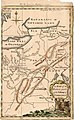 A Map of the Western parts of the Colony of Virginia, 1754.jpg 952 × 1,544; 1.78 MB
-
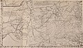
 La vallée de l'Ohio et ses forts en 1755.jpg 1,438 × 959; 638 KB
-
 Map of the Country about the Mississippi, Circa 1755 WDL9587.png 1,729 × 1,024; 2.66 MB
-

-


.jpg)
.jpg)