Category:1755 Mitchell Map
historic map of the United States of America  | |||||
| Upload media | |||||
| Instance of | |||||
|---|---|---|---|---|---|
| Named after | |||||
| Creator | |||||
| Inception |
| ||||
| |||||
Media in category "1755 Mitchell Map"
The following 25 files are in this category, out of 25 total.
-

-

-

-

-

-

-

-

-

-
-
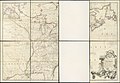
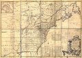
 Mitchell Map 1 quarter north west.jpg 5,986 × 4,255; 20.62 MB
-
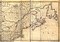 Mitchell Map 2 quarter north east.jpg 5,986 × 4,255; 21.93 MB
-
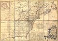
 Mitchell Map 3 quarter south west.jpg 5,986 × 4,255; 21.66 MB
-
 Mitchell Map 4 quarter south east.jpg 5,986 × 4,255; 22.99 MB
-
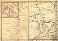
 Mitchell map michigan.jpg 2,356 × 2,366; 5.97 MB
-
 Mitchell Map-06full2 compressed.jpg 11,686 × 8,255; 19.15 MB
-
 Mitchell Map-06full2.jpg 11,686 × 8,255; 96.59 MB
-
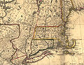 Mitchell Map-excerpt01.jpg 2,400 × 1,864; 1.34 MB
-
 Mitchell Map-excerpt02.jpg 1,735 × 1,200; 1.11 MB
-
 Mitchell Map-excerpt03.jpg 2,188 × 1,600; 872 KB
-
 Mitchell Map-full.jpg 4,000 × 2,826; 2.49 MB
-
 Mitchell Map-Louisiana 1770s.jpg 1,801 × 1,445; 1.69 MB
-
 Mitchell-map-tellico-1755.jpg 433 × 318; 31 KB
-
 Mitchellmap-1755-telliquo.jpg 528 × 410; 75 KB
-
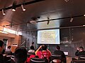 WikiConference North America 2018 - Bjork-James - Mitchell map.jpg 4,032 × 3,024; 8.72 MB
_A_map_of_the_British_and_French_dominions_in_North_America,_with_the_roads,_distances,_limits,_and_extent_of_the_settlements,_by_John_Mitchell,_C%C3%B3vens_et_Mortier,_from_the_Digital_Commonwealth_-_commonwealth_w9505r950.jpg)

.jpg)
.jpg)
.jpg)
.jpg)
.jpg)
.jpg)
.jpg)
.jpg)


