Category:1760s maps of Georgia (U.S. state)
States of the United States: Alabama · Alaska · California · Connecticut · Florida · Georgia · Louisiana · Maine · Massachusetts · Mississippi · New Hampshire · New Jersey · New York · North Carolina · Ohio · Pennsylvania · South Carolina · Tennessee · Vermont · Virginia
Puerto Rico
Puerto Rico
Subcategories
This category has only the following subcategory.
Media in category "1760s maps of Georgia (U.S. state)"
The following 2 files are in this category, out of 2 total.
-
 Carte de la nouvelle Georgia. LOC 74692212.jpg 2,462 × 3,121; 1.11 MB
-
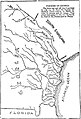 Parishes of Georgia, 1765.jpg 563 × 829; 85 KB

