Category:1770s maps of Georgia (U.S. state)
States of the United States: Alabama · Alaska · California · Connecticut · Delaware · Florida · Georgia · Illinois · Indiana · Kentucky · Louisiana · Maine · Maryland · Massachusetts · Mississippi · Missouri · New Hampshire · New Jersey · New York · North Carolina · Ohio · Pennsylvania · Rhode Island · South Carolina · Tennessee · Vermont · Virginia
Puerto Rico
Puerto Rico
Media in category "1770s maps of Georgia (U.S. state)"
The following 11 files are in this category, out of 11 total.
-
 1776 map of coastal Georgia.tif 988 × 785; 1.59 MB
-

-

-
-

-
 A new and accurate map of the province of Georgia in North America. LOC 2008625108.jpg 4,921 × 5,868; 3.51 MB
-
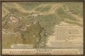
 Battle of Brier Creek Hollingsworth Map.jpg 910 × 1,223; 508 KB
-
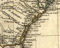
 CentralSavannahRiver1775.jpg 564 × 660; 73 KB
-
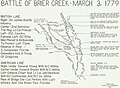 Clyde d hollingsworth 1953 map battle of brier creek-cropped & resized-1280.jpg 1,280 × 934; 340 KB
-
 Original city plan for Brunswick, Georgia, 1771.jpg 780 × 838; 165 KB
-


