Category:1770s maps of Mississippi
States of the United States: Alabama · Alaska · California · Connecticut · Delaware · Florida · Georgia · Illinois · Indiana · Kentucky · Louisiana · Maine · Maryland · Massachusetts · Mississippi · Missouri · New Hampshire · New Jersey · New York · North Carolina · Ohio · Pennsylvania · Rhode Island · South Carolina · Tennessee · Vermont · Virginia
Puerto Rico
Puerto Rico
Subcategories
This category has the following 2 subcategories, out of 2 total.
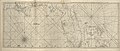
Media in category "1770s maps of Mississippi"
The following 6 files are in this category, out of 6 total.
-

-

-
-

-
 Embouchure du Missisipi, Fort rond à droite, BNF.tif 5,985 × 4,602; 78.8 MB
-
 Embouchure du Missisipi, fort rond à gauche, BNF.tif 3,008 × 2,111; 6.06 MB
_(Mobile_area).jpg)

