Category:1770s maps of Maine
States of the United States: Alabama · Alaska · California · Connecticut · Delaware · Florida · Georgia · Illinois · Indiana · Kentucky · Louisiana · Maine · Maryland · Massachusetts · Mississippi · Missouri · New Hampshire · New Jersey · New York · North Carolina · Ohio · Pennsylvania · Rhode Island · South Carolina · Tennessee · Vermont · Virginia
Puerto Rico
Puerto Rico
Subcategories
This category has the following 2 subcategories, out of 2 total.
Media in category "1770s maps of Maine"
The following 18 files are in this category, out of 18 total.
-
 (Coast of Maine from Frenchmans Bay to Mosquito Harbor). LOC 99446171.jpg 9,441 × 13,328; 19.44 MB
-
 (Coast of Maine from Frenchmans Bay to Mosquito Harbor). LOC 99446171.tif 9,441 × 13,328; 360 MB
-
 (Coast of Maine from Moose Cove to Gouldsboro Bay. LOC 77692978.jpg 18,899 × 8,864; 19.5 MB
-
 (Coast of Maine from Salter Island to Portland Head. LOC 75693431.jpg 12,918 × 9,073; 17.59 MB
-
 (Coast of Maine from Salter Island to Portland Head. LOC 75693431.tif 12,918 × 9,073; 335.33 MB
-

-

-

-
 (Coast of New England from Cape Elizabeth, Me. to Newburyport, Mass. LOC 77693969.jpg 12,728 × 8,922; 11.33 MB
-
 (Coast of New England from Cape Elizabeth, Me. to Newburyport, Mass. LOC 77693969.tif 12,728 × 8,922; 324.9 MB
-
 (Falmouth Harbour. LOC 77692986.jpg 6,485 × 8,985; 7.25 MB
-
 (Falmouth Harbour. LOC 77692986.tif 6,485 × 8,985; 166.71 MB
-
 (Mount Desert Island and neighboring coast of Maine. LOC 77692985.jpg 9,006 × 12,799; 13.14 MB
-
 (Mount Desert Island and neighboring coast of Maine. LOC 77692985.tif 9,006 × 12,799; 329.78 MB
-

-
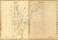
 A Plan of the late Province of Main as far as Kennebeck River. LOC 74692577.jpg 12,660 × 10,540; 17.3 MB
-
 A Plan of the late Province of Main as far as Kennebeck River. LOC 74692577.tif 12,660 × 10,540; 381.76 MB
-
 MachiasBay1776.png 600 × 753; 633 KB
._LOC_99446171.jpg)


